


-
 2399 Hits
-
 80.49% Score
-
 12 Votes
|
|
Route |
|---|---|
|
|
45.67908°N / 7.38468°E |
|
|
Summer, Fall |
|
|
A long day |
|
|
Note
|
La montagna chiama i suoi figli, ed essi rispondono fedelmente al suo appello… Osvaldo Cardellina, Diario alpinistico, 1964-65 Page texts: @ OsvaldoCardellina "Osva", passed away on May 2, 2022. Page owners: Christian Cardellina e Osvaldo Cardellina. Any updates from September 12, 2022: Antonio Giani, page administrator, friend and climbing companion. Testi della pagina: @ OsvaldoCardellina "Osva", scomparso il 2 maggio 2022. Proprietari pagina: Christian Cardellina e Osvaldo Cardellina. Eventuali aggiornamenti dal 12 settembre 2022: Antonio Giani, amministratore della pagina, amico e compagno di salite. |
Tour Overview
This "Tour of Emilius" it is not our invention. Take a cue from "33 ROUTES of M. Emilius Marathon Tours & Other Things (Second Part)", where we had already hinted at this possibility, over the hill of the same, the entire tour at its base, starting from West to arrive always to the West. we must go back in time to the thirties to find the first news of this marathon around this mountain; are Dr. Anselmo "Ansel" Falcoz and Companions to fulfill convinced "have teased him Emilius": Second half years 30' (In the Tirties): Minitour "To make fun Emilius"; in day from Pila - Comboé - Carrel Pass - Arpisson W and E Glaciers - Peckoz Pass - Les Laures Lakes - Three Capuchins Pass - S-SE Arête of Monte Emilius in ascent and in descent - Three Capuchins Pass - Gelato Lake - Pila to Aosta; (Anselme Falcoz and company) r. Minitour 01: A/24; A/24. So from personal accounts had the same Falcoz summer of 1978. First there is no news because the exploration of the ridges of the Emilius begins in 1902 and ends in 1906 and that of the walls began in September 18th, 1875 or 1878 (?) with an attempt on the North Face of Martino Baretti and Luigi Bruno of Turin with Mountain Guides Susa Valley Augusto and Vittorio Sibille, he continues in August 30th, 1897 with the ascent of the North small Emilius (Daniel-Devalle and Guides Bich-Pession Valtournanche), comes to the exploits of Lino Binel, Amilcare Crétier and Renato Chabod in 1926, which were confirmed in the following year by the first two with the ascent complete and ends in June 26th, 1935 with the strong consortium Giusto Gervasutti and Renato Chabod on East. More information on this tour you do not have and you will have until July 1971, when Marco Cossard and Companions is planning to repeat this unusual Marathon: "1971 (Jul 14th): Tour EIGHT "From Emilius to Tersiva"; from Pila - Comboé - Gros Scez - S-SW Slope of Becca di Nona - S-SE Arête in descent - Carrel Pass - Arpisson W and E Glaciers - Mont Blansette and Pass - Blantsette Glacier - Ménabreaz Hut; (Jul 15th): Laures Lakes (three) - Three Capuchins Pass - S-SE Arête Mount Emilius in ascent and in descent - Three Capuchins Pass; Cossard, Lamazzi, Lenzi and Trussoni to Ervillères (Tersiva), Cardellina Gelato Lake - Arbolle - Pila to Aosta; (Osvaldo Cardellina, Marco Cossard, Giuseppe Lamazzi, Franco Lenzi and Ezio Trussoni) r. Tour 08: G/16 part/A/24; A/24. Usually so far, as well as explorations of ridges and walls, they could only record some big crossings such as in 1936, again by the usual Falcoz, from Punta Garin to Emilius and repeated the following summer but always from the same "only" to Pass of the Three Capuchins to have met there a group of "friends defeatists". Or those of 1902 since Colle Carrel via the West Ridge-northwest and again in July 20th, 1941 by Giulio Adolfo "Dulo" Ourlaz with his wife Aurora Wuillerminaz with ascent to the Edge North-Northeast, down the Col Carrel, lifts the Becca di Nona and descent for the "Crestone" North-northeast of the latter. A full tour over the Vallon of Arpisson, but that has nothing to do with the "Tour of Emilius". But this tour has had particular implications: while the first, fresh wedding, had to return home by completing the Tour, the other three from Arbolle pass (3.154m), they crossed to the Laures (3.035m) and then moved to Ervillères Pasture (2.515m), where the next day they climbed the Punta Tersiva. But even this was not so full, because the long descent to the Valley of Arbolle eluded in the completeness of the same, requiring the crossing with the final ascent to the Col Ròss (3.091m) and the subsequent crossing the Col Carrel (2.912m) . Only in such a way you could say of avre you made the "Lap of Emilius", passing underneath all its walls and bypassing all the ridges. "Half Tour" I had already made in August 1980 and in July 1984 by scaling the North Face and then down through the East Ridge, cross the glacier Blantsette, back homonym Head and Colle, get off on the two Glaciers Arpisson, crossing and return to Carrel Hill. But it was only half a turn, so, prodded in pride, I had promised myself to complete the discussion. The opportunity presents itself to me the 23/24 July 1993 when, after climbing the "Becca" and bivouacked at Federigo Zullo to Colle carrel in the first day, the day after giving birth to my children Elisa and Roy and Luca Ferronato to make the rounds. I crossed the two glaciers Arpisson, we climb to the Head Blantsette and the namesake hill descend on the Glacier Blantsette, under the East Wall; traversed the same rocks to go back to the Cross Charrey-Norat (3.110m) through the ultra-marches rocks, at the beginning of the East Ridge even called "Ridge of Brissogne" that climb to the Summit. The descent is the normal route or "Cresta dei Tre Cappuccini" to the pass where, cutting diagonally across the stony high above Lake Gelato reach that of the "Macigni or Boulders" (2.943m); that remains up towards the Col Ròss and navigate to Northwest reaching the Federigo Zullo Bivouac, where we started this morning. And so we do with young people who never stop complaining about fatigue, but, having reached the same, we find it full of young Varese that make spree. Although it's a bad storm coming, I prefer to go down up to Pila, where we arrive, between the complaints of fatigue of young people, to Midnight. So the tour was thoroughly completed. I am not aware of other paths grains like ours, either as regards the Gamekeeper Baron Beck Peckoz Gressoney in '800: typically only went through from Les Laures Valley towards the Arpisson Vallon and viceversa, bypassing Peckoz Pass (3.042m). But do not we know more, for which what our point of reference remain the Thirties with Doctor Anselme "Ansel" Falcoz and Companions. But if you do know more, let us know.
Questo "Giro dell'Emilius" non é una nostra invenzione. Prendiamo spunto da: "33 ROUTES of M. EMILIUS Marathon Tours & Other Things (Second Part)", dove già avevamo accennato a questa possibilità d'effettuare, oltre alla salita del medesimo, l'intero Tour alla sua base partendo da Ovest per arrivare sempre ad Occidente. Dobbiamo ritornare indietro nel Tempo agli Anni Trenta per trovare le prime notizie su questa Maratona intorno a questa montagna. Sono il Dottor Anselmo "Ansel" Falcoz e Compagni a compierla convinti di "aver preso in giro l'Emilius": Seconda metà degli Anni Trenta: Minitour "Prendendo in giro l'Emilius"; in giornata da Pila - Comboé - Col Carrel Pass- Ghiacciai Occidentale ed Orientale dell'Arpisson - Col Peckoz - Laghi delle Laures - Passo dei Tre Cappuccini - Cresta S-SE del Monte Emilius in salita e discesa- ancora Passo dei Tre Cappuccini - Lago Gelato - Pila onde ad Aosta; (Anselme Falcoz e Compagni) r. Minitour 01: A/24; A/24. Così da racconti personali avuti dallo stesso Falcoz nell'estate del 1978. Di prima non s'hanno notizie anche perché l'esplorazione delle creste dell'Emilius inizia nel 1902 con la Ovest-nordovest per concludersi nel 1906 e quella delle pareti inizia il 18 Settembre 1875 (o 1878?) con un tentativo sulla Parete Nord di Martino Baretti, Luigi Bruno e le Guide della Val di Susa Augusto e Vittorio Sibille, prosegue il 30 di Agosto 1897 con la salita della Nord del Piccolo Emilius (Daniele-Devalle e Bich-Pession Guide di Valtournanche), perviene agli exploits di Lino Binel, Amilcare Crétier e Renato Chabod nel 1926, ribaditi nell'anno successivo dai primi due con la salita completa e termina il 26 di Giugno 1935 con la forte cordata Giusto Gervasutti-Renato Chabod sulla Est. Altre informazioni su questo Tour non si hanno e non si avranno fino al Luglio 1971, quando a Marco Cossard e Compagni viene in mente di ripetere questa inusuale Maratona: "1971 (Jul 14th): Tour OTTO "Dall'Emilius alla Tersiva"; da Pila - Comboé - Gros Scez - Versante S-SW della Becca di Nona - Cresta S-SE in discesa - Col Carrel - Ghiacciai Ovest ed Est d'Arpisson - Mont Blansette e Colle - Ghiacciaio di Blantsette - Rifugio Ernesto Ménabreaz; (15 Luglio): tre Laghi delle Laures - Passo dei Tre Cappuccini - Cresta S-SE del Monte Emilius in salita ed in discesa - nuovamente Passo dei Tre Cappuccini; Cossard, Lamazzi, Lenzi e Trussoni verso l'Alpe di Ervillères (Tersiva), Cardellina al Lago Gelato - Arbolle - Pila ed Aosta; (Osvaldo Cardellina, Marco Cossard, Giuseppe Lamazzi, Franco Lenzi ed Ezio Trussoni) r. Tour 08: G/16 part/A/24; A/24. In genere fino a questo momento, oltre ad esplorazioni su creste e pareti, si potevano soltanto registrare alcune grandi traversate come quella nel 1936, sempre da parte del solito Falcoz, dalla Punta Garin all'Emilius e ribadita nell'estate successiva sempre dal medesimo ma "solo" fino al Passo dei Tre Cappuccini per avere lì incontrato un gruppo di "amici disfattisti". Oppure quelle del 1902 dal Colle Carrel tramite la Cresta Ovest-nordovest ed ancora il 20 Luglio del 1941 da parte di Giulio Adolfo "Dulo" Ourlaz con la moglie Aurora Wuillerminaz con salita per lo Spigolo Nord-nordest, discesa al Colle Carrel per quella Ovest-nordovest, risalita alla Becca di Nona con discesa per il Crestone Nord-nordest di quest'ultima. Un Tour completo sopra il Vallone di Arpisson, ma che nulla ha a che fare con il "Giro dello Emilius". Ma anche questo Giro del 1971 ha avuto dei risvolti particolari: mentre il primo, fresco di matrimonio, doveva rientrare a casa completandolo, gli altri tre dal Colle di Arbolle (3.154 m) traversavano a quello di Laures (3.035 m) per poi trasferirsi all'Alpeggio d'Ervillères (2.515 m), da dove il giorno appresso salivano la Punta Tersiva. Pur questo non era ancora così completo, poiché la discesa per il lungo Vallone d'Arbolle eludeva in parte la completezza, tale da richiedere la traversata con risalita finale al Col Ròss (3.091 m) e la successiva traversata al Colle Carrel (2.912 m). Solo in siffatto modo si poteva affermare di aver compiuto il "Giro completo dell'Emilius", passando al di sotto di tutte le sue pareti e scavalcandone tutte le creste. "Mezzo Giro" l'avevo già compiuto nell'Agosto 1980 e nel luglio 1984 scalando la Parete Nord per poi scendere tramite la Cresta Est, traversare il Ghiacciaio di Blantsette, risalire all'omonima Testa e Colle, scendere sui due Ghiacciai di Arpisson e ritornare al Colle Carrel. Ma era solo mezzo giro, per cui, pungolato nell'orgoglio, mi ero ripromesso di completare il discorso. L'occasione mi si presenta il 23/24 Luglio 1993 quando, dopo aver salito la "Becca" e pernottato al Federigo al Colle carrel nel primo giorno, il giorno appresso parto con i miei figli Elisa e Roy e Luca Ferronato per effettuare il giro completo. Attraversati i due Ghiacciai di Arpisson, saliamo alla Testa Blantsette e dall'omonimo colle scendiamo sul Ghiacciaio Blantsette, sotto la Est; traversato il medesimo risaliamo per rocce ultra marce alla Croce dei Fratelli Charrey e Cino Norat (3.110 m), all'inizio della Cresta Est od anche detta "Cresta di Brissogne", che scaliamo sin in Cima. La discesa avviene per la Via Normale o "Cresta dei Tre Cappuccini" fino al passo dove, tagliando alto in diagonale sulla pietraia sopra il Lago Gelato raggiungiamo quello dei "Macigni" (2.943 m); non rimane che risalire al Col Ròss e traversare a Nordovest raggiungendo il bivacco, donde siam partiti stamane. Così facciamo, con i giovani che non smettono di lamentarsi per la stanchezza; ma, ivi giunti, lo troviamo pieno di giovanotti e giovanotte di Varese che fan baldoria. Nonostante sia in arrivo un forte temporale, preferisco scendere giù fino a Pila, dove arriviamo, tra i lamenti di fatica dei giovani, per Mezzanotte. Così il giro é stato abbondantemente completato. Non sono a conoscenza di altri percorsi integrali come il nostro, neppure per quanto concerne i Guardiacaccia del Barone Beck Peckoz di Gressoney nello '800: in genere si limitavano ad attraversare dalle Laures all'Arpisson, scavalcando il Col Peckoz (3042 m), e viceversa. Ma non ne sappiamo di più, per la quale cosa il nostro punto di riferimento rimangono gli Anni Trenta con il Dottor Anselme "Ansel" Falcoz e Compagni. Ma se Voi ne sapeste di più, mi raccomando, fatecelo sapere ... Monte Emilius (3.559m) GREAT TOUR with Traverse towards the Punta Tersiva (3.515m)
 |
 |
 |
Getting There
By car:- From TORINO, MILANO, etc: Motorway A5. Exit at IVREA or Quincinetto (PIEDMONT)
- From IVREA Town: in West towards Pont Saint Martin, Donnas, Bard, Pontey, Fénis, Saint Marcel, Grand Brissogne, Pollein, Charvensod, Gressan Municipalities.
- From Courmayeur Resort: in East towards Pré St. Didier, Morgex, La Salle, Saint Pierre, Sarre, Aosta, Gressan, Charvensod, Pollein and Grand Brissogne Municipalities.
- From Grand Brissogne (827m) to L'Arp, dirt road, Les Laures Vallon-Ernesto Ménabreaz Shelter (2.546m) at Lower Laures Lake (2.544m), path-muletrack. From Pollein (575m; secondary road) or from Charvensod (746m; main road and connection) to Martsaouchy Damon-Arpisson Vallon, through dirt road, and to Arpisson Lower and Upper (2.010m) Alpages with path. To Federigo Zullo Bivouac (2.907m), through moraines on Western Arpisson Glacier. From Charvensod to Dard-Comboé-Arbolle Vallons towards Ponteilles (1.697m) Alp/Waterfall, through dirt road, Comboé Alp/Saint Ours Shelter (2.114m), through dirt road, and Arbolle Refuge (2.516m), near Lakes (2.497m), by Chair Lift to Chamolé Station (2.309m), Lake (2.325m) and muletrack. From Charvensod (main road from Pont Suaz 567m) or from Gressan, nearby the Municipality, with alternative Regional Road towards Pila-Resort.
Routes Description
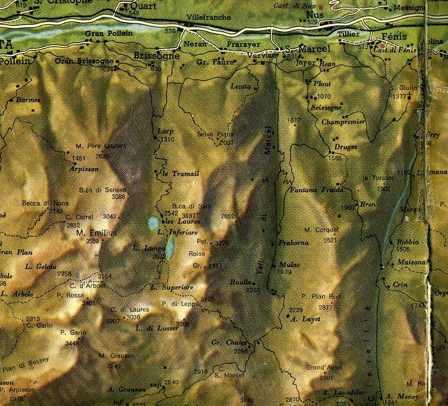
The great divide between the Arpisson Les Laures Vallons of which we have just discussed above, paradoxically, was first climbed in his most difficult part (North-northeast Edge, 1906) and later in the simplest (North-northwest Ridge of Becca Seneva, 1924), but other traits, the ascent of Mount Père Laurent, Peckoz Pass, Testa (Head) Blantsette and nearby Blantsette Pass (or, better, Carving) were visited and frequented "ab immemorabilis" by shepherds and hunters, forming the famous "Passer lo Cordagnì" with which the latter they identified and signaled a definite place hunting, always well heeled by Gamekeepers of Baron Beck Peckoz, Walser originally from Valley of Gressoney, who guarded these vallons and that of Grauson-Lussert up to the current Grauson New (Hunting Houses in Mulàc-Saint Louis, Great Chaux, small refuge under the Carrel Hill, now completely destroyed and rebuilt, and still in the Grande Chaux in Grauson Vallon, corresponding to the current Nuove or New Grauson. The Normal Route to adjacent Becca of Seneva (3.081m) (Southern Crest, after having climbed the West Face, 1897) instead was "up down", by the rope of 30 August, which came to Peckoz Pass to get off on both Eastern and Western Glaciers of the Arpisson with the intent to observe the still virgin on which North Face of Monte Emilius, the next day, make an attempt to uphill. But almost certainly, this part of the ridge, incidentally easy, had already been beaten by Guards Hunting Reserve Beck Peckoz, wherefore to Daniele Devalle with the two Mountain Guides Valtournanche Bich and Pession is nothing more than the first climbing mountaineering note. There was still a short section of ridge to explore, what Renato Chabod with two companions, Giuseppe Riconda and Alessandro Nouchy, had escaped, or between Mount Père Laurent and the onset of North-northwest Ridge rising from them: "... June 15, 1924, on the opposite side of the Combe of Arpisson, reaching the watershed of Père Laurent-Becca of Seneva a hundred yards South of the Père Laurent and then continuing along the ridge to the Becca Seneva. Remember a pleasant dihedral with crack, excellent gray gneiss and the long descent to Quart Villefranche, through the lakes Laures". We went to remove the "footprint" July 20, 1978 when with my son Christian (5 years!) and Professor Giorgio Fruttaz, starting from Martsaouchy and, this time, to the Valley of Arpisson, we went first to the Mont Père Laurent (2.625m ) and then cross, return, those three small tops (2.646m, the highest South Point, even if only slightly), the surprise was that at the top of the first, between an unbearable stench, we found a dozen dead sheep. Exposing us to the big jump to the East, we saw the rest of the flock, smashed on stony ground below. The storm had driven up there and missed the first one, all the others had gone behind. As in the famous painting "of the blind", by Bruegel, if I'm not mistaken. We covered so that little more than a hundred yards that were missing, among broken rocks and covered with dangerous and treacherous grass "Ollina". This necessary and historical premise to make understand that this long watershed (from Emilius to Mont Père Laurent; see photo below) , turned to the North, is the focal point of the entire "Tour of Emilius". In fact in all this stretch of over 2 Km. allows only two points passing and then crossing between the Vallons Arpisson and Laures: Col Peckoz, between Becca di Seneva in North and Head Blantsette or Beak of the Boucs (Steinbocks) in the South, or the above Blantsette Pass or Carving, against the Black Triangle of Emilius. For the rest of the description directed to the path we see in the two proposals that we analyze, through a "Large Tour" and a definitely more "Strait".
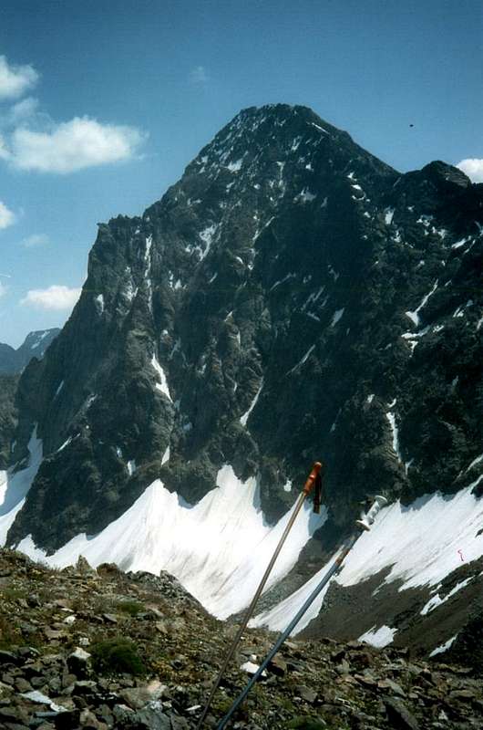
![]()
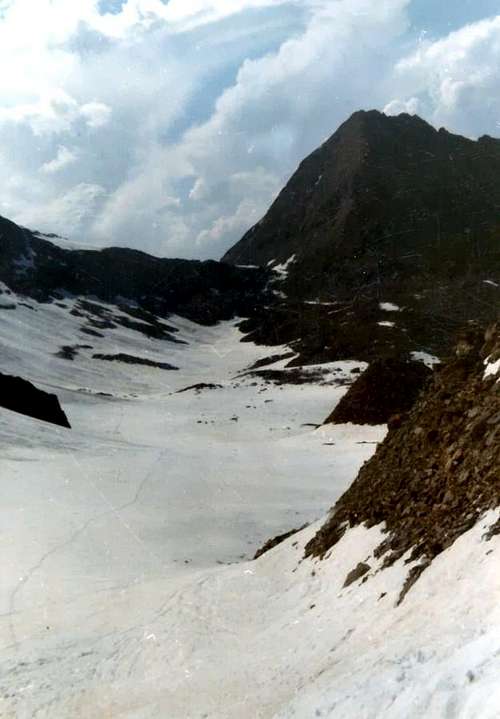
Les Laures/Arpisson great watershed from East, by Osw
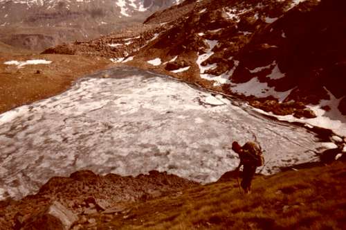
![]()
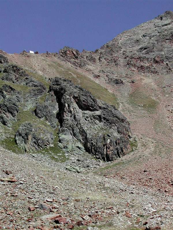
Fork near Gros Scez, by livioz
![]()
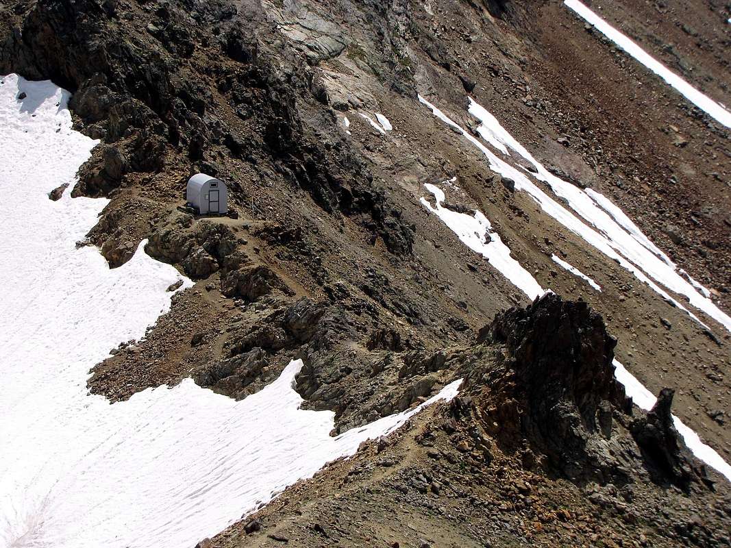
Federigo Bivouac, by Antonio
![]()
![]()
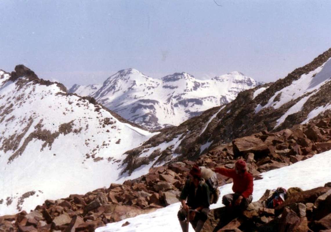
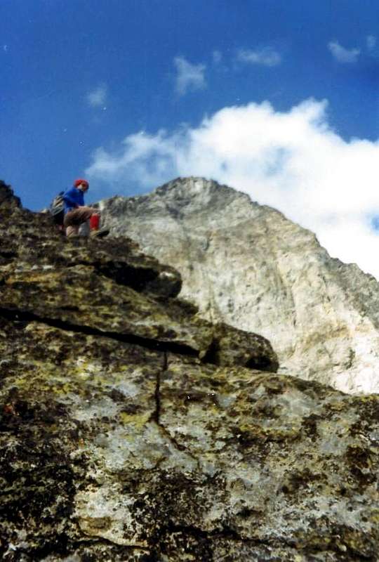
East Crest, by "Gigi" Gadin
![]()
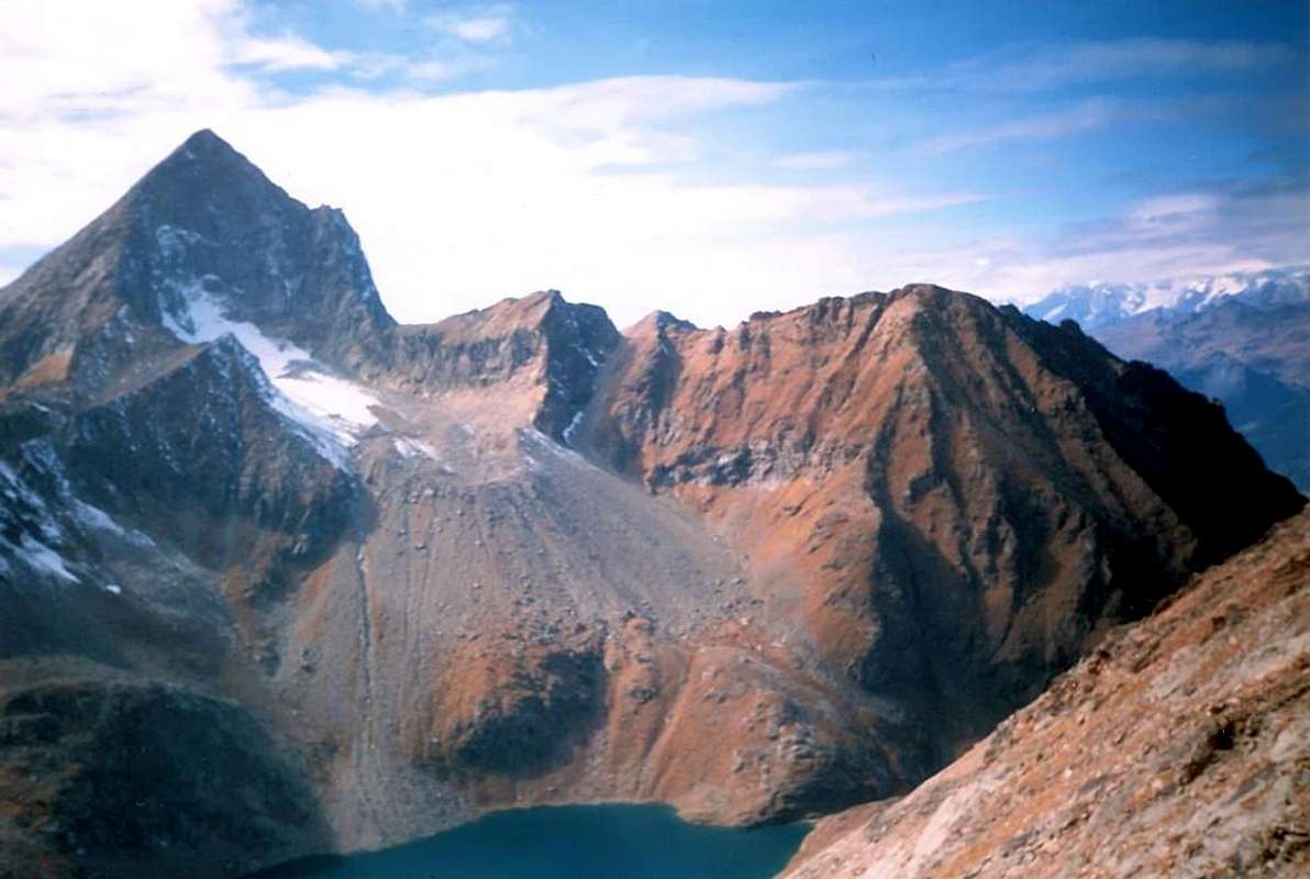
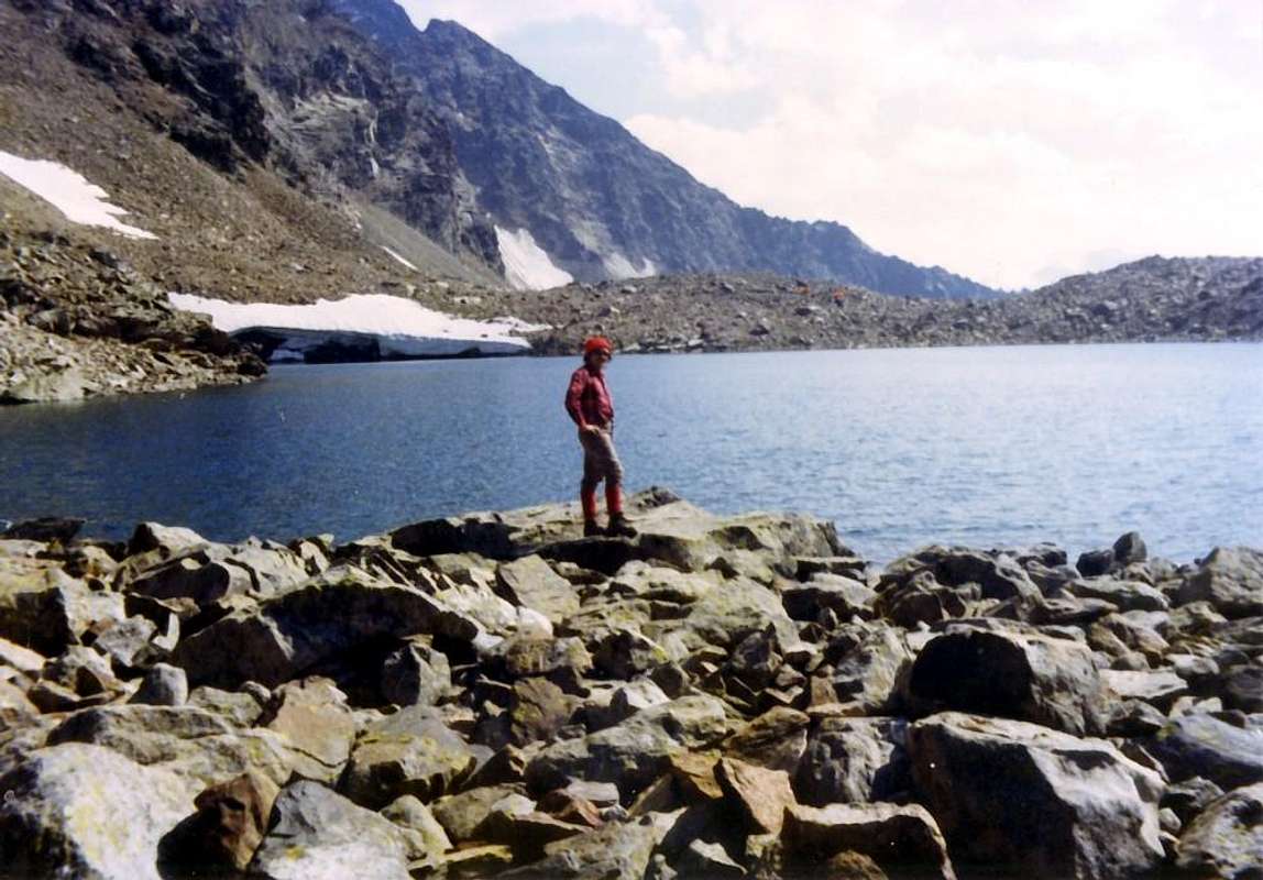
Lake Gelato (2.957m), by Osw ![]()
South Faces, amongst three crests, of M. Emilius, by Osw
 |
 |
 |
Lo spartiacque tra l'Arpisson e Les Laures del quale abbiamo giusto trattato, paradossalmente é stato salito prima nella sua parte certamente più difficile (Spigolo N-NE, 1906) e successivamente in quella più semplice (Cresta N-NW della Becca Seneva, 1924); ma gli altri tratti, ovverossia salita del Mont Père Laurent, Col Peckoz, Testa Blantsette e vicino Intaglio o Colle Blantsette erano stati visitati e frequentati "ab immemorabilis" da pastori e cacciatori, costituendo il famoso "Passer lo Cordagnì" con i quale questi ultimi individuavano e segnalavano un preciso luogo di caccia, sempre ben tallonati dai Guardiacaccia del Barone Beck Peckoz, Walser originario della Valle di Gressoney, che presidiavano questi valloni e quello del Grauson-Lussert fino all'attuale Grauson Nuove (Case di Caccia a Mulac-Saint Louis, Grande Chaux, piccolo rifugio sotto al Colle Carrel, andato distrutto ed oggi completamente ricostruito, ed ancora di Grande Chaux nel Grauson, corrispondente all'attuale Grauson Nuove. La Via Normale all'adiacente Becca di Seneva (3.081m) (Cresta Sud, dopo la salita per la Faccia Ovest, 1897) invece fu "salita in discesa" dalla cordata del 30 Agosto, che giunse al Col Peckoz per quindi discendere sui due Ghiacciai Orientale ed Occidentale di Arpisson con l'intento di osservar l'ancor vergine Parete Nord dell'Emilius sulla quale, il giorno appresso, effettuarne un tentativo di salita. Ma quasi sicuramente, questo tratto di cresta, daltronde facile, era già stato battuto dalle Guardie di Caccia della Riserva Peckoz, per la qual cosa quella di Devalle-Daniele con le due Guide di Valtournanche Bich e Pession altri non é che la prima ascensione alpinistica nota. Rimaneva ancora un breve tratto incognito di cresta da esplorare, quello che Renato Chabod con i due compagni, G. Riconda ed A. Nouchy, aveva evitato, ovvero tra il Mont Père Larent e l'inizio della Cresta Nord-nordovest da loro salita: " ... il 15 Giugno 1924, sull'opposto versante della Comba di Arpisson, raggiungendo la cresta Père Laurent-Becca di Seneva un centinaio di metri più a sud del Père Laurent e poi continuando per cresta fino alla Becca di Seneva. Ricordo un piacevole diedro con fessura, di ottimo gneiss grigiastro, nonché la lunga discesa fino a Quart Villefranche, passando per i laghi di Laures.". Andammo a togliere l'"ingombro" il 20 Luglio 1978 quando con mio figlio Christian (5 anni!) ed il Professor Giorgio Fruttaz, partendo da Martsaouchy e, questa volta, per il Vallone di Arpisson, salimmo dapprima al Père Laurent (2.625 m) per poi attraversare, andata e ritorno, quelle tre puntine (2.646 m, la Punta Sud più elevata, anche se di poco); la sorpresa fu che in vetta al primo, tra un fetore insopportabile, trovammo una decina di pecore morte. Esponendoci sul grande salto ad Est, vedemmo tutto il resto del gregge, sfracellato sulla sottostante pietraia. Il temporale le aveva spinte fin lassù e, saltata la prima, tutte le altre le erano andate dietro. Come nel famoso quadro "del cieco" di Bruegel, se non sbaglio. Così coprimmo quel poco più di un centinaio di metri che mancavano all'appello, tra rocce rotte e ricoperte da pericolosa ed infida erba "ollina". Questa doverosa e storica premessa onde far comprendere che questo lungo spartiacque (dal Monte Emilius al Mont Père Laurent; vedi foto appena sotto) rivolto a Settentrione costituisce il punto focale dell'intero "Tour dell'Emilius". Infatti in tutto questo tratto di oltre 2 Km. concede due unici punti di passaggio e quindi di attraversamento tra i Valloni di Arpisson e delle Laures: il Col Peckoz, tra la Becca di Seneva a Nord e la Testa Blantsette o Becca des Boucs a Sud, oppure il soprastante Col o Intaglio Blantsette, contro il Triangolo Nero. Per il resto del percorso lo vediamo nelle due proposte che andiamo ad analizzare, tramite un "Giro Largo" ed uno più "Stretto".
"Tour Large" 1930 & 1971 (4 vallons)
This tour can be considered the four Vallons: Comboé, Arpisson, Laures and Arbolle. In practice is a)- Tour Thirties reaching from the Vallon of Comboé, through the path n° 16A, to Arpisson, crossing two glaciers on top of that and get off at the shelter (then only alp) to Laures (2.552m), crossing the Col Peckoz (3.042m ), and then up the vallon of the same name to the Passo dei Tre Cappuccini (3.242m) and finally conclude with the Normal or Via Crest South-southeast. The descent was through the long Vallon Arbolle to reach again Comboé, closing the circle. A variation could be to bivouac just below the Carrel Hill in the nearby old "Peckoz House of Gamekeeper", at the pond 2.873 meters (today Federigo Camp Zullo on the hill). The other possibility is instead in b)- Tour 13 July 1971 did not reach by Glacier Eastern Arpisson the Col Peckoz but, discarding the left (North) up through scree and easy rock ribs on the West Side of the above Testa Blantsette (3.139 m); from this, taking the short Crest South reach the hill of the same name or, better, carving (3.126m), just the beginning of the North-Northeast Corner or "Cresta Three Curates" of Mount Emilius. A steep and delicate descent of about fifty metres, through a small gully with rocky soil, leading to the lateral Northern moraine of the Glacier Blantsette, whence a rapid descent leads to the Western shore of Lac des Laures Dessous (Lower; 2.544m; rejoining the trail n° 8 to the Col Peckoz and, via a wooden walkway on the effluent, to the n° 1A, coming from Grand Brissogne, in the short time we reach the Ernesto Ménabreaz Shelter (2.546m; private but with a local equipped always open). The next day you reach the Long Lake (2.630m) with the trail n° 3/4/6 and subsequent Lac d'En Haut or Dessus (2.787m), on-site even "Lac Dzacquin" and Ghiacciato or Frozen Lake (2.944m) with the trail n° 6. from this a small track (be careful in case of hard snow) leads to Pass of the Three Capuchins and the route n° 14, just below the Normal Route to the East, to the Summit of Monte Emilius (3.559m). The descent is via the same route, but it comes down from the hill to the West toward a large reddish moraine to the junction 3.048 meters (to the Col d'Arbolle), at the pitiful remains of the Glacier or the Emilius of Lac Gelé. Soon you will reach the underlying Lake Gelato (2.957m), from which the trail n° 14/102 to Arbolle Refuge (2.516m). A steep descent through a narrow gorge with unnumbered path leads to the ruins of Alpe Grand Plan (2.158m), from which the trail n° 16 to the Alpe di Comboé (2.114m), Chamolé Alp or St. Grat Hermitage (1.773m) and, finally, Pila-Resort.
Questo Tour può essere considerato dei quattro Valloni: Comboé, Arpisson, Laures ed Arbolle. In pratica consiste nel a)- Tour Anni Trenta raggiungendo dal Vallone di Comboé, per mezzo del sentiero n° 16A, quello di Arpisson, attraversare in alto sui due ghiacciai del medesimo e scendere al rifugio (allora solo alpe) alle Laures (2.552 m), attraversando il Col Peckoz (3.042 m), per poi risalire l'omonimo vallone fino al Passo dei Tre Cappuccini (3.242 m) ed infine concludere con la Via Normale o Cresta Sud-sudest. La discesa avveniva tramite il lungo Vallone di Arbolle per raggiungere nuovamente il Comboé, chiudendo il cerchio. Una variante poteva consistere nel bivacco subito al di sotto del Colle Carrel all'antica "Casa Peckoz dei Guardiacaccia", presso il laghetto 2.873 metri (oggi Bivacco Federigo Zullo al colle). L'altra possibilità consiste invece nel b)- Tour 13 Luglio 1971 non raggiungere dal Ghiacciaio Orientale di Arpisson il Col Peckoz, bensì, scartandolo a sinistra (Nord) salire tramite sfasciumi e facili costole rocciose sul Versante Ovest alla soprastante Testa Blantsette (3.139 m); da questa, percorrendo la corta Cresta Sud raggiungere l'omonimo colle o, meglio, intaglio (3.126 m), proprio allo inizio dello Spigolo Nord-nordest o "Cresta dei Tre Curati" del Monte Emilius. Una ripida e delicata discesa di una cinquantina di metri, tramite un canalino roccioso con terriccio, conduce alla morena laterale Settentrionale del Ghiacciaio Blantsette, donde una rapida discesa porta alla sponda Occidentale del Lac des Laures Dessous (2.544 m); ricongiungendosi al sentiero n° 8 per il Col Peckoz e, passando una passerella in legno sull'emissario, a quello n° 1A, che arriva da Grand Brissogne, in breve tempo si raggiunge il Rifugio Ernesto Mènabreaz (2.546 m; privato ma con un locale attrezzato sempre aperto). Nella giornata successiva si raggiunge il Lago Lungo (2.630 m) con il sentiero n° 3/4/6 ed i successivi Lac d'En Haut o di Sopra (2.787 m), in loco anche "Lac Dzacquin", ed il Lago Ghiacciato (2.944 m) con il sentiero n° 6. Da questo una piccola traccia (fare attenzione in caso di neve dura o ghiaccio) conduce al Passo dei Tre Cappuccini e con il sentiero n° 14, appena sotto ad Est della Via Normale, alla Cima del Monte Emilius (3.559 m). La discesa avviene tramite la stessa via, ma dal colle si scende ad Ovest verso una grande morena rossastra fino al bivio 3.048 metri (per il Col d'Arbolle), presso i miseri resti del Ghiacciaio dell'Emilius od anche detto del Lac Gelé. In breve si raggiunge il sottostante Lago Gelato (2.957 m), donde con il sentiero n° 14/102 al Rifugio d'Arbolle (2.516 m). Una ripida discesa in una stretta gola con sentiero non numerato conduce ai miseri resti dell'Alpe Gran Plan (2.158 m), dalla quale con il sentiero n° 16 al Comboé (2.114 m), Alpe di Chamolé o, in alternativa, Eremitaggio di San Grato (1.773 m) e Resort di Pila.
"Circle Narrow" 1993 (4 ridges & 4 faces)
Trip Tour can be considered as the "True Tour of Emilius". Indeed visit closely all its ridges and walls and through all the hills that form the basis of the same: Col Carrel, Col Blantsette, Three Capuchins Pass and Col Ròss. The installation of the Federigo Camp Zullo (2.907m) to the Col Carrel took place July 28th, 1984 promotes the fulfillment of this beautiful hike, certainly much more than previous Mountaineering. The route remains the same until the descent from the Col Blantsette (not to deal with absolutely direct ascent from East Glacier of Arpisson as very dangerous for rock steep and unstable), but, come on moraine instead of down to Lac Dessous, cross towards Southeast Glacier Blantsette moving toward the East Ridge, which rises from Les Laures. This is not particularly difficult or risks being devoid, in memory, of crevasses while you have to be at a certain distance from the vertical Wall East, highlighting, in the stretch at the Black Triangle Emilius's, evidence of landslides rock. The crossing takes place almost on a slight slope and reach the Southern margin in altitude of 3.080/90 meters; little more than a hundred metres of rock broken and very soggy wet soil leads to the ridge at what is called "Cross of "Dino" Jean Charrey Brothers and Cino Norat (3.110m; dead in East Face August 25th, 1929), which takes the beginning of "Ridge of Brissogne". Initially the same bends slightly to the Southwest, then turn sharply to the West becoming increasingly steep, sharp and exposed: easy but never boring, and if you walk on the wire, it also passages of III°, while remaining under the edge of the ridge in South the steps are of I°/I°+/II°-. In not much time you reach the Summit and then descend with the "Crest of the Three Capuchins" or Standard Via up the hill of the same name; but, unlike the previous itinerary, instead of going down to Lake Gelato, it is "cut" the moraine higher towards North over the same until you reach, a diagonal along the "Lake of the Boulders" (2.943m). From this climb a fairly steep, but short, grassy slope-moraine reaching the Col Ròss (3.091m), between the Mont Ròss de Comboé (3301m) and Punte del Lago Gelato (3.115m). A descent on the opposite side (Comboé Vallon) through steep lava moraine or residual snowfields can: 1) - straight down the trail n° 16A at the crossroads 2.525 meters above the "Gros Scez", whence to Comboé. 2) - Traversing progressively to the right (North-northwest) under the West Face of the Mont Ròss of Comboé (but keeping some distance) to finally reach the same path n° 16A to the Federigo Camp. The same, if you have not already done the day before, to close "in beauty" reaching the "Becca" (3.142m) through the easy Crest Sout-southeast, for after downhill through the ancient mule track on South-southwestern Slope.
Questo giro può essere considerato come il "Vero Giro dell'Emilius". Infatti visita dappresso tutte le creste e pareti ed attraversa tutti i colli alla base delle stesse: Col Carrel, Col Blantsette, Passo dei Tre Cappuccini e Col Ròss. L'installazione del Bivacco Federigo Zullo (2.907 m) al Colle Carrel avvenuta il 28 Luglio 1984 favorisce il compimento di questa bella Escursione, sicuramente molto più Alpinistica rispetto alle precedenti. Il percorso rimane identico fino alla discesa dal Col Blantsette (da non affrontare assolutamente con salita diretta dal Ghiacciaio Orientale di Arpisson, poiché molto pericolosa per la roccia ripida ed instabile), ma, giunti sulla morena invece di scendere verso il Lac Dessous, attraversare verso Sudest il Glacier Blantsette indirizzandosi verso la Cresta Est, che sale dalle Laures. Questo non presenta particolari difficoltà o pericoli essendo sprovvisto, a memoria, di crepacce, mentre bisogna stare ad una certa distanza dalla verticale Parete Est, che evidenzia, nel tratto presso il triangolo Nero, evidenti segni di frane rocciose. La traversata avviene quasi in falsopiano e si raggiunge il margine Meridionale a quota 3.080/90 metri circa; poco più di un centinaio di metri su roccia molto rotta e fradicia di terriccio bagnato porta in cresta presso quella che viene chiamata "Croce dei Charrey e Norat, dove prende inizio la "Cresta di Brissogne". Inizialmente la stessa flette leggermente a Sudovest, poi piega decisamente ad Occidente diventando progressivamente più ripida, affilata ed esposta: facile ma mai banale e, se percorsa sul filo, presenta anche passaggi di III°, mentre restando sotto il filo di cresta a Meridione i passaggi sono di I°/I°+/II°-. In non molto tempo si raggiunge la Vetta per poi scendere con la "Cresta dei Tre Cappuccini" o Via Normale fino all'omonimo colle; ma, a differenza del precedente itinerario, invece di scendere sino al Lago Gelato, si "taglia" la morena più in alto verso Nord sopra il medesimo fino a raggiungere con un lungo diagonale il "Laghetto dei Macigni" (2.943 m). Da questo risalire un abbastanza ripido, ma breve, pendio erboso-morenico raggiungendo il Col Ròss (3.091 m), tra il Mont Ròss de Comboé (3.301 m) e le Punte del Lago Gelato (3.115m). Una discesa sul versante opposto (Vallone di Comboé) tramite ripide colate moreniche o residui di nevai permette di: 1) - scendere direttamente al sentiero n° 16A presso il bivio 2.525 metri sopra il "Gros Scez", donde a Comboé; 2) - traversare progressivamente a destra (Nord-nordovest) sotto la Parete Ovest del Mont Ròss (ma tenendosi ad una certa distanza) per infine raggiungere lo stesso sentiero che porta al Bivacco Federigo. Da qui, se non l'avete già fatto il giorno prima, chiudere "in bellezza" raggiungendo la "Becca" (3.142 m) per la facile Cresta Sud-sudest e scendere con l'antica mulattiera del Versante Sud-sudovest.
Difficulties & Equipment
DIFFICULTIES From F to PD- for all the routes described above; PD+ for the East Crest Emilius in the edge of the ridge.Dal F al PD- per tutte le vie descritte; PD+ per la Cresta Est dell'Emilius integrale.

Da Alto Escursionismo, meglio se con corda.
- Meteo: you can find all the needed informations at the official site of the Valle d'Aosta Region:
- Valle d'Aosta Meteo
Books and Maps
- "Guida del Monte Emilius", di Osvaldo Cardellina Editore in collaborazione con il Club Alpino Italiano Sezione di Aosta, Dicembre 1978.
- "Guida dei Monti d'Italia – Emilius Rosa dei Banchi Parco del Mont Avic" di Giulio Berutto e Lino Fornelli - Club Alpino Italiano/Touring Club Italiano, Marzo 2005.
- "Guida delle Alpi Occidentali" di Giovanni Bobba e Luigi Vaccarone C.A.I. Sezione di Torino Volume II (parte II), 25 Maggio 1896.
- "80 itinerari di Escursionismo Alpinismo e Sci Alpinismo in Valle d'Aosta", di Osvaldo Cardellina, Ed. Musumeci, Giugno 1977 (in Italian); seconda Ed. Luglio 1981; terza Ed. Luglio 1984; (in French), prima Ed. Febbraio 1978; seconda Ed. Marzo 1980.
- "Diari Alpinistici" di Osvaldo Cardellina e Indice Generale accompagnato da Schedario Relazioni Ascensioni 1964-2019 (inediti).
 |
 |
 |
- Kompass "Gran Paradiso Valle d'Aosta Sentieri e Rifugi" Carta turistica 1:50.000.
- L'Escursionista "Conca di Aosta-Pila-Monte Emilius" Carta dei sentieri (n° 4) 1:25.000.
- Hapax "Les Sentiers Comunità Montana Monte Emilius", Luglio 2000 1:25.000.
- Enrico Editore Ivrea-Aosta "Gruppo del Gran Paradiso" 1:50.000.
- I.G.C. Istituto Geografico Centrale, Torino "Carta delle Passeggiate ed Escursioni in V.D.A. Conca di Pila-Gressan, 1:20.000.
External Links
- More about Emilius Another description with 40 shots, 6 panoramas and a "handmade" map, about Emilius.
- Pila web-site Pila, the famous winter station, has an active life even in summertime. In this link, you'll able to find time schedule for Chamolè Chair Lift.
- REGIONE AUTONOMA VALLE D'AOSTA the official site.
- FONDAZIONE MONTAGNA SICURA Villa Cameron, località Villard de la Palud n° 1 Courmayeur (AO) Tel: 39 0165 897602 - Fax: 39 0165 897647.
- A.I.NE.VA. (Associazione Interregionale Neve e Valanghe).
Useful numbers
- Protezione Civile Valdostana località Aeroporto n° 7/A Saint Christophe (Ao) Tel. 0165-238222.
- Bollettino Valanghe Tel. 0165-776300.
- Bollettino Meteo Tel. 0165-44113.
- Unità Operativa di Soccorso Sanitario Tel. 118.