Toggle navigation
Mountains
Routes
Images
Trip Reports
Forum
What's New
People
Areas & Ranges
Articles
Trailheads
Canyons
Huts & Campgrounds
Albums
Logistical Centers
Fact Sheets
Lists
Custom Objects
Gear
Plans & Partners
WELCOME TO SUMMITPOST
SIGN IN
REGISTER
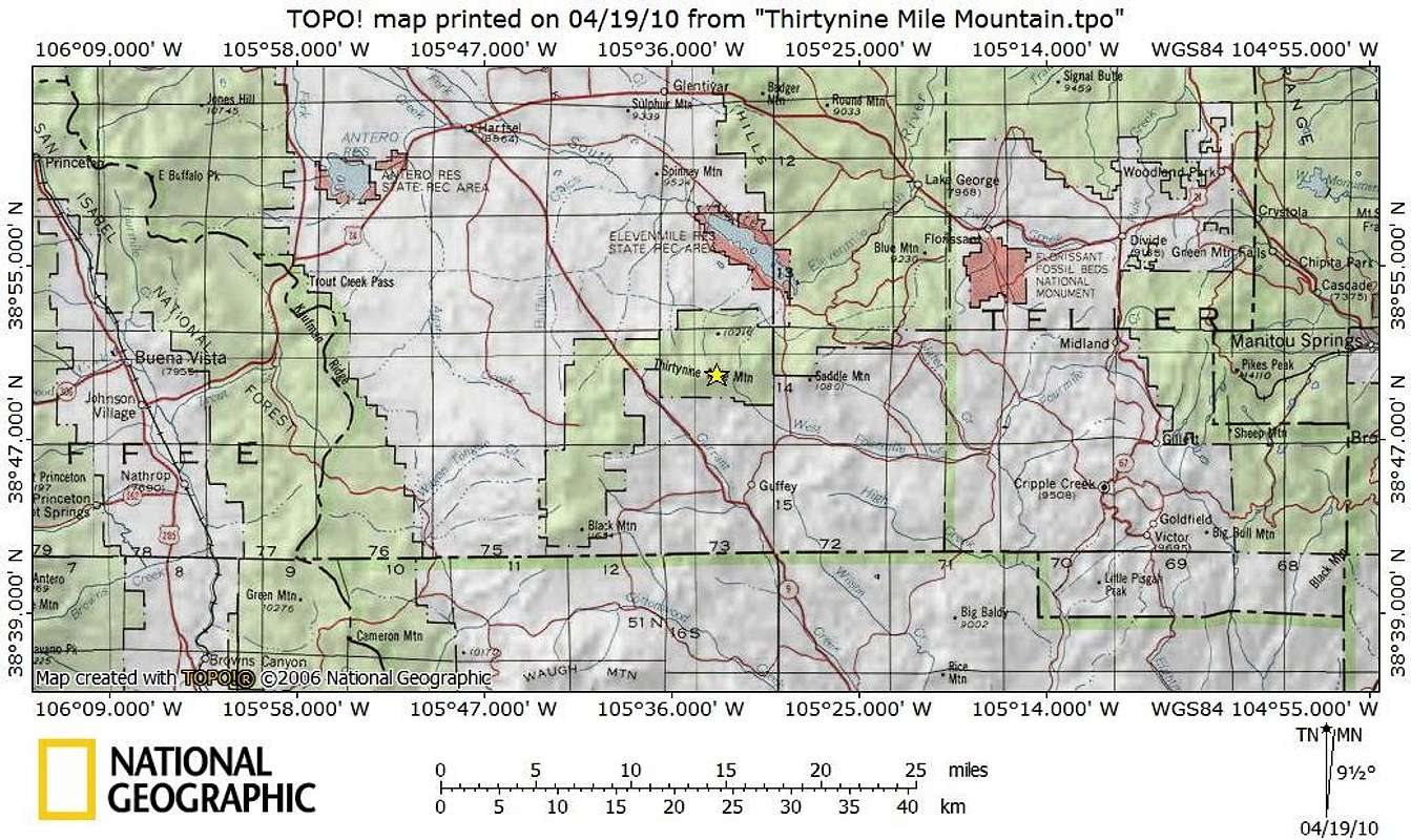
Thirtynine Mile Mountain_Getting There Map
View High-Resolution Image
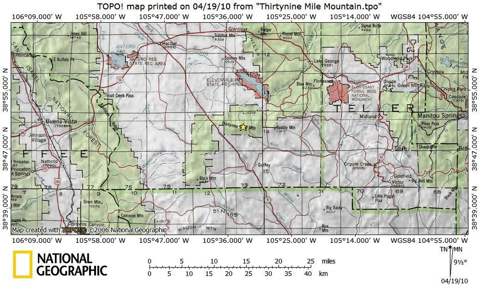
Thirtynine Mile Mountain_Getting There Map
Thirtynine Mile Mountain sits forty miles west as the raven flies from Colorado Springs, 30 miles by road southeast of Hartsel and less than 10 miles north of the town of Guffey.
Map created April 2010
« PREV
NEXT »
Sarah Simon
on
Apr 25, 2010 9:32 pm
Comments & voting
Other parents
Lat/Lon:
38.83250°N / 105.5552°W
Image Type(s):
Topo/Diagram
Image ID:
616375
5348 Hits
74.01
% Score
4
Votes
Log in to vote
Comments
No comments posted yet.
to post!
Don't have an account?
Thirtynine Mile Mountain
(Mountain/Rock)
You are at
the First
Image
Viewing
#1 of 1
GALLERY
You are at
the Last
Image
Sarah Simon's Image Gallery
« PREV
Viewing
#1706 of 5480
GALLERY
NEXT »
Thirtynine Mile Mountain
(Mountain/Rock)
Loading....
×
You need to login in order to vote!
User Name
Password
Remember me
Forgot your password?
Log me out when I close my browser.
Keep me logged in all the time.
sign in as a user
Don't have an account?
Register now for FREE
Rating available
Suggested routes for you
People who climb the same things as you
Comments Available
Create Albums
Register Here


