
Viewing: 1-1 of 1

cftbq - Mar 1, 2005 6:30 pm - Hasn't voted
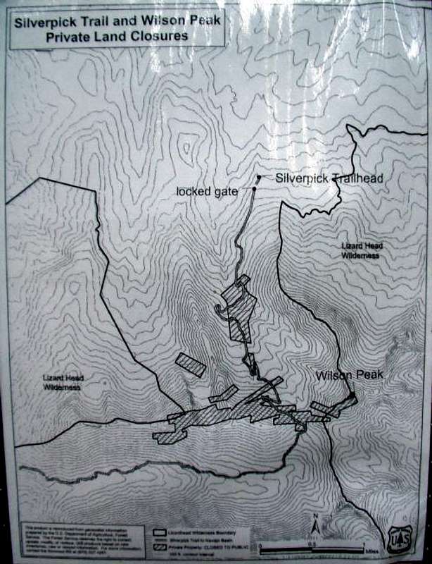
This really stinks!Thanks for posting an accurate map, which shows just where the private property is. I'd feel more sympathetic to the private land owner's right to close off public access if I thought that these anachronistic mining claims had any real value, OR that hikers and climbers were really interfering with the owner's ability to use his "mine." But I don't believe either of these things.
But whatever the details may be, _anything_ that makes it harder for the hapless peakbagger to complete all of the fourteeners just plain ticks me off!
Viewing: 1-1 of 1


Comments
Post a Comment