
This is a TOPO! 3D map of the...
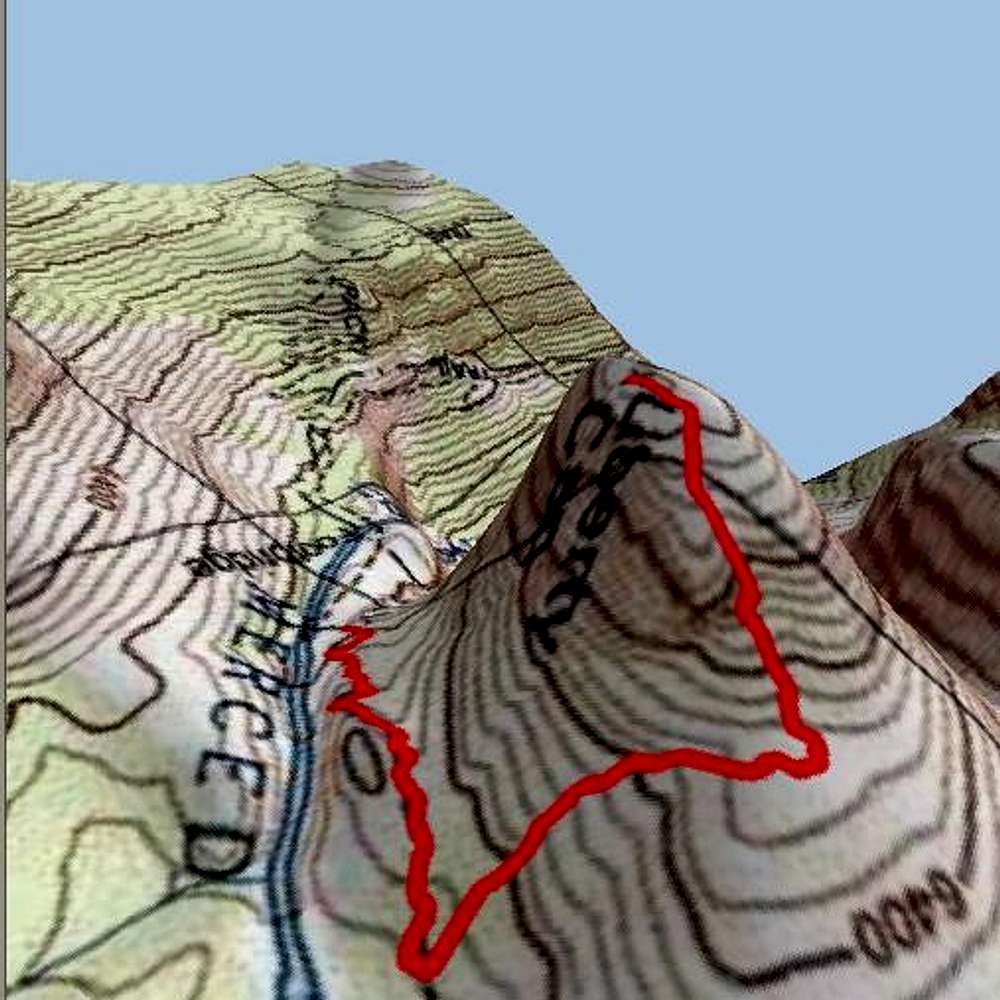
This is a TOPO! 3D map of the route up LIberty Cap from the intersection of the JMT with the Mist Trail above Nevada Falls. I chose to ascend the climbers left side of the gully visible on the north side of Liberty Cap once I reached the plateau at 6500'.


