Toggle navigation
Mountains
Routes
Images
Trip Reports
Forum
What's New
People
Areas & Ranges
Articles
Trailheads
Canyons
Huts & Campgrounds
Albums
Logistical Centers
Fact Sheets
Lists
Custom Objects
Gear
Plans & Partners
WELCOME TO SUMMITPOST
SIGN IN
REGISTER
Cone Peak
Additional Parents
USGS Benchmarks
Image
This is the USGS Marker that...
View High-Resolution Image
This is the USGS Marker that...
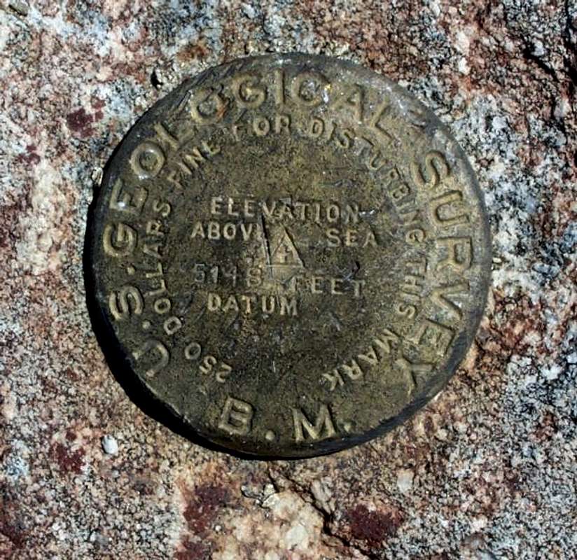
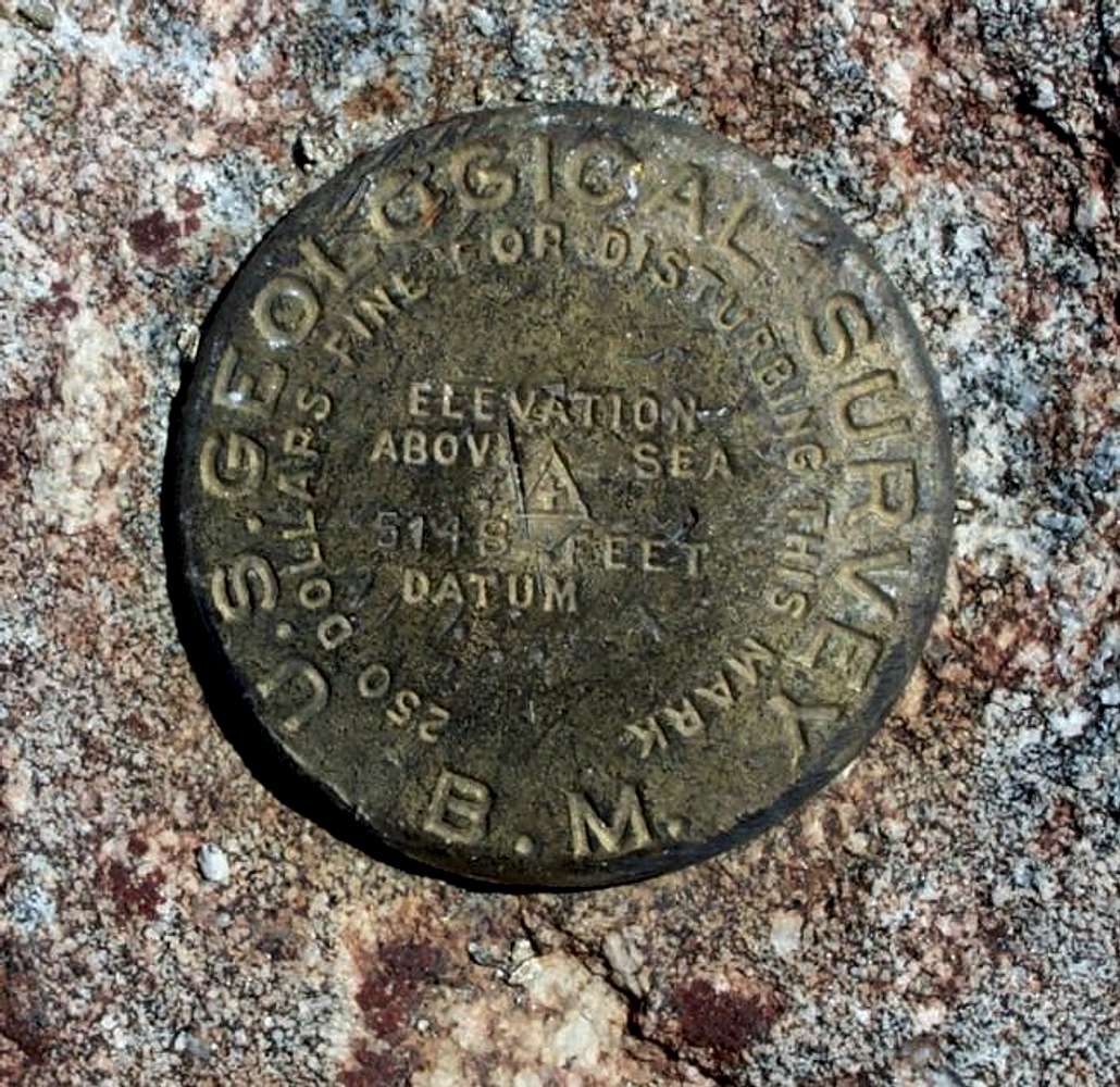
This is the USGS Marker that is located at the summit. Taken 9-7-02. Heidi Daley
« PREV
NEXT »
butterflywings73
on
Sep 8, 2002 2:42 pm
Comments & voting
Other parents
Lat/Lon:
36.05190°N / 121.495°W
Image ID:
10917
2805 Hits
71.37
% Score
3
Votes
Log in to vote
Comments
No comments posted yet.
to post!
Don't have an account?
Cone Peak
(Mountain/Rock)
« PREV
Viewing
#58 of 70
GALLERY
NEXT »
butterflywings73's Image Gallery
« PREV
Viewing
#17 of 30
GALLERY
NEXT »
USGS Benchmarks
(Album)
Loading....
×
You need to login in order to vote!
User Name
Password
Remember me
Forgot your password?
Log me out when I close my browser.
Keep me logged in all the time.
sign in as a user
Don't have an account?
Register now for FREE
Rating available
Suggested routes for you
People who climb the same things as you
Comments Available
Create Albums
Register Here


