

Viewing: 1-2 of 2

nomad - Oct 4, 2005 8:01 am - Voted 10/10
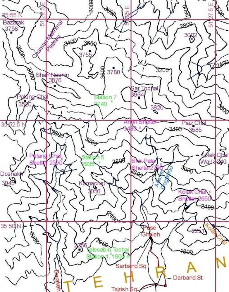
MapYou didn't send me map of this area ?
have you seen google's maps ? it's great you can zoom far down... I couldn't point velenjak and Tochal summit... but Damavand area is so easy to locate.

nader - Oct 4, 2005 9:46 am - Hasn't voted
Re: MapYes, I forgot this and the map of Dizin. I have not yet added the other ones you did because there are a few things in them I want to change. If you don't mind, I will send these and the other ones to you.
Google Satellite photos are great. I love how the Caspian coastal forests suddenly appear. I can even identify the major freeways in Tehran.
Viewing: 1-2 of 2


Comments
Post a Comment