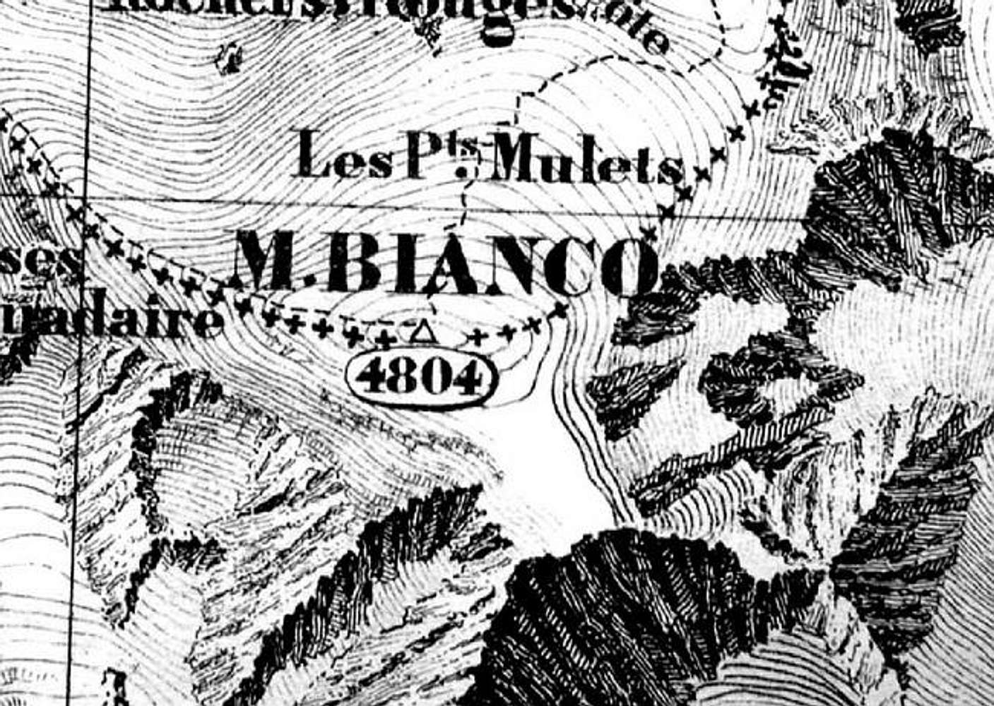
This map is part of the second - and definitive - treat signed between Napoleon III and the Italian King Vittorio Emanuele II and shows - unambigously - that the French-Italian border line passes on the summit of Mont Blanc The extreme precision of the height (4,804m against the 4807m of most recent surveys) does not justify any French subsequent claim. The summit of Mont Blanc is shared between Italy and France. Any French territorial claim is an abuse.


