Welcome to SP!  -   
 
 New features are here! - Read More... 
Areas & Ranges·Mountains & Rocks·Routes·Images·Articles·Trip Reports·Gear·Other·People·Plans & Partners·What's New·Forum

This was the general route...

 
[ Sizes: Orig | Med | Small | Thumb ]
This was the general route...
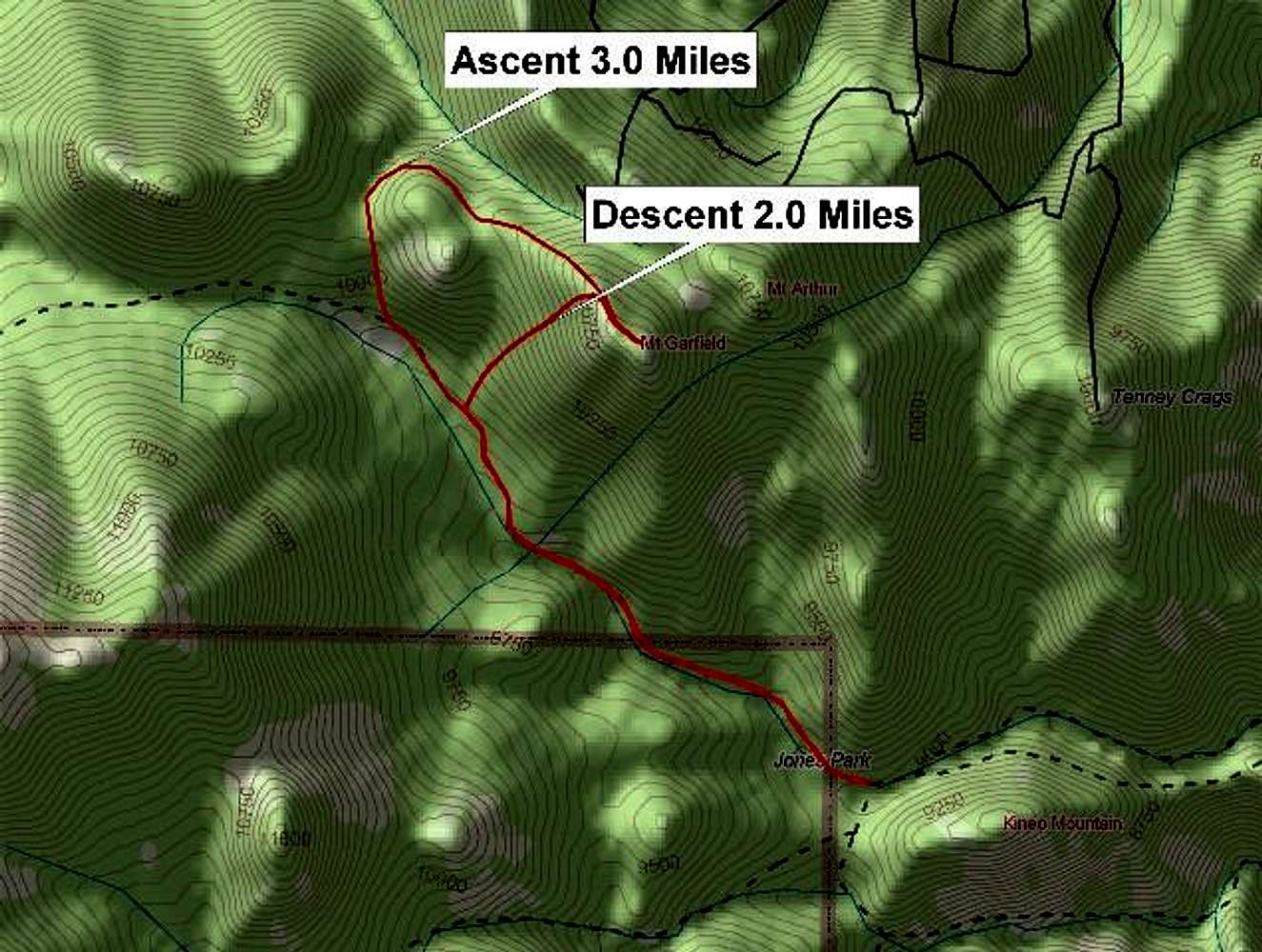
This was the general route taken on my May 28, 2005 summit. This route was based on what appeared to be the best based on the contours of the area. The section between the two saddles was rather steep and heavy with boulders and downfall. This made for a rather unpleasant quarter mile or so. I would recommend heading up the steep southwest face rather than retracing my ascent route. One might try to head directly from Jones Park directly to the saddle between Mt. Garfield and Mt. Arthur.


Comments

No comments posted yet.


Sign in to post!

Don't have an account? Register now.


Rate This Image
Current Score: 86.39

Log In To Vote
 West Ridge via upper Bear Creek Valley (Route)


You are at
the First
Image

Viewing
#1 of 3
GALLERY
General slope of southwest...
NEXT »

 csmcgranahan's Image Gallery

The summit rock of Mt....
« PREV

Viewing
#146 of 659
GALLERY
Interesting formations and...
NEXT »


 Mount Garfield (Mountain/Rock)


 Mt. Garfield via Jones Park (Trip Report)


Image Data

csmcgranahanSubmitted by csmcgranahan
on May 30, 2005 10:12 pm

Image ID: 107551
Hits: 2041 

Lat/Lon: 38.80760°N / 104.9472°W


"It is impossible to fully enjoy procrastination unless one has plenty of work to do."

© 2006-2012 SummitPost.org. All Rights Reserved.