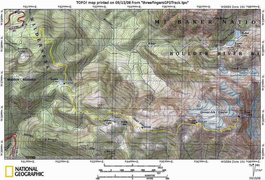
Three Fingers route

Three Fingers route

This is the unedited GPS track that was created by combining pieces from the ascent and descent tracks. If I believe the tracks, it was a 4950', 15.1 mile day. Initially I thought the elevation gain was too high. Most beta puts it in the 4200-4300' range. I used the TOPO! software route "Build Profile" command to plot the route, and identified five legitimate downhills that add up to 500'. The TH to summit gain is 3850', and when you add 2x500' to that you get 4850' total. I would be curious to see what others compute for this route's elevation gain. Sept 14, 2008.
larryN
on Sep 19, 2008 12:43 am
Image Type(s): Topo/Diagram
Image ID: 444481

Comments

Post a Comment
Viewing: 1-2 of 2
gimpilator

gimpilator - Sep 19, 2008 2:53 pm - Voted 10/10

Nice Work!

This is great trip beta and I'm sure many people will find it helpful. Thanks for adding this to the page.

Adam

larryN

larryN - Sep 19, 2008 6:21 pm - Hasn't voted

Re: Nice Work!

You've done a nice job with this page, Adam, and I've enjoyed looking at the pictures from your last trip. Larry

Viewing: 1-2 of 2