
|
|
Mountain/Rock |
|---|---|
|
|
40.55665°N / 118.16057°W |
|
|
Pershing |
|
|
Hiking |
|
|
Spring, Summer, Fall, Winter |
|
|
9090 ft / 2771 m |
|
|
Overview
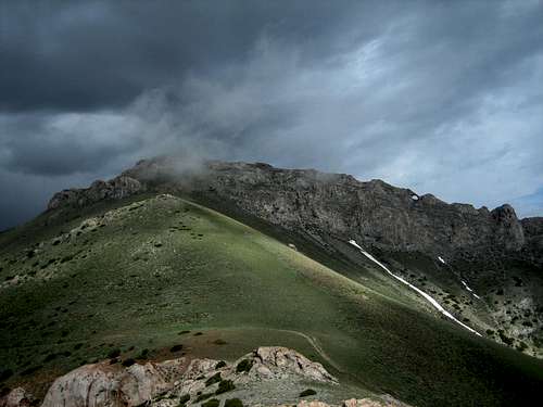
Located in the Humboldt Range in central Nevada, Thunder Mountain rises impressively from Star Creek Canyon and forms the north eastern portion of the cirque around the same canyon. Thunder Mountain is the third highest named summit in the Humboldt range being only shorter than nearby Star Peak (9,866) and Van Zant Peak (9,262).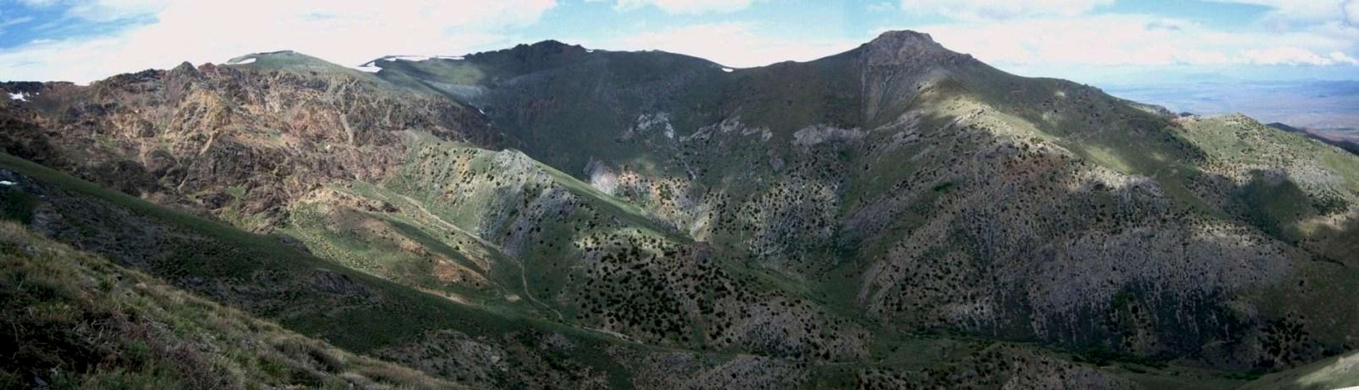  |
The north ridge of the peak showcases a large natural arch that is visible from the Buena Vista valley almost 5,000 feet below. Additionally, another, lesser know arch is located on the mountain.


The views from this traverse are grand, encompassing all of the nearby peaks, Star Canyon, much of the Buena Vista Valley to the east, the Rye Patch Reservoir and I-80 to the west.
The peak can be climbed year round but in winter substantial snowfall may make approaches difficult.
Area Overview
The Humboldt Range runs north/south and stretching approximately 33 miles from near Imlay in the north to slightly east of the small town of Lovelock. The southern portion of the range forms the eastern boundary of mountains serving to contain the Humboldt Sink located another 30 miles further to the southwest. The Humboldt Sink is a dry lake fed only by the Humboldt River flowing in from the north. There is no natural outlet to the Humboldt Sink. In the early 1980’s the Nevada Department of Transportation cut a channel from the Humboldt Sink to the Carson Sink located slightly west, in order to alleviate flooding pressure from nearby Lovelock. Both sinks are remnants of the prehistoric Lake Lahontan.In addition to the natural features the area is rich in mining history. Star City itself is a Nevada State historical site
Star City
Star City, located in the Star Creek Canyon had its heyday between 1864 and 1865. The Sheba mine produced some $5 million worth of silver. The party ended around 1870 when the ore veins were depleted. Today, all that is left of the city are some crumbling foundations and lots of evidence of mining.

Unionville
Unionville is located about 8 miles south of Star City. Unionvlle is frequently cited as being a ghost town but there are about 20 people still living there. Mark Twain lived in the town for a short while and the ruins of his cabin still exist.
Getting There
Since the peak is located close to I-80, getting to the trailhead is relatively easy. As mentioned above, there are two frequently used approaches. Both require some off-road driving but passenger cars should be able to navigate them, at least for the early portions. They are:Star Creek Canyon (aka Star City Canyon)
From I-80 near Mill City, exit Nevada Hwy 400 and head south. After about 8.5 miles, on the right hand side, there is a Nevada State historical marker for Star City. Turn right and continue west for about 6.5 miles. A 4wd road intersects with the main dirt road and heads north from this point. This road is the beginning (or end) of the traverse route between Thunder Mountain and Star Peak. The road continues further west to the historical site where is begins to deteriorate rapidly.

El Dorado Canyon
Following the directions found on the El Dorado Canyon route page from Star Peak will lead to the southern portion of the ridge traverse between the two peaks.
Camping
Dispersed camping is allowed just about anywhere. Within Star Creek Canyon, there are numerous informal campsite with stacked stone fire rings. There is evidence of a relatively recent brush fire in the hills. Common sense dictates caution when having campfires in these locations.A state run campground is located at the Rye Patch State Recreation Area. Currently, fees are $10 per night and sites are on a first come / first served basis.
Red Tape
As the peak and surrounding area is mostly BLM land, there are few if any restrictions. More information can be found at the BLM district office website.5100 East Winnemucca Blvd.
Winnemucca, NV 89445
Phone: 775-623-1500
Fax: 775-623-1503
Email: wfoweb@nv.blm.gov
Office hours: 7:30 am-4:30 pm, M-F
District Manager: Gene Seidlitz