-
 3397 Hits
-
 90.73% Score
-
 33 Votes
|
|
Mountain/Rock |
|---|---|
|
|
31.32035°N / 6.2029°W |
|
|
Hiking, Scrambling, Canyoneering |
|
|
Spring, Fall, Winter |
|
|
6037 ft / 1840 m |
|
|
Overview
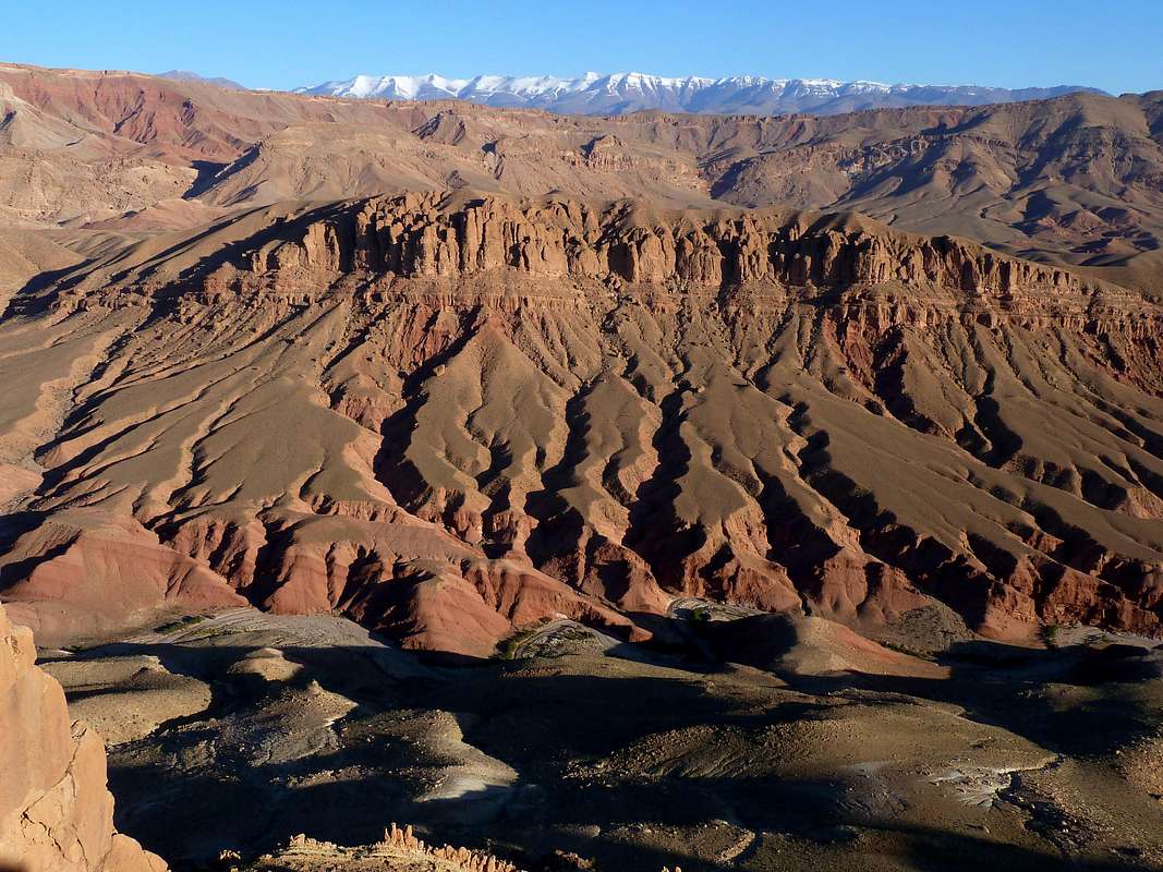
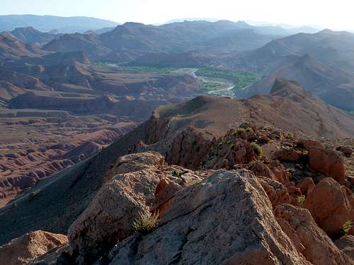
Looking north from the Timassinine Ridge
Travelers to Morocco will find plenty of information about guided multi-day treks across the Atlas and Anti-Atlas, and an absurd surfeit of web pages touting the basic route up Jbel Toubkal. But Morocco has another mountain experience for those who want it--thousands of smaller peaks that provide a morning or afternoon's ramble in some of the most spectacular desert country this planet has to offer, with only a Berber herdsman or two for company--or maybe no company at all. This page describes one of those little gems.
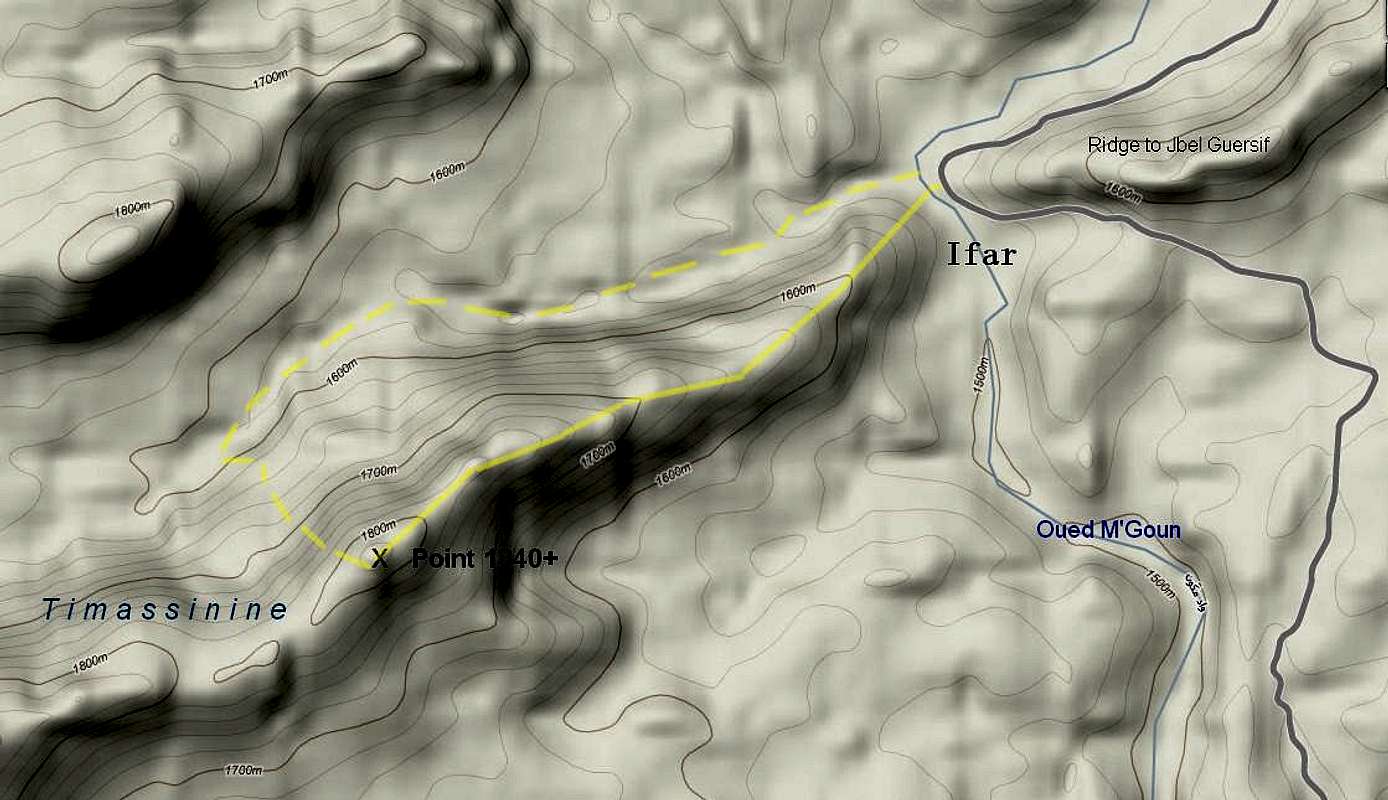
The Dades Valley, the Valley of Roses, forms a broad, open divide between the Atlas and Anti-Atlas for the 130 kilometers between Boumaine Dades and Ouarzazate. Between El Kelaa M'Gouna and the Skoura oasis, this basin is bounded on its north side by an abrupt ridge, the first ridge of the Atlas. This is the Timassinine, a narrow crest 25 kilometers long. You'll find it on the EWP 1:160,000-series map entitled "Ouarzazate," created (gross inaccuracies and all) from Soviet military mapping sheet H 29-06. Point 1840+ is the easternmost summit of this ridge, dominating the village of Ifar.
Invest a couple of hours of your vacation on this mountain, and you'll get a taste of high desert scenery that you won't soon forget.
Getting There
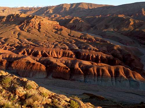
Looking east toward Ait Said and Jbel Ta'louit
A hundred kilometers east of Ouarzazate, at the marketplace in the center of El Kelaa M'Gouna, leave the N10 and head north on the 6903. It's the only paved road going north, so you'll find it easily. All vestiges of tourist traffic will soon be left behind. The road follows a bench along the east side of Oued M'Goun. About a dozen kilometers north of El Kelaa, at the village of Ifar (or Ifre), the road descends right down to the river to pass through the first gap in the mountains. Park here, next to the southbound sign for "Station Hydrogeologique Ifre."
Routes

Access bridge.
The Timassinine is accessed by crossing the rickety bridge depicted at right. On the far side, the ridge rises directly out of the water. Get on the crest (goat paths make this easy) and walk and scramble two kilometers to the obvious peak. You'll climb 350 meters/1150 feet, traversing one gentle intermediate summit. It takes about an hour to get to the top. The traveling is rougher than trail walking but never exceeds YDS class 2.
Another two kilometers down the ridge is the next peak, Point 1995. It looks like a worthy goal, but you'd need another hour to reach it.
To make a fun loop out of the trip, you can descend north into a beautiful wadi that provides easy travel back to Oued M'Goun. To get down to the wash, one can make a fourth class (UIAA II) descent of Peak 1840+'s north face (a couloir a few meters west of the summit provides a good line) or one can take a broader detour around the summit cliffs. Don't try this unless you're comfortable with off-trail routefinding in rugged desert--it's quite a bit more challenging than the ridgecrest route. Once in the wadi, walk about 30 minutes to Oued M'Goun, then wade or scramble around a natural rock wall to reach the bridge.
The loop can also be done in reverse.
Summit Views
|
|


Nature of the Terrain
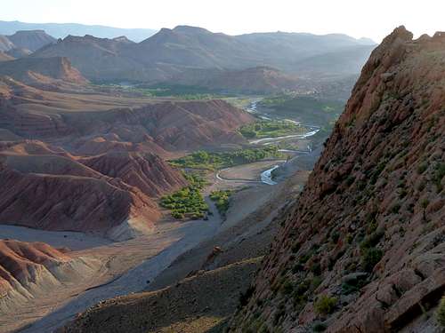
This view shows the ascent ridge
Local Lodging and Guides
There is fabulously romantic lodging on the 6903 just north of El Kelaa M'Gouna at Kasbah Itran. The place is very professionally run by people genuinely concerned for your welfare, the rates are reasonable at less than 30 euros per person in half board, and the food is safe and excellent.Less expensive (under 20 euros half board), but clean and with some charm, is Kasbah Chems, perched on a hillside a few kilometers past the starting point for this hike.
I didn't use a guide for Point 1840+, but a local Berber guide might enhance your ability to extend your trip to the gorgeous canyonlands to the northwest. Guides can also arrange good multiday treks and day-long village-to-village walks in this area. Both inns listed above offer guide services, available whether you stay there or not. With Chems, the cost is about 20 euros/person for a day out, including food and transport; with Itran it would probably be similar.