Toggle navigation
Mountains
Routes
Images
Trip Reports
Forum
What's New
People
Areas & Ranges
Articles
Trailheads
Canyons
Huts & Campgrounds
Albums
Logistical Centers
Fact Sheets
Lists
Custom Objects
Gear
Plans & Partners
WELCOME TO SUMMITPOST
SIGN IN
REGISTER
Southeast Idaho Ranges
Additional Parents
Sherman Peak
Franklin County HP (The Felt Hat)
Image
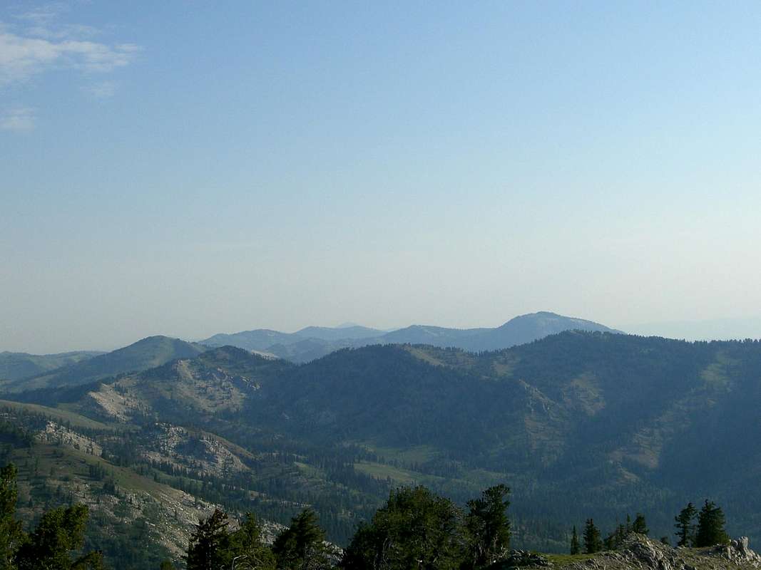
To the North
View High-Resolution Image
To the North
This is the view to the north of the Franklin County High Point. St. Charles Mountain, Bloomington Peak, Midnight Mountain, Paris Peak, and Sherman Peak are all visible. Photo by Matt Durrant on July 23, 2007.
« PREV
NEXT »
mtybumpo
on
Jul 26, 2007 2:09 am
Comments & voting
Other parents
Lat/Lon:
42.09700°N / 111.5799°W
Image Type(s):
Hiking
,
Scenery
Image ID:
316372
2427 Hits
71.06
% Score
1
Votes
Log in to vote
Comments
No comments posted yet.
to post!
Don't have an account?
Southeast Idaho Ranges
(Area/Range)
« PREV
Viewing
#24 of 25
GALLERY
NEXT »
mtybumpo's Image Gallery
« PREV
Viewing
#1121 of 1359
GALLERY
NEXT »
Sherman Peak
(Mountain/Rock)
Loading....
Franklin County HP (The Felt Hat)
(Mountain/Rock)
Loading....
×
You need to login in order to vote!
User Name
Password
Remember me
Forgot your password?
Log me out when I close my browser.
Keep me logged in all the time.
sign in as a user
Don't have an account?
Register now for FREE
Rating available
Suggested routes for you
People who climb the same things as you
Comments Available
Create Albums
Register Here


