Toggle navigation
Mountains
Routes
Images
Trip Reports
Forum
What's New
People
Areas & Ranges
Articles
Trailheads
Canyons
Huts & Campgrounds
Albums
Logistical Centers
Fact Sheets
Lists
Custom Objects
Gear
Plans & Partners
WELCOME TO SUMMITPOST
SIGN IN
REGISTER
Pansy Basin to Schreiner
Additional Parents
Image
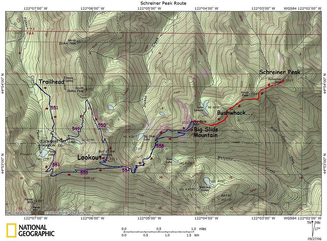
TOPO! map of the route...
View High-Resolution Image
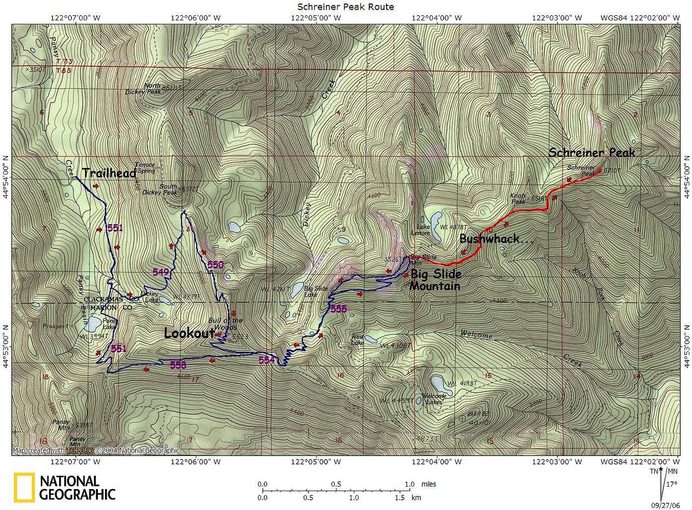
TOPO! map of the route...
TOPO! map of the route showing direction, trail numbers...etc The red line indicates the bushwhack area and the blue line indicates the maintained trail. At total of 14-Miles RT x about 4900' total gain
« PREV
NEXT »
Karl Helser
on
Sep 28, 2006 2:29 am
Comments & voting
Other parents
Image ID:
229992
2238 Hits
71.06
% Score
1
Votes
Log in to vote
Comments
No comments posted yet.
to post!
Don't have an account?
Pansy Basin to Schreiner
(Route)
« PREV
Viewing
#6 of 7
GALLERY
NEXT »
Karl Helser's Image Gallery
« PREV
Viewing
#642 of 746
GALLERY
NEXT »
×
You need to login in order to vote!
User Name
Password
Remember me
Forgot your password?
Log me out when I close my browser.
Keep me logged in all the time.
sign in as a user
Don't have an account?
Register now for FREE
Rating available
Suggested routes for you
People who climb the same things as you
Comments Available
Create Albums
Register Here


