Toggle navigation
Mountains
Routes
Images
Trip Reports
Forum
What's New
People
Areas & Ranges
Articles
Trailheads
Canyons
Huts & Campgrounds
Albums
Logistical Centers
Fact Sheets
Lists
Custom Objects
Gear
Plans & Partners
WELCOME TO SUMMITPOST
SIGN IN
REGISTER
Southwest Ridge
Additional Parents
Image
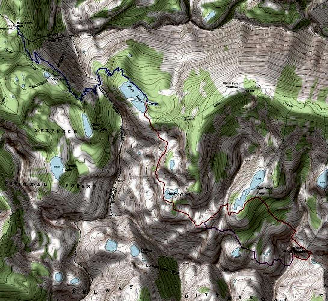
Topo of Entire Route
(approach and climb)
View High-Resolution Image
Topo of Entire Route
(approach and climb)
Topo of entire route from trailhead to White's summit. GPS recorded, 18-20jul07.
Blue
- Trail to base camp at Fish Lake
Red
- Ascent of White's Mountain
Purple
- Descent from White's Mountain
« PREV
NEXT »
Michael Hoyt
on
Jul 28, 2007 6:49 pm
Comments & voting
Other parents
Lat/Lon:
46.11656°N / 114.49187°W
Image Type(s):
Topo/Diagram
,
Informational
Image ID:
317271
3624 Hits
74.92
% Score
5
Votes
Log in to vote
Comments
No comments posted yet.
to post!
Don't have an account?
Southwest Ridge
(Route)
« PREV
Viewing
#16 of 36
GALLERY
NEXT »
Michael Hoyt's Image Gallery
« PREV
Viewing
#648 of 1801
GALLERY
NEXT »
Whites Mountain
(Mountain/Rock)
Loading....
North Ridge
(Route)
Loading....
×
You need to login in order to vote!
User Name
Password
Remember me
Forgot your password?
Log me out when I close my browser.
Keep me logged in all the time.
sign in as a user
Don't have an account?
Register now for FREE
Rating available
Suggested routes for you
People who climb the same things as you
Comments Available
Create Albums
Register Here


