Toggle navigation
Mountains
Routes
Images
Trip Reports
Forum
What's New
People
Areas & Ranges
Articles
Trailheads
Canyons
Huts & Campgrounds
Albums
Logistical Centers
Fact Sheets
Lists
Custom Objects
Gear
Plans & Partners
WELCOME TO SUMMITPOST
SIGN IN
REGISTER
Dog Mountain
Additional Parents
Image
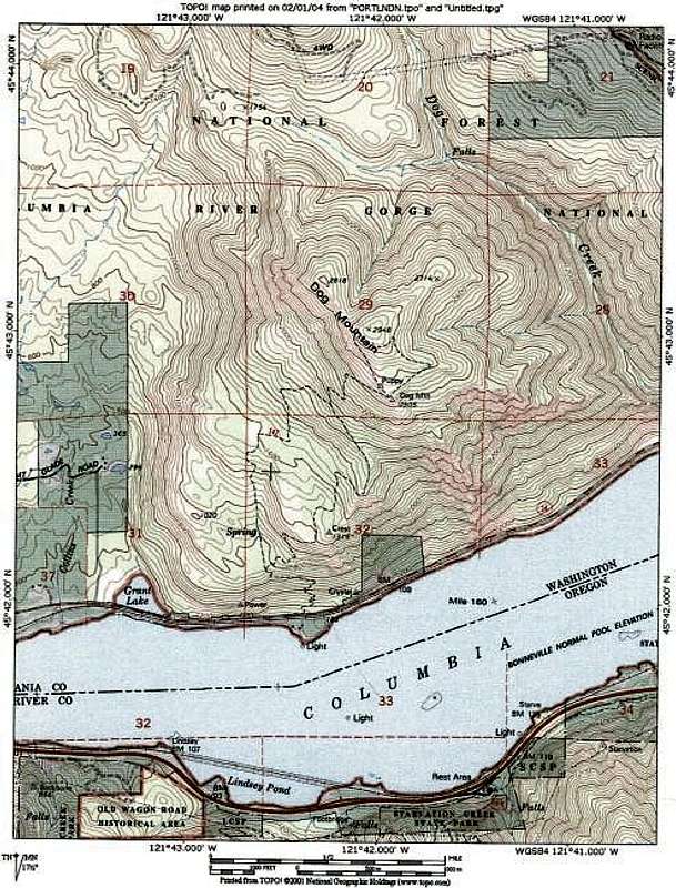
Topo showing Old Route (left...
View High-Resolution Image
Topo showing Old Route (left...
Topo showing Old Route (left fork) and the Scenic Route (right fork). Augspurger Mountain Trail is not shown on this map but starts from the same parking lot and contours around the west side of the mountain.
« PREV
NEXT »
Brian Jenkins
on
Feb 2, 2004 2:41 am
Comments & voting
Other parents
Lat/Lon:
45.71710°N / 121.7011°W
Image ID:
40400
3564 Hits
76.66
% Score
7
Votes
Log in to vote
Comments
No comments posted yet.
to post!
Don't have an account?
Dog Mountain
(Mountain/Rock)
« PREV
Viewing
#25 of 130
GALLERY
NEXT »
Brian Jenkins's Image Gallery
« PREV
Viewing
#725 of 4042
GALLERY
NEXT »
×
You need to login in order to vote!
User Name
Password
Remember me
Forgot your password?
Log me out when I close my browser.
Keep me logged in all the time.
sign in as a user
Don't have an account?
Register now for FREE
Rating available
Suggested routes for you
People who climb the same things as you
Comments Available
Create Albums
Register Here


