Io son la Regina del Cielo e della Terra e quindi tutti vengon da me ed io loro accolgo. Si siedon ai miei piedi e curan le lor pene e fatiche. Nessuno, o pochi che avidamente cercan cose futili, raggiungono quel mucchietto di sassi che stà appena al di sopra. Qualcuno lo fa ma poi, guatando in basso verso l'abisso, si gira e ritorna sui suoi passi riavvicinandosi a me. Poi mi salutan prima d'andar via. Io no, rimango qua da più di cent'anni, quasi duecento, a vegliar su tutta la Valle. Neppur il fulmine può impensierirmi e non ho paura del serpente che schiaccio sotto i miei piedi. L'Emilius, alle mie spalle, lo sà ...
like all younger brothers, he has always created problems. Caring. Of all three walloons is one that has always created problems in this Little Old, already tired and decrepit. The people that knows him and he has always looked good to give him confidence. When he did have pain. For this reason, at the end of its travel, close to the Village of Saint Bénin, they built the votive Chapel of Santa Barbara. At the top, where he takes the start on the slopes of Punta del Dard and near the Alp Ponteilles with its waterfall before going to the Valley of Comboé, another Chapel dedicated to Saint Joseph, but far departed from the bottom of the gorge and quietly
at Reverier Dessous. Incidentally also the Abbot Henry, watching on a mule pyramids erosion site at the top after Les Pousses, had dubbed the
. That definitely has created this Little Devil that has scared even the La Barma, Le Pointier Alps; peasants, always careful, cautious and wary, they have built over the banks and at top. Only boys and
went to play in there, climbing on the back of the Hell. But we know: the ones not afraid even of
and the others are armed. And then, every so often, someone goes there to collect firewood ...
the walloon beneath the stems of Comboé where this comes down with a series of small waterfalls, progressively more impetuous, culminating in a larger above the Alpe di Ponteilles
. In addition goes down and winding up the water intake of La Mare (
; "The Mother of all waters", attention to the danger of landslides from the West side with a sign prohibiting transit), and from this point is addressed through a ravine deeper and deeper toward the Bridge Rongachet
and then reach a waterfall with a tiny pond just upstream of the Rock Gym Chenaux and the village
, leaving just the top in the East Chapel of Saint Bénin dedicated to Santa Barbara. Deflects here Northeast towards Regional Road reaching the Dora Baltea between the Pollein Municipality and the Fraction Pian Felina or Plan Félinaz
you can visit the impressive containment works carried out over the Village Chénaux.
, at the side of the previous year, reaching, rising high above the Rock Gym Chénaux and through the woods, the small Village of Le Pointier (
, and from this a private road leads to the Regional Pila), perched above the ravine.
A new Municipal Road in asphalt, starting from Chénaux, climbs steeply up the East side of the Gorge/Walloon coming, after another small settlement, to the Village of Rongachet
at the homonym small bridge. It is a very wild that is worth visiting with beautiful views of the Central Valley and above Aosta Town.
, which talks about the Abbé Joseph Maria Henry recalling a popular legend, is in an area of erosion pyramids, long around 150 metres and high up to 40 metres about can be reached after a short descent from Les Pousses or Pouce Pasture (
. Or going further down from one of the four Villages of Reverier (Reverier du Tzat, du Marendet, Dessous and Dessus,
). Gorgeous and scenic trail in the middle of a beautiful hardwood forest, now crossed by a dirt road that passes by Félinaz to Le Créton
. Unfortunately you do not respect even more the Dead!
Hike, with different starting points, and by the Municipalities of Charvensod Pollein, to the Falls of Ponteilles (
), at the beginning of the valley of the same name.
via farm roads and trails, rounding the Punta del Dard and crossing the Black Forest of Combatissière, reach in succession the Alps Les Leyzères, Le Vaccoz, Les Usellières, Chevrère, Combatissière (
, depending on the chosen route).
. Unfortunately, many parts were demolished to retrieve the stones suitable for the construction of retaining walls on the Torrent Comboé. The old entrance no longer exists and you need to enter from the Chapel of St. Bénin towards the Southwest with ford on the torrent to get to the central area (
). In any case, check the nails, even expansion, because by now rather old.
Sempre no "scavezzacollo", na "pellaccia" é stato il più giovane dei Figli della Becca:
come per tutti i fratelli minori, anche lui ha sempre cercato grane. Fregandosene d'ogni cosa. Di tutti e tre i valloni é quello che ha sempre creato problemi a sta Vecchietta, già stanca e decrepita. La gente lo sà e s'é sempre guardata ben di dargli troppa confidenza. Quando l'ha fatto son stati Dolori. Per tutti. Con sta precisa considerazione al termine della sua corsa, vicino al Villaggio di Saint Bénin, han costruito la Cappella votiva di Santa Barbara. In alto, dove lui prende le mosse alle pendici della Punta del Dard e nei pressi dell'Alpe di Ponteilles con la sua bella Cascata prima di salire alla Valle di Comboé, han dedicato un'altra Cappella a Saint Joseph, ma ben discostata dal fondo della gola, sicura tra i prati al limitar del bosco e tranquillamente "appartata" presso l'Alpeggio del Reverier Dessous o di Sotto. Daltronde anche l'Abbé Henry, osservando a dorso di mulo le piramidi d'erosione site in alto dopo l'Alpeggio di Les Pousses, le aveva soprannominate il "Muro del Diavolo". Sicuramente generante sto Diavoletto che ha spaventato pur gli Alpeggi di La Barma e Le Pointier; ma i contadini, sempre attenti, prudenti e diffidenti, l'han costruiti sopra le sponde ed in alto. Soltanto i ragazzi e gli Alpini son andati a giocare là dentro, arrampicandosi sulla groppa del Diavolo. Ma si sà: gli uni non han paura neppure del "Signor Diavolo" e gli altri son armati. E poi, ogni tanto, và lì qualcuno, a rastrellar legna ...
Annotazioni Topografiche: il vallone prende origine sotto quello di Comboé, dove questo scende con una serie di piccole cascate, progressivamente più impetuose, che si concludono con una più grande sopra l'Alpe di Ponteilles (1697 m). Oltre prosegue in basso e sinuoso fino alla presa dell'acqua di La Mare ((1187 m; "La Madre", attenzione pericolo di frane dal lato Occidentale con cartello di divieto di transito); da questo punto si indirizza, tramite un burrone sempre più profondo, verso il Ponte di Rongachet (circa 1100 m) per poi raggiungere una cascata con laghetto proprio a monte della Palestra di Roccia di Chénaux ed il villaggio (630 m), lasciando appena in alto ad Est la Cappella di Saint Bénin dedicata a Santa Barbara. Qui devia a Nordest verso la Strada Regionale per Pollein raggiungendo la Dora tra questo comune e la Frazione di Piano Felina (559 m).
Curiosità: 1)- si posson visitare l'imponenti opere di contenimento effettuate sopra il Villaggio di Chénaux. 2)- Un sentierino partendo dalla Frazione di Roulaz (632 m), a lato della precedente, raggiunge, passando alto sopra la Palestra di Roccia ed attraverso il bosco, il Villaggetto di Le Pointier (976 m; da questo una strada poderale conduce a quella Regionale per Pila), abbarbicato sopra la burra. 3)- Una nuova Strada Comunale in asfalto, partendo da Chénaux, risale ripidamente il lato Orientale della Gorge arrivando, dopo un altro piccolo insediamento, fino al Villaggio di Rongachet (1070 m), presso l'omonimo ponte. Trattasi d'un'area molto selvaggia che merita una visita con belle vedute sulla Valle Centrale e sopra Aosta. 4)- Il famoso "Muro del Diavolo", del quale parla l'Abbé Jopseph Henry ricordando una leggenda popolare, consiste in una zona di piramidi d'erosione, lunghe fino a 150 metri ed alte circa 40, alla quale si perviene, dopo breve discesa dall'Alpe di Les Pousses o Pouce (1601 m, raggiungibile tramite poderale dalla Regionale per Pila), sotto la Punta del Dard (2033 m). Oppure salendo più in basso da uno dei quattro Villaggi di Reverier (du Tzat, du Marendet, Dessous e Dessus; da 1019 a 1124 metri).
Passeggiate, Escursioni ed Arrampicate consigliate: 1)- passeggiata da Piano Felina a Félinaz Alta (588 m) e da questa, tramite l'antico Sentiers des Morts" che serviva per le sepolture, fino a Charvensod Capoluogo (746 m; 0h'35). Splendido e panoramico sentiero in mezzo ad un bel bosco di latifoglie, oggi percorso da una strada sterrata che da Félinaz passa per Le Créton (609 m). Purtroppo non si rispettano più neppure i Morti! 2)- escursione, con diversi punti di partenza dai Comuni di Charvensod e Pollein, alle Cascate di Ponteilles (1750 metri circa; 1h00/1h'15), oppure raggiungendo al termine del vallone il Comboé Dessous (2041 m; 1h'30/2h'00), all'inizio del vallone con lo stesso nome. 3)- escursione dall'Alpe di Ponteilles (1706 m) tramite strade poderali e sentieri che, doppiando la Punta del Dard ed attraversando la Foresta Nera di Combatissière, raggiungono in successione le Alpi di Les Leyzères, Le Vaccoz, Les Usellières, Chevrère, Combatissière (1750 m; due splendidi e molto antichi "Rascards" in legno) ed infine l'Eremitaggio di San grato (1787 m; volendo su comoda strada sterrata si può arrivare a Pila in 2h'00/3'00, secondo l'itinerario prescelto). 4)- La Palestra di Roccia di Chénaux offre varie possibilità di arrampicata sia in "libera" che in "artificiale"; purtroppo molte parti sono state demolite per recuperare le pietre atte alla costruzione delle mura di contenimento sul Torrent de Comboé. Il vecchio ingresso non esiste più e bisogna entrare dalla Cappella di Saint Bénin verso Sudovest guadando il torrente per raggiungere la zona centrale della medesima con la scritta in bianco "S.M.A." (0h'20). In ogni caso verificare lo stato dei chiodi in essere, compreso quelli ad espansione, poiché piuttosto datati.
Comboé's Valley
In a number of ways you can join in the beautiful Valley of Comboè:
in reality it is a walloon, but so is
"lying", which looks like a green and peaceful valley. Indeed, the
"Valley of Eden". Surely it is the first of three children of Becca, the more staid, judicious and then attended. Always. People is not stupid and not realize it, for which it has always had a great respect for this place, as if it were a
"Sacred Valley". As a precaution, however, have erected two tall wooden crosses at the entrance: a top al Col Plan Fenetre, coming from Pila to the Chamolé Pasture or with a steep ascent from the Hermitage of San Grato, and the other going down to Comboé Dèsott (Lower), where the ends of the Walloon Dard. But this last, present until the Sixties, no longer exists. Here, too, came the
"Vandals"; I do not think that it was the Devil. Other revenue rather have no signs of
"Christendom", because those who arrive from the Station of chairlift Chamolé via the Replan pass is definitely a
"Tourist" and we know that they have already for some time lost
"Faith". So there is certainly a
"Cross" that can stop them. The last possibility is that you get from the overlying Walloon Arbolle, a valley in its own right that goes down from Emilius to the Arbolle Shelter. A bad cousin that makes a whole other life; discharges its waters below, but then he goes to Pila through Chamolé Hill, if it has not already done with the Garin to Cogne Valley. But to get off this Comboé is necessary to pass to a deep and somewhat narrow gorge, carved into the rock. It is not something for the
"Mass" and so we are quite comfortable. At least I hope so. Thus three possibilities by means of a descent and a uphill coming from Ponteilles Alpages. This last is
"reserved to the locals", while the
"classic" is from Col Plan Fenetre through the Alp Chamolé
(2152m) with trail n° 19 that starts just below the Perché Dessus Pasture
(1865m) at the Restaurant
"Lion Noir", or by Gorraz Damon
(1930m) through n° 14/19A.
Topographical notes: the Valley of Comboé stretches from North to South, starting from Comboé Dessous or Lower and reaching with the small climb Comboé itself (
2114m; private retreat of the Canons of Saint Orso with adjacent and pretty little chapel, just above of the homonymous pasture with fountain). Continuing South, with semi-flat path, reaches a very old pasture, now completely in ruins with large beams collapsed in his barn, known as the Grand Plan
(2158m), where the walloon ends against a huge rocky rampart, sailed to the East from a throat and on the opposite side from the Torrent de Comboé that descends from above Walloon Arbolle. Laterally to the East opens a deep walloon that leads to the secondary plateau Plan Valé with perimeter remains of an ancient and namesake pasture
(2379m), on the route leading to Federigo Zullo Bivouac at the Carrel Hill
(2907m, 2912m) and to the Becca. To the West rises instead the paths for the two Replan Hills or South and North
(2437m, 2366m) and the Plan Fenetre Hill
(2229m), respectively addressed to Lake Chamolé and Pila, going to the Alpage of Chamolé
(2152m) or ride down to St. Grat Hermitage
(1787m), neighbor a homonym alp.
Trivia & Tragedies: surely the crossing between the Walloon of the Dard and Pila Basin elicits considerable curiosity from the point of view Religious, with distance to cover in one or the other way. The
"keystone" is the Hermitage of Saint Gratus, home to ancient Processions, but also visit the numerous votive chapels can be both interesting and instructive. The Walloon of Comboé has always been a quintessential valley clerical, generally owned by the Canons of Saint Orso, among which excels the figure of Georges Carrel (* Valtournanche 1800 + Aosta 1870), Priest-Mountaineer, Photographer, Scientist-Naturalist and Writer of considerable interest. We owe him a
"Les Alpes Pennines dans un jour, soit, Panorama boréal de la Becca de Nona ...", in 1855, known throughout Europe. Also just above had built an Astronomical Observatory and dedicated it to his friend and Scientist Angelo Sismonda. At Zullo Bivouac has been reported recently the presence of the viper, already abundant in the rocks of the great Comboé; garbage attract mice and that the same, according to a natural cycle. Just below, at a mini pond, has been restored to the old shelter of the Keeper of the Baron Beck Peckoz when the Hunting Reserve stretched up to here (now somewhat reduced only in the Walloon of Saint Marcel is owned by the Marquis of Turati Turin); however, consists of a private retreat, and always closed to the public. It is not clear precisely the use of the same and, in any case, we hope that the same has been built with private money and not public. Very interesting to investigate the fact ... The old Book of Federigo Zullo Bivouac owned by the C.A.I. of Aosta, which ended July 01th, 2007, is no longer replaced.
Why not do more useful things for the Alpinism? Respecting the ancient Traditions of hospitality always
"feel to the end and deeply" in this so close and
"far" from the same time, as taught by the History of these mountains. See, in this respect, in
SP Article
"Such a shame! “Apartheid” in Charvensod", by buxlex Ivrea in September 07th, 2008. On the other hand, scenes of rudeness and vandalism we have recorded galore against Federigo, and this, in part, it may make people understand this choice less desirable. But another question arises spontaneously: why they chose to place the same at the Col Carrel, when questioned in 1984 by Guide Valtournanche Enrico Mauro, I suggested to place the same at an alluvial fans (with water) to the base of the North Face? A position certainly
"more Climbing" and worthy of the wild walloon and its rugged walls and ridges. Instead, it is preferred to place the same in a little more than half an hour from the Top of Becca. A solution then, twenty years later, he
"bore" the idea of the installation, immediately above, of
"Via Ferrata" on the wild West Crest. A ridge Mountaineers facing real and certainly not to the mass, as has become today. Accusing, unfortunately, even a dead man.
Really true that Misfortunes never come completely alone ...
Excursion & Walks recommended: 1)- to Comboé yellow signed by the path n° 14 to Alp Ponteilles, n° 15 to Comboé Shelter and Alpage and then n° 16 to the Grand Plan Alp (
1h'15/1h'30, by Ponteilles Alp).
2)- to the Refuge of Arbolle
(2516m);
1h'30/1h/'45 from Comboé Shelter through the trail that runs through the gorge on the left or East).
3)- walk to the above Plan Fenetre Hill and the nearby Punta Ponteilles (
2164m;
0h'25), to admire the North Wall Becca and the great Landslide of 2000.
4)- Or, turning in the opposite direction and via a small path leading into the woods (yellow signs with hours), you can easily walk between the watershed Comboé and the area of Chamolé; reached the Signal Sismonda (
2300m; remains perimeter of the Observatory;
* do not expose yourself to the East because it falls with a big cliff), continue towards the South on crest or just below the West. Reached the first of the two Hills Replan there are three possibilities:
a)- fell back to Comboé (sign) via a small winding path that comes right behind the hut (
** attention in case of rain or simply if wet);
b)- continue in the same direction, cutting just below the small Punta Replan and the South Hill, and then down the path with more convenient to Lake Chamolé
(2325m) and with a long diagonal on a slight slope, to the nearest station Chairlift (
2311m;
1h'40 from Comboé; closure to the 17h'00/17h'30, according to the season, in summer even after).
c)- From Lake (yellow signs) go up with a good path to the above Chamolé Pass
(2641m) and then quickly drop to Arbolle Refuge (
2516m;
1h'00), at the lake of the same name.
5)- Plan Fenetre Hill continue with a flat path to a first junction; from this, leaving the left to continue to the Chamolé Pasture, off-trail with a steep path up to the Alp and the subsequent Hermitage of San Grato (
1787m; fountain;
0h'50).
6)- On the other side the most
"classic" of the excursions to Becca: crossing the torrent on a catwalk, climb to the Plan Valé (
2350m; ruins), the above Gros Scez (
2550m; Big Boulder) and the near fork
2556 metres; from the latter two possibilities:
d)- continue through the old path that winds to the left, or
e)- get on the right path with not much renovated (but again in gradual degradation in the middle via) that rises to Federigo Bivouac (
2912m;
2h'15) and from there to the Top via a small path to the alternate tracks on the easy Crest South-southeast (
0h'40).
In diversi modi puoi entrare nella splendida Valle del Comboè:
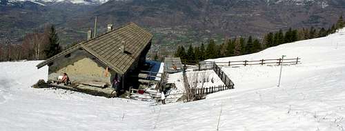
in realtà si tratta d'un vallone, ma é così "adagiato", verde e tranquillo che par na valle. Anzi la "Valle dello Eden". Sicuramente è il primo dei tre Figli della Becca, il più posato, giudizioso e quindi frequentato. Da sempre. La Gente non é stupida e se n'accorge, per la quale cosa ha sempre avuto gran rispetto per sto luogo, come fosse una "Valle Sacra". Per prudenza, comunque, hanno eretto due alte croci in legno all'ingresso: una in alto al Colle Plan Fenetre, arrivando da Pila per l'Alpe di Chamolé o con la ripida salita dall'Eremitaggio di San Grato, e l'altra in basso salendo al Comboé Dèsott (di Sotto), dove termina il Vallone del Dard. Ma quest'ultima, presente fino agli Anni Sessanta, non esiste più. Anche qui son arrivati i "Vandali"; non credo sia stato il Diavolo. Le altre entrate invece son prive di segnali della "Cristianità", perché chi arriva dalla Stazione della Seggiovia di Chamolé tramite il Col Replan é sicuramente un "Turista" e si sà che quelli han già perso da diverso tempo la "Fede". Quindi non é certo una "Croce" che può fermarli. L'ultima possibilità risulta quella d'arrivare dal soprastante Vallone di Arbolle, un vallone a se stante che scende dall'Emilius al Rifugio d'Arbolle. Un cuginastro che fà tutta un'altra vita; scarica le sue acque di sotto, ma poi se ne và a Pila pel Colle di Chamolé, se già non l'ha fatto con il Garin andandosene a Cogne. Ma per scendere da questo al Comboé é necessario passar na profonda e strettissima gola, intagliata nella roccia. Non é cosa per la "Massa" e quindi siam abbastanza tranquilli. Almeno lo speriamo. Quindi tre possibilità per mezzo d'una discesa ed una in salita arrivando da Ponteilles. Quest'ultima é "riservata ai locali", mentre la "classica" rimane dal Col Plan Fenetre tramite l'Alpe di Chamolé (2152 m) con sentiero n° 19 che parte appena sotto l'Alpe Perché Dessus (1865 m) presso il Ristorante "Lion Noir", oppure da Gorraz Damon (1930 m) tramite il n° 14/19A.
Annotazioni Topografiche: il Vallone del Comboé s'allunga da Nord verso Sud partendo dal Comboé Dessous o di Sotto e raggiungendo con piccola salita il Comboé vero e proprio (2114 m; rifugio privato dei Canonici di Sant'Orso con attigua e graziosa piccola Cappella, appena al di sopra dell'omonima alpe con fontanile). Continuando verso Mezzogiorno, con percorso semipianeggiante, raggiunge una antichissima alpe, ormai completamente in rovina con le grandi travi crollate dentro la stalla, detta di Grand Plan (2158 m), ove il vallone termina contro un enorme spalto roccioso, solcato ad Est da una gola e sul lato opposto dal Torrent de Comboé che scende dal soprastante Vallone di Arbolle. Lateralmente ad Oriente s'apre un vallone secondario conducente all'altipiano di Plan Valé con resti perimetrali d'una antica ed omonima alpe (2379 m), sulla via che porta al Bivacco Federigo Zullo presso il Colle Carrel (2907 m, 2912 m) nonché alla Becca. Ad Ovest risalgono invece i sentieri per i due Colli di Replan Sud e Nord (2437 m, 2366 m) e quello di Plan Fenetre (2229 m), rispettivamente indirizzati al Lago di Chamolé ed a Pila, passando per l'Alpe di Chamolé (2152 m) o con giro più dabbasso verso San Grato.
Banalità & Tragedie: sicuramente la traversata tra il Vallone del Dard e la Conca di Pila suscita delle notevoli curiosità anche dal punto di vista Religioso, con percorso da effettuare nell'uno o nell'altro senso. La "chiave di volta" rimane l'Eremitaggio di San Grato, sede d'antiche Processioni, ma anche la visita in numerose cappelle votive può diventare tanto interessante quanto istruttiva. Il Vallone di Comboé é sempre stato per eccellenza un vallone clericale, in genere di proprietà dei Canonici di Sant'Orso, tra i quali eccelle la figura di Georges Carrel (* Valtournanche 1800 + Aosta 1870), Prete-Alpinista, Fotografo, Scienziato-Naturalista nonché Scrittore di notevole interesse. A lui devesi un "Les Alpes Pennines dans un jour, soit, Panorama boréal de la Becca de Nona ...", del 1855, conosciuto in tutt'Europa. Inoltre sulla cresta soprastante fece costruire un Osservatorio Astronomico, dedicandolo all'amico Scienziato Angelo Sismonda. Al Bivacco Zullo é stata riscontrata di recente la presenza della vipera, già abbondante nelle grandi pietraie del Comboé; le immondizie attirano il topo e questo la medesima, secondo un naturale ciclo. Appena al di sotto, presso un mini laghetto, é stata restaurato il vecchio Ricovero dei Guardiacaccia del Barone Beck Peckoz quando la Riserva di Caccia s'estendeva fino a qui (ora alquanto ridotta nel solo Vallone di Saint Marcel é di proprietà del Marchese Turati di Torino); però consiste in un rifugio privato, nonché sempre chiuso al pubblico. Non si capisce proprio l'uso dello stesso e, comunque, speriamo che lo stesso sia stato costruito con soldi privati e non pubblici. Alquanto interessante indagare sul fatto ... Il vecchio Libro del Bivacco Federigo Zullo di proprietà del C.A.I. di Aosta, terminato il 01 Luglio 2007, non é più stato sostituito. Perché non fan cose più utili per l'Alpinismo? Rispettando antiche Tradizioni d'ospitalità sempre "sentite" in questo vallone, com'insegna la Storia di queste montagne. Vedi al riguardo in SP Articolo "Such a shame! “Apartheid” in Charvensod", dell'eporediese buxlex del 07 Settembre 2008. Per contro, scene di maleducazione e vandalismo ne abbiam registrate a bizzeffe nei confronti del Federigo e questo, in parte, può far comprendere sta scelta poco simpatica. Però insorge spontanea un'altra domanda: perché han scelto di piazzare il medesimo al Colle Carrel, quando, interrogato nel lontano 1984 dalla Guida Enrico Mauro, avevo suggerito di posizionare il medesimo presso una conoide di deiezione (con acqua) alla base della Parete Nord? Una posizione certamente "più Alpinistica", nonché degna di questo selvaggio vallone e delle sue aspre pareti. Invece s'é preferito piazzare il medesimo a poco più di mezz'ora dalla Becca. Una soluzione che poi, venti anni appresso, ha "partorito" l'idea della installazione della "Via Ferrata" sulla selvaggia Cresta Ovest. Una cresta per veri Alpinisti e non certo di massa, come oggi é diventata. Accusandoci poi, purtroppo, anche il morto.
Proprio vero che le Disgrazie non vengon mai completamente sole ...
Escursioni e Passeggiate consigliate: 1)- al Comboé tramite il sentiero siglato in giallo n° 14 fino all'Alpe di Ponteilles, n° 15 fino al Rifugio ed all'Alpe di Comboé e successivamente n° 16 per il Grand Plan (1h'15/1h'30, da Ponteilles). 2)- al Rifugio d'Arbolle (2516 m); 1h'30/1h/'45 dal Comboé col sentiero percorrente la gola di sinistra). 3)- Passaggiata al soprastante Colle Plan Fenetre ed alla vicina Punta di Ponteilles (2164 m; 0h'35), onde ammirare la Parete Nord della Becca e la grande Frana del 2000. 4)- Oppure, volgendo nel senso opposto e tramite un sentierino che entra nel bosco (cartello giallo con orario), puoi percorrere facilmente lo apartiacque tra il Comboé e l'area di Chamolé; raggiunto il Segnale Sismonda (2300 m; resti perimetrali dell'Osservatorio; * non esporsi ad Est perché cade con un grande dirupo) continuare verso Sud in cresta od appena sotto ad Ovest. Raggiunto il primo dei due Colli Replan esiston tre possibilità: a)- scendere nuovamente al Comboé (cartello) tramite un tortuoso sentierino che arriva proprio dietro il rifugio (** attenzione in caso di pioggia o semplicemente se bagnato); b)- continuare nella stessa direzione, tagliando appena al di sotto della piccola Punta di Replan e del Colle Sud, per poi scendere con sentiero più comodo al Lago di Chamolé (2325 m) e, con un lungo diagonale in falsopiano, alla vicina Stazione della Seggiovia (2311 m; 1h'40 da Comboé; chiusura verso le 17h'00/17h'30, secondo la stagione, in piena estate anche dopo). c)- Dal Lago (cartelli gialli) risalire con buon sentiero al soprastante Colle di Chamolé (2641 m) e da questo in breve tempo discendere al Rifugio di Arbolle (2516 m; 1h'00), presso l'omonimo lago. 5)- Dal Colle Plan Fenetre continuare con un buon sentiero pianeggiante fino ad un primo bivio; da questo, lasciando a sinistra la continuazione per l'Alpe di Chamolé, scendere con un ripido sentiero-mulattiera fino all'Alpe ed al successivo Eremitaggio di San Grato (1787 m; fontana; 0h'50). 6)- Sul lato opposto la più "classica" delle escursioni alla Becca: attraversato il Torrent Comboé su d'una passerella, salire al Plan Valé (2350 m; rovine), al soprastante Gros Scez (2550 m; Grande Masso) ed al vicino bivio 2556 m; da questo ultimo due possibilità: d)- continuare tramite l'antica mulattiera snodantesi sulla sinistra, oppure e)- salire a destra con il sentiero da non molto ristrutturato (ma nuovamente in progressivo degrado nella parte media) che sale al Bivacco Federigo Zullo (2912 m; 2h'15) e da questo alla Sommità tramite un sentierucolo alternato a delle tracce sulla facile Cresta Sud-sudest (0h'40).
Arpisson Vallon
If you hear of "The Cordagnì also Cordagnë", do not take fright:
it is not a bad spider, a Yeti local or a wild beast. Simply is the way in which
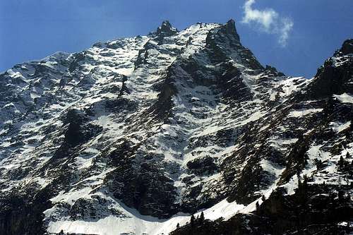
"Hunters & Trappers" indicate the Arpisson Walloon, the third son of Becca. Of a more wild wild spends his life in the great North Face of Emilius, hence a true
"Moloch", and above the steep cliffs that fall on or Tschinò Chenoz and Terreblanche Alpages, above the Commune of Pollein. Character rude and bashful are in the sidelines, semi-abandoned and compressed between the high walls of Becca to the West and Becca of Seneva. This side pass few climbers roped in the 1897, by the intrepid Daniele and Devalle with the very strong Guides Valtournanche Pession & Bich, and then us. In 1978, to go on repeating the East, starting from the Alps of Arpisson, he had climbed the legendary Amilcar Crétier in June 1927. Then others? No one. I accept bets. But the poachers yes, always for
"Passer le Cordagnì" chasing the chamois and ibex; coming from Martsaouchy (Walk Up) to get around the obstacle of the Keeper of the Gressoney Baron Beck Peckoz, then owner of the Hunting Reserve. Since '800. Otherwise, only Herdsmen, grazing, including the barking of dogs shepherd "mangy", their cows in the plain marked by trees felled by the avalanche coming down from the
"Dent de la Becca" in all Springs. Then bringing the same to the watering to the
"Sources of Emilius", just more towards the South. Or pushing their sheep and goats upward to the Mont Père Laurent, where every so often frightened by lightning, making the collective suicide by jumping down the big wall at Les Laures ...
Topographical notes: in the low and mid hill/mountain above the Municipality of Pollein rise the steep rocky terraces that reach the forest-alpine pastures of Chenoz
(1017m), Terreblanche Dessous and Dessus
(1015m, 1064m) and more toward the East Rongachet, Gorrettaz
(1089m), La Barma
(1255m) on the opposite side, that borders the Gorge of Dard. A small bridge at the Village of Rongachet combines this with one of Reverier Dessous
(1042m), already in the Municipality of Charvensod. This is the unique next road between the two, logically apart from the existing ones on the bottom of the valley. In addition, these two areas mentioned at the beginning, gather at the foot of the great "Crestone" North-northeast that descends from the Becca di Nona up over the ancient Alp of Plan Croix now in ruins
(1745m) and to the three underlying Pastures of Martsaouchy, or d'En Bas du Meitin and Damon
(on average from 1300 to 1400 metres). Above you open the wild Walloon of Arpisson on the slopes of Mont Père Laurent
(2625m) and the high walls of the Becca of Seneva
(3081m), Mont Emilius
(3559m) and Becca. In order to enter this it is necessary to bypass just the
"Crestone", just beyond Plan Croix, as the Torrent of Arpisson, here steep and frothy, flowing between steep rock walls that
"strangle" in a nasty throat, preventing the passage and climb direct from the bottom. With a diagonal toward the Southeast path reaches the Waterfall Arpisson and, after transiting through a very small walloon that leads to the water intake slightly anticipates the Alps Arpisson Lower and Upper
(1951m, 2010m). From these, after an esplanade with many remains of avalanches, the same fades against the large and triangular bedrock, up over 450 metres, the long Ridge East-northeast of the Becca. On the right (West) gets up a steep and small unnamed vallon, squeezed between this ridge and the East Wall of Becca. Opposite goes down a large moraine at the base of the two Glaciers of Arpisson Eastern and Western, from which
"the Sources gush of Emilius". This goes back to the same in a much large as wild and pristine basin that subsequently bending to the right (Southwest) ends at the Carrel Hill, between itself Becca and the Mont Ròss de Comboé
(3301m) also West great Shoulder of Emilius. In the East, the vertical wall of the Black Triangle
(3378m), Blantsette Pass
(3126m) and nearby Head
(3139m) and Peckoz Pass
(3042m) now indicate
"another world", already oriented towards the next Wallon des Laures, above the Municipality of Grand Brissogne.
Curiosities, Amenities and Tragedies: in the forest between Martsaouchy and Plan Croix existed until 1978 an old and rudimentary wooden aqueduct crossing, in the manner of those built by the Romans, the plants at a height varying between eight and twelve metres. In subsequent trips I was to see him as much as possible. It might be of interest to a nice
"Exploratory Hike". A small path, which is used to transfer the cattle and marked on the Maps as n° 14A, connects La Barma
(1255m) with the water intake La Mare (
(1187m; "The Mother of All Waters"): do not walk the same, because it is exposed and collapsed in several sections at Torrent Comboé. Let go my friend Munier Charvensod and his brothers, because working with cows Reverier Dessous to Martsaouchy, know him very well. Another trail, which passes over the top, marked n° 13B, reaches an average altitude of
1500 metres before the junction Plan Croix
(1745m) by connecting to the Alp of Ponteilles
(1697m), which comes back again marked as n° 14A. Discarded too. Cartographers are already the confusion: it's what for
"Cowboys", imagine what happens to you who are
"Christians Metropolitan". At best is for
"Seekers of Mushrooms". Experts. A final path, more high altitude and reported as n° 15, connects the Alps Arpisson with the ruins of Morion
(1948m), under the North Face of Becca; but from this point to be able to reach the Comboé Dessous
(2041m) must cross the great landslide of 2000. Never mind this too, even if it has been restored. It requires a good experience of the zone and shows the old links that existed in the Valley of Aosta at high altitude to move the herds. At best what is for
"Poachers". There are splendid steinbocks at the base of Becca, but do not say it to them. In the Fifties a young Aosta fell from the Summit towards the Arpisson to pick edelweiss; they found him on a ledge of the East Wall and a plaque on the pedestal of the statue of the Madonna recalls. In the mid-Seventies saw another tragedy for two Young Plan Felina: Gianfranco Zafferetti and his friend Giovanni Barmasse ventured from Arpisson grassy-rocky slopes to the right of the
"La Dent"; with modest experience soon found themselves in trouble. The first fell dying, while the second, because the sorrow and a strong sense of guilt, committed suicide a few years below. The mountain is also this and for that I never tire of making recommendations, at the cost of appearing boring. These sad events take us away from it, making us think deeply. Prefer an old photo that reminds me calm and safe walks made in the company of friends with whom we grew up then in the difficult path of Life. Maybe starting to walk from our house to get right here at the entrance of Terreblanche wild Walloon of the Arpisson, under the great Wall of Emilius. A journey that ends, immediately below, with some suggestions, advice and recommendation, the result of many
"scramblings" into
"Sacred Walloons Becca", under his anticheed now
"decrepit" faces. A chance to get together, even if just reading.
Incidentally need very little power to dream ...
Excursion tips: to Bivouac Federigo Zullo neighbor Carrel Hill (
2912 m;
2h'30/3h'00 from Upper Arpisson Alp;
4h'30/5h'00, by Martsaouchy Damon or Upper Pastures
1450m).
2)- At Mont Père Laurent
(2625m) with a small path that, starting from Arpisson Superior through the grassy Face West-southwest. The hike is easy, unfortunately not always possible to follow the same, because it often disappears only to reappear as a faint trace. Great views of Aosta (
1h'30).
3)- At Becca through the long Ridge East-northeast, rarely traveled in memory of the youth climbs by Amilcare Crétier and Renato Chabod with their peers; do not attach it right away, but take it higher up where this, almost at the base of Mont Ròss of Comboé, bend from the North to the East. A not difficult and fun climbing leads to the Summit: beware exposure on the steep East Face remaining a little below the edge of the ridge (
3h'00/5h'00, depending on your state of training).
4-5-6)- The other excursions Peckoz Pass
(3042m) and to the Testa or Head Blantsette
(3139m) at least require the crossing of the Glacier Western Arpisson under the Black Triangle of Emilius
(3378m). Do not go up very much in a direct way through a gully on the left (East), because in the highest part of the often encountered
"verglass"; crossed rather higher but do not forget that there are crevasses. Deep and well hidden. In addition, the crossing of the pass is not recommended in the presence of the snow, especially if it's cool (below we have a considerable precipice of
over 300 metres, at the end of '800 The Gamekeeper Baron Beck Peckoz had driven the great nails or iron pitons better but no longer exist). The climb to the Blantsette Head, called by inhabitants, Becca des Boucs (Ibex) is simple and however these two tours require a good experience and are therefore not suitable for everyone. If you want to cross in the Walloon of the Laures, you should go easy on the ridge South to a nearby carving, called Blantsette Col (
3126m;
*** do not go up for no reason from the West), and then descend through a steep gully with soil on moraine that flanks the namesake glacier at the base of the vertical East Wall Emilius. From this reach the Lac Dessous and Ménabreaz Refuge
(2546m). Better, in each case, starting from Bivouac Zullo at Carrel Hill (
2h'00/2h'30 from this;
6h'00/7h'00, by Arpisson and other
2h'00 for the descent to the Laures). All other climbs in the area are difficult, with broken rock and directed exclusively at Mountaineers, including the
"Via Ferrata" that goes along the West Ridge of Emilius.
Se sentite parlar del "Lo Cordagnì o Cordagnë", non prendete spavento:
non trattasi d'un brutto ragno, uno Yeti locale oppure d'una bestia feroce. Semplicemente é il modo col quale "Bracconieri & Cacciatori" indicano il Vallone dell'Arpisson, il terzo Figlio della Becca. Di carattere più selvatico che selvaggio passa la sua vita sotto la grande Parete Nord dell'Emilius, da qui un vero "Moloch", e al di sopra degli aspri dirupi cascanti su Tschinò o Chénoz e Terreblanche, sopra il Comune di Pollein. Di carattere rude e schivo stà in disparte, semi abbandonato e compresso tra le alte pareti della Becca ad Occidente e della Becca di Seneva. Di qua passan pochi alpinisti: la cordata del 29 Agosto del 1897, degli intrepidi Daniele e Devalle colle Guide di Valtournanche pregiata Ditta Louis Bich & Anselme Pession, e poi noi: il "Peppino", il Camillo Roberto detto Micke Burke" ed il sottoscritto. Nel 1978 per andare a ripeter la Est che, partendo dall'Alpe di Arpisson, aveva salito il mitico Amilcare Crétier, nel Giugno del 1927. Poi altri? Nessuno. Accettasi scommesse. Ma i Bracconieri sì, da sempre per "Passer lo Cordagnì" inseguendo camosci e stambecchi; arrivando da Martsaouchy (Cammina Sù) per aggirar l'ostacolo dei Guardiacaccia del Gressonaro Barone Beck Peckoz, allora padrone della Riserva di Caccia. Dal '800. Altrimenti solo alpigiani, che pascolano, tra l'abbaiar di cani pastore "spelacchiati", le lor mucche nella piana segnata dagli alberi abbattuti dalla valanga che scende dalla "Dent de la Becca" in tutte le Primavere. Portando poi le stesse all'abbeveraggio verso le "Sorgenti dell'Emilius", appen più verso Mezzogiorno. Oppure spingendo pecore e capre sù pel Mont Père Laurent dove, ogni tanto spaventate dal fulmine, effettuano il suicidio collettivo saltando giù per la grande parete verso Les Laures ...
Annotazioni Topografiche: nella bassa e media collina/montagna al di sopra del Comune di Pollein s'elevano dei ripidi terrazzamenti roccioso-boschivi raggiungenti gli Alpeggi di Chénoz (1017 m), Terreblanche Dessous e Dessus (1015 m, 1064 m) più verso Oriente e Rongachet, Gorrettaz (1089 m), La Barma (1255 m) sul lato opposto, che fiancheggia la Gorgia del Dard. Un ponticello presso il Villaggio di Rongachet unisce questo con quello di Reverier Dessous (1042 m), ormai già nel Comune di Charvensod. Questo risulta l'unico cllegamento stradale tra i due, prescindendo logicamente da quelli esistenti sul fondo valle. Oltre, questi due settori, citati all'inizio, si riuniscono ai piedi del grande "Crestone" Nord-nordest che scende dalla Becca di Nona fino sopra l'antica Alpe di Plan Croix oramai in completa rovina (1745 m) ed ai tre sottostanti Alpeggi di Martsaouchy, ovvero d'En Bas, du Meitin e Damon (mediamente dai 1300 ai 1400 metri). Al di sopra s'apre il selvaggio Vallone dell'Arpisson, alle pendici del Mont Père Laurent (2625 m) e delle alti pareti della Becca di Seneva (3081 m), del Monte Emilius (3559 m) e della Becca. Per potere accedere a questo é necessario bypassare proprio il "Crestone", appena oltre Plan Croix, poiché il Torrent d'Arpisson, qui ripido e schiumoso, scorre tra ripide pareti rocciose che lo "strangolano" in un'orrida gola, impedendo il passaggio e la salita diretta dal basso. Con un diagonale verso Sudest il sentiero raggiunge la Cascata di Arpisson e, dopo aver transitato per un vallocello, conduce alla presa dell'acqua che di poco anticipa le Alpi di Arpisson Inferiore e Superiore (1951 m, 2010 m). Da queste, dopo una spianata con molteplici resti di valanghe, lo stesso si smorza contro il grande e triangolare basamento roccioso, alto oltre 450 metri, della lunga Cresta Est-nordest della Becca. Sulla destra (Ovest) si innalza un ripido e piccolo innominato vallone, compresso tra questa cresta e la Parete Est della Becca. Sul lato opposto cola una grande morena alla base dei due Ghiacciai Est ed Ovest di Arpisson, dalla quale "zampillano Le Sorgenti dell'Emilius". Questa risale fino ai medesimi in un tanto ampio quanto selvaggio ed incontaminato bacino che, successivamente piegando sulla destra (Sudovest), termina al Colle Carrel, tra la Becca medesima ed il Mont Ròss de Comboé (3301) o Spallone Occidentale dell'Emilius. Ad Oriente la verticale Parete del Triangolo Nero (3378 m), il Colle Blantsette, la viciniora Testa (3139 m) ed il Col Peckoz (3042 m) indicano ormai "un'altro mondo", da qui già orientato verso il successivo Vallone des Laures, sopra il Comune di Grand Brissogne.
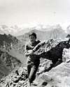
Curiosità, Amenità e Tragedie: nella foresta tra Martsaouchy e Plan Croix esisteva fino al 1978 un vecchio e rudimentale acquedotto in legno attraversante, a guisa di quelli costruiti dai Romani, le piante ad un'altezza variabile tra gli otto ed i dodici metri. In gite successive non m'é stato più possibile vederlo. Potrebbe interessare per una simpatica "Escursione Esplorativa". Un piccolo sentiero, usato per trasferire il bestiame e segnato sulle Carte come n° 14A, collega La Barma (1255 m) con la presa dell'acqua di La Mare ((1187m; "La Madre di Tutte l'Acque") : non percorrerlo, perché esposto e franato in diversi tratti presso il Torrent Comboé. Lasciate passare il mio amico Munier di Charvensod ed i suoi fratelli che, causa il lavoro con le mucche da Reverier Dessous a Martsaouchy, lo conoscono molto bene. Un altro sentiero, che passa più in alto, segnato n° 13B, raggiunge in altitudine media di 1500 metri il bivio prima di Plan Croix (1745 m) collegandosi con l'Alpe di Ponteilles (1697 m), alla quale arriva nuovamente segnato come n° 14A. Scartate pur questo. Già fan confusione i Cartografi: é cosa per "Cowboys", immaginate cosa succede a voi che siete Cristiani Metropolitani". Al massimo é per "Fungaioli". Esperti. Un ultimo sentiero, di più alta quota e segnalato come n° 15, collega le Alpi di Arpisson con quella diroccata del Morion (1948 m), sotto la Parete Nord della Becca; ma da questo punto per potere raggiungere il Comboé Dessous (2041 m) deve attraversare la grande frana del 2000. Lasciate stare anche questo, anche se é stato ristrutturato. Richiede una buona esperienza del territorio e dimostra gli antichi collegamenti esisteenti in Valle di Aosta in alta quota per spostar le mandrie. Al massimo é cosa per "Bracconieri". Esiston splendidi stambecchi alla base della Becca, ma non ditel loro. Negli Anni Cinquanta un giovane di Aosta precipitò dalla Sommità verso l'Arpisson per raccogliere stelle alpine; lo trovarono su d'una cengia della Parete Est ed una targa sul basamento della statua della Madonna lo ricorda. A metà degli Anni Settanta un'altra tragedia accorse per due Giovani di Piano Felina: Gianfranco Zafferetti ed il suo amico Giovanni Barmasse si avventurarono dallo Arpisson sui pendii erboso-rocciosi a destra della "La Dent"; con modesta esperienza si trovarono presto in difficoltà. Il primo precipitò morendo, mentre il secondo, causa il dispiacere ed un forte senso di colpa, si suicidò qualche anno appresso. La montagna é anche questo e per ciò non mi stancherò mai, a costo d'esser noioso, di far delle raccomandazioni. Questi tristi episodi ci allontanano dalla medesima, facendoci profondamente riflettere. Preferisco una vecchia foto che mi ricorda tranquille e sicure passeggiate in compagnia d'Amici coi quali poi siam cresciuti nel difficile cammino della Vita. Magari partendo a piedi da casa nostra per arrivare proprio qui a Terreblanche all'ingresso del selvaggio Vallone dell'Arpisson, sotto la grande Parete dell'Emilius. Un viaggio che si conclude, immediatamente qui sotto, con qualche suggerimento, consiglio e raccomandazione, frutto di tanti "scarpinamenti" nei "Sacri Valloni della Becca", sotto le sue antiche ormai decrepite facce. Un'occasione per stare insieme, anche se solamente leggendo. Daltronde serve molto poco per poter sognare ...
Escursioni consigliate: 1)- al Bivacco Federigo Zullo presso il Colle Carrel (2912 m; 2h'30/3h'00 dall'Arpisson Superiore; 4h'30/5h'00, dall'Alpeggio di Martsaouchy Damon o di Sopra 1450m). 2)- Al Mont Père Laurent (2625 m) con un sentierucolo che, partendo dall'Arpisson Superiore, sale tramite l'erboso Versante Ovest-sudovest. L'escursione é facile, purtroppo non sempre si riesce a seguir lo stesso, perché spesso scompar per poi riapparir come tenue traccia. Grandi viste su di Aosta (1h'30). 3)- Alla Becca tramite la lunga Cresta Est-nordest, assai raramente percorsa a ricordo delle giovanili ascensioni di Amilcare Crétier e Renato Chabod coi loro compagni; non attaccatela subito, bensì prendetela più in alto dove questa, quasi alla base del Mont Ròss, piega da Nord verso Est. Una non difficile e divertente arrampicata conduce alla Sommità: fate attenzione all'esposizione sulla ripida parete Est restando un poco al di sotto del filo di cresta (3h'00/5h'00, a seconda del vostro stato di allenamento). 4/5/6)- Le altre escursioni al Col Peckoz (3042 m) ed alla Testa Blantsette (3139 m) richiedon l'attraversamento almeno del Ghiacciaio Occidentale di Arpisson sotto il Triangolo Nero dell'Emilius. Non salite assolutamente in modo diretto tramite un canalone sulla sinistra (Est), perché nella parte più elevata spesso s'incontra del "verglass"; attraversate invece più in alto ma non dimenticate che esiston crepacci. Profondi e ben nascosti. Inoltre la traversata al colle é sconsigliabile in presenza della neve, soprattutto se fresca (al di sotto abbiamo un notevole precipizio di oltre 300 metri; a fine '800 i Guardiacaccia del Barone Beck Peckoz vi avevan infisso dei grandi chiodi o meglio fittoni in ferro ma non esiston più). La salita alla Testa é più semplice e comunque queste due escursioni richiedono buona esperienza e non son quindi indicate per tutti. Se si vuol attraversare nel Vallone delle Laures, conviene continuare sulla facile Cresta Sud fino ad un vicino intaglietto, chiamato Col Blantsette (3126 m; *** da non salire per nessun motivo da Ovest), e poi scendere per mezzo d'un ripido canalino con terriccio sulla morena che fiancheggia l'omonimo ghiacciaio alla base della verticale Parete Est dell'Emilius. Da questa raggiungere il Lac Dessous ed il Rifugio Ernesto Ménabreaz (2546m). Meglio, in ogni caso, partire dal Bivacco Zullo al Colle Carrel (2h'00/2h'30 da questo; 6h'00/7h'00, dall'Arpisson ed altre 2h'00 per la discesa alle Laures). Tutte l'altre ascensioni in zona son difficili, con roccia rotta e rivolte esclusivamente ad Alpinisti, compresa la "Via Ferrata" lungo la Cresta Ovest dell'Emilius.
and ... other three "Valloncelli": Morion, Plan Valé & La Dent
Three small walloons secondary complement the speech around the Becca:
each of the three vallons above, in turn, is correlated with a secondary. They are the
"grandchildren" of Becca. Let's see:
a)- the Gorge of the Dard is divided in its highest part with a branch that goes to the South and the second most in the Southeast that creates, on the Eastern side, a recessed vallon, called the Morion; this is the left branch, watching, the big Y. Worked around the rounded rocky promontory high over a hundred yards, he joins up with the steep moraine to the base of the North Face. Popular in ancient times with a path that came from Comboé also from Ponteilles Alp today, especially after the landslide of 2000, it is completely abandoned.
b)- Another small walloon, but more than a walloon it is a plateau, is located to the East of Comboè Walloon; is formed by a small basin, above which
"meanders" a moraine ridge that reaches the Western slopes of the Mont Ròss Comboé, including this great shoulder of Emilius to the Becca. At about the middle of its course you can see the remains of an old pasture, probably designed to repair the pastor or to serve as a shelter for cattle during lightning storms or just for overnight.
c)- On the opposite side, ie the Arpisson, just to the right of and below the Upper Alp to the East Wall of Becca, opens, somewhat steep and narrow, a very small walloon which takes its origin below the
"La Dent" and as such, unnamed being, we call it. If the first and the last are by no means popular, it is not so for the second which is right and it is compulsory on the Normal Route to the Becca di Nona. Starting from any where that is from Ponteilles with route n° 14, Pila-Resort through Hill Plan Fenetre with path n° 16, Lake Chamolé by one of the two Hills of Replan with trail n° 19 or down from Refuge Arbolle (steep downhill path connection n° 14 at the Grand Plan and this n° 16 in diagonal quiet hillside under the Trident de Comboé and Punta del Lago Gelato).
Tre piccoli valloncelli secondari completano il discorso intorno alla Becca:
ognuno dei tre valloni di cui sopra, a sua volta, é correlato con uno seconadario. Son i "nipotini" della Becca. Vediamoli: a)- il Vallone del Dard si divide nella sua parte più elevata con un ramo che sale verso Sud ed un secondo maggiormente a Sudest tale da originare, sul fianco Orientale, un valloncello molto incassato, detto del Morion; questo costituisce il ramo di sinistra, guardando, della grande Y. Aggirato il rotondeggiante promontorio roccioso, alto più di cento metri, s'unisce verso l'alto con la ripida morena di base della Parete Nord. Frequentato negli antichi tempi con un sentiero che arrivava da Comboé o da Ponteilles, oggi, soprattutto dopo la frana del 2000, é completamente abbandonato. b)- Un altro piccolo vallone, ma più che un vallone trattasi d'un pianoro, trovasi ad Oriente del Comboè; é formato da un piccolo bacino, sopra il quale "serpeggia" una dorsale morenica raggiungente le pendici Occidentali del Mont Ròss de Comboé, tra questa grande spalla dell'Emilius e la Becca. A circa la metà del suo percorso si posson ancor notar i resti d'una antica alpe, probabilmente atta a riparare il pastore oppure a fungere da riparo per i manzi durante i temporali o semplicemente per il pernottamento dello stesso. c)- Sul lato opposto, ovvero dell'Arpisson, appena sulla destra dell'Alpe Superiore e sotto la Parete Est della Becca, s'apre, alquanto ripido e ristretto, un valloncello che prende inizio al di sotto del caratteristico dente roccioso detto "La Dent" e come tale, essendo innominato, lo pensiam di chiamare. Se il primo e l'ultimo non son per nulla frequentati, non é così per il secondo che si trova proprio ed obbligatoriamente sulla Via Normale verso la Becca di Nona. Partendo da ogni dove cioé dall'Alpe di Ponteilles con sentiero n° 14, da Pila pel Colle Plan Fenetre con sentiero n° 16, dal Lago di Chamolé tramite uno dei due Colli di Replan con sentiero n° 19 o scendendo dal Rifugio di Arbolle (tramite il ripido sentiero, in discesa nella stretta gola, di collegamento n° 14 al Grand Plan e da questo n° 16 con tranquillo diagonale a mezzacosta sotto il Trident de Comboé e la Punta del Lago Gelato).
Comments
No comments posted yet.