After hitting up Delano and Brian Head Peak in Utah on 9/23, Sean and myself headed down to Vegas for a couple of days, with plans to do some hiking in Southern Utah afterwards. Unfortunately, Sean was met with some horrendous luck in Vegas, and had to subsequently head back to LA. As for me, two weeks into my vacation I was getting a little homesick, and decided that instead of squeezing my three weeks off from work down to its last drop, I would try to make it back to enjoy a weekend at home before having to return to work (though this return ultimately took place before that designated weekend). But not before one last shot at peakbagging in Nevada’s Great Basin.
I drove from Vegas to Baker, NV on Friday, 9/26. To my dismay, there is a dearth of lodging choices (as well as people in general) in Baker. Only one small motel had wireless access, and it was full, so I drove down the highway to the hamlet of Border, consisting solely of a combined motel-gas station-general store-restaurant-slot machine "complex", barely in time for the first Presidential Debate.
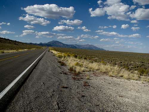
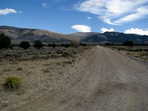
![Schell Creek Range from 93]() Schell Creek Range from 93
Schell Creek Range from 93
I caught up on some sleep that night, and got off to a late start on Saturday morning (afternoon, really). My plan was to climb Wheeler Peak, and this close to October I did not expect daily thunderstorms to still be lingering around as the norm in Nevada. That, however, was the reality, and on this day, the storms began around 11 AM. I drove up the Wheeler Peak road to find extremely chilly weather at 10,000 ft along with raindrops that felt like daggers of ice on your skin. Wheeler could wait for another day.
I did some sightseeing in the park and took the requisite Lehman Cave tours (nice place, definitely worth a visit) before driving an hour away to Ely. I watched Alabama upset Georgia in Georgia, had a few beers and wings, and crashed early so I could get an earlier start on North Schell the next day, 9/28.
My main concern about this peak was whether my Camry could make it to the trailhead. The gravel road to Timber Creek was a little rough but definitely passable by passenger cars. I drove through the campground and parked right before the gate marking the beginning of the 4WD road.
The route follows the 4WD road as it continues straight east into the drainage towards the crest of the Schell Creek Range. Soon the road becomes a trail, and it eventually contours to the north as it continues to follow the mostly dry Timber Creek. The trail is faint as it winds through a few treeless openings and crosses the creek several times. Even though it is located in a National Forest, grazing is allowed, and I observed more than 40 cows on this trip. Needless to say, there were cow droppings everywhere, and the smell wasn’t too pleasant at times.
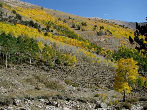
![Brilliant colors at Timber Creek]() Aspen Aspen |
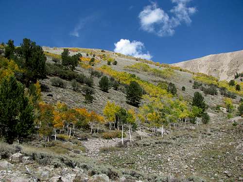
![North Schell]() I departed the trail around here I departed the trail around here |
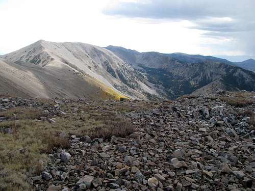
The trail returns to some thicker tree cover as the peak of North Schell disappears from view. I think, but am not sure, that the trail continues all the way up the drainage and canyon to a saddle somewhat to the west of North Schell, where you can continue towards the peak along the connecting ridge. I felt that such a route would prove to be a little more circuitous than preferable, and thus chose to take a more direct route, cross-countrying directly up the slopes of the subpeak to North Schell’s northwest.
There were various cow trails up the slope at times. Otherwise I trod carefully in little avenues and lanes between the lines and clusters of sagebrush which dotted the slope, heading straight up when I had the energy and switchbacking around when I was more tired, passing scattered groves of Aspen along the way. The slope is deceivingly long, and as I figure now, probably possessed the bulk of the 3000’ elevation gain required to summit.
After traversing above the last Aspen grove around halfway up the slope, the sagebrush thinned and gave way more and more to lines, and eventually fields, of talus. As the saddle between North Schell and its northwestern, unnamed neighbor finally appeared behind the ridge, I noticed that the clouds were building up and spied pockets of steady rain in the valley to the west. Rain I could deal with, but what really worried me were the distant claps of thunder.
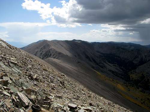
![Summit Ridge]() Summit from the saddle Summit from the saddle |
![Summit Ridge]() Summit ridge Summit ridge |
Upon reaching the saddle I met up with a couple of backpackers who had just descended the summit. They had camped out in the woods the night before and scampered straight up the western slopes of North Schell this morning; now they planned to return via Timber Creek. I remarked upon my worries about the weather; they were not concerned, as they figured the storm would stay stationary and not move in to our direction. They proved to be correct.
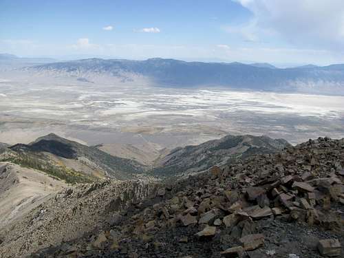
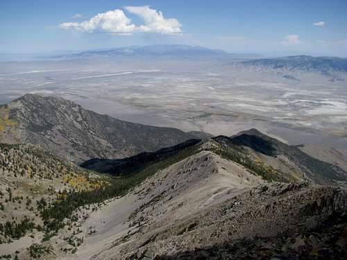
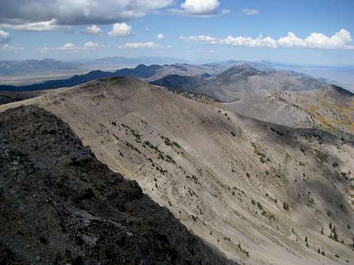
From this saddle the summit was only another 10 minutes away. The ridge was surprisingly narrow and rocky, and there was a decent amount of exposure on the east (left) side. Somehow I had reception on the summit, and placed a call to my roommate. The views were great, and I identified at least two ultra-prominents within sight: Wheeler and Ibapah.
![Looking south from summit]() South South |
![North from the summit]() North North |
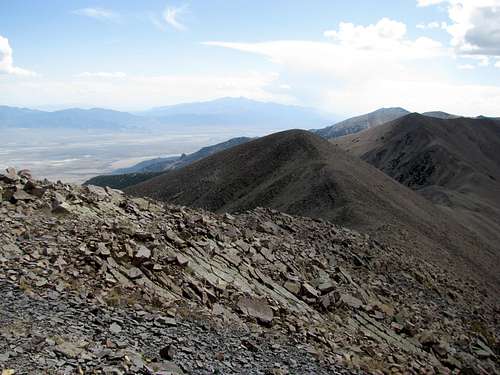
![West towards McGill]() West West |
![View SW]() SW SW |
![SSW]() SSW SSW |
![South]() View South View South |
![SSE towards Wheeler]() SSE SSE |
![SE]() SE and Wheeler SE and Wheeler |
![View East]() East East |
![View NE]() NE NE |
![NNE]() NNE NNE |
![North along the spine of the Schell Creek Range]() North North |
![From a small saddle north of North Schell]() Summit ridge Summit ridge |
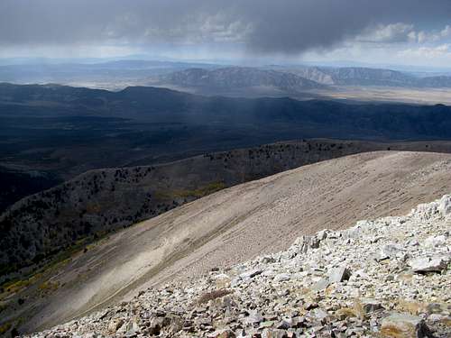
![South towards South Schell]() Towards South Schell Towards South Schell |
Upon returning to the saddle, I chose to stick to the ridge crest a little longer before cutting straight down back to Timber Creek, meeting up in the drainage probably .7 miles further up the drainage from where I had originally departed the trail. It was on this descent when I realized that some, and maybe all, of the distant claps of thunder I had heard earlier were actually the sound of Aquafina bottles clanging around in my backpack. That solved the mystery of “why does it only thunder when I’m walking, and not when I stop, turn around, and try to listen and spot the thunder?”
![Back down towards the Timber Creek drainage]() Timber Creek Drainage on the descent Timber Creek Drainage on the descent |
|
|
|
|
|
|
![North Schell Peak]() N Schell from FR Road N Schell from FR Road |
The weather stayed dry in the immediate area as I made my way back to the car under the watchful gaze of the local cattle population. It would be back into Baker for one last mountain before heading back to Boston.


Comments
Post a Comment