
|
|
Mountain/Rock |
|---|---|
|
|
46.32760°N / 11.33849°E |
|
|
Bolzano - Alto Adige |
|
|
Hiking |
|
|
Spring, Summer, Fall, Winter |
|
|
6004 ft / 1830 m |
|
|
Overview
Trudner Horn / Monte Corno 1830 m
Trudner Horn 1830 m, also called Monte Corno or also Horn Spitz, is the main peak of the area included in the homonymous Parco Naturale Monte Corno, located in the Southern area of the province of Bolzano between the Val d’Ega, the Bassa Atesina and the Val di Fiemme. This mostly wooded mountain is a minor peak located on the border between Bolzano Alto Adige and Trentino.
Its summit has various access points. This page will describe in detail a loop with departure and return from the picturesque village of Cauria in the municipality of Salorno. Moreover a couple of other possibilities to summiting from other sides will be mentioned.
Getting There
As already introduced, the access to the top of the mountain can be done from different starting points. We will describe here in more detail a loop from the village of Cauria (Gfrill in German). The locality of Cauria, in the municipality of Salorno, is located at 1230 m of altitude and is an excellent starting point for a climb to Monte Corno.
Road access
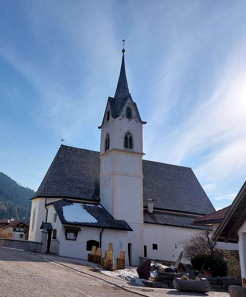
From the A22 motorway, exit at Egna/Ora and take the SS 12 to Salorno. From the square of Salorno take Via Loreto, then Via Molini and Via Dornach and drive up until you reach the village of Cauria. Park the car in a parking lot near the church of the village in the upper part of the village. From here we take the European Path E5.
Trudner Horn loop from Cauria
Trudner Horn / Monte Corno loop from Cauria
Summit quote: 1830 m
Difficulty: E
Difference in level: 500 m from Cauria parking lot
Starting point: village of Cauria
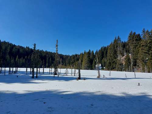
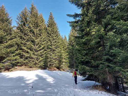
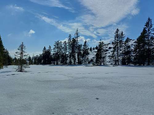
The starting point is Cauria (Gfrill in German), a picturesque village at 1330 m above sea level nearby Salorno. From the parking lot near the church take the European Path E5. The itinerary starts along a large forest road that we follow for the first 15-20 minutes. Then a detour leads us to the left on a path, but we can also continue walking on the forest road, in fact the path is a shortcut crossing it after 10-15 minutes. Back on the forest road we follow it for a long time in the forest passing through other detours until we reach the Lago Bianco at 1670 m (White Lake, swamp with info panel).
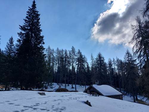
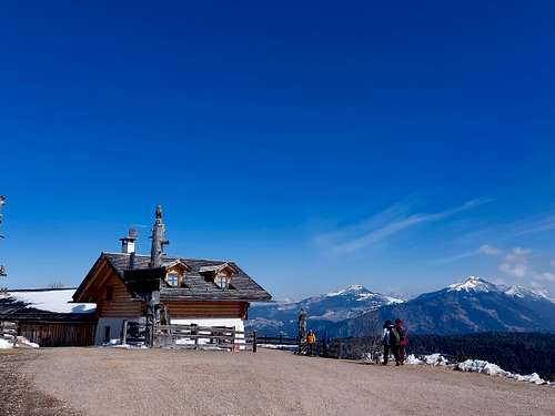
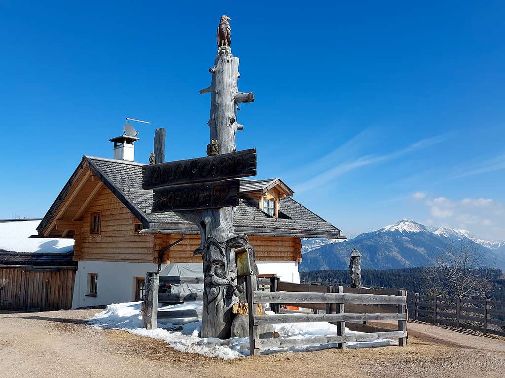
It is one of the frequent peat bogs that characterize the plateau. A look at the lake, then we continue following the road, which with the last downhill stretch where the forest thins out leads to a flat large clearing where it rises Malga Corno.
It's a spectacular panoramic balcony from which in the East direction we can enjoy a beautiful view of the Lagorai chain with the Val di Fiemme, the Corno Bianco with the Rio delle Foglie or Bletterbach, the Corno Nero and further away the Catinaccio group with the Roda di Vaèl and the Pale di San Martino. Towards the North the Sarentini with the Sarner Scharne and the Sciliar.
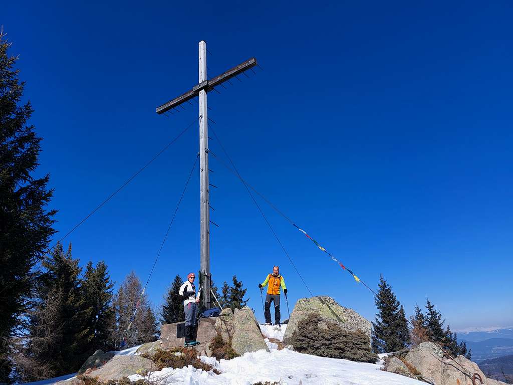
From the Malga Corno, behind the hut we take the path which leads in a brief time to the summit of Trudner Horn, first on a mule track then on the forest road and finally on a short steep path (1830 m, cross, 15 minutes from Malga Corno, 2.15 hours from the start).
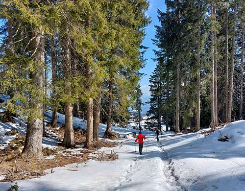
From the top we return back to the hut. From the clearing we retrace uphill the twenty meters of the last short descent (signposts) and instead to take the left forest road we keep the right (path n. 3) and in about 15 minutes along a forest road at first on open ground, then in the wood, we reach the Lago Nero 1717 m, another suggestive swamp in the forest with an info panel. We follow the forest road, reching a crossroad where we ignore both the left forest road and the central forest road and take instead a path on the right (signpost Gfrill/Passo Cauria, path n. 4). This path descends steeply into the woods and then enters a mule track and reaches the Passo Cauria locality, where, continuing along a forest road, you reach the lower part of the village of Cauria. Going up for about 1 km you return to the parking lot.
Other itineraries in the Monte Corno Nature Park
A second possible way to get Monte Corno is from Anterivo, a small village reachable from the San Lugano Pass which connects the Bassa Atesina with the Val di Fiemme. Also this route allows you to enjoy the beauty of the woods of the Monte Corno Natural Park and to reach the Malga Corno, the refuge located just below the summit, and after the main peak. The route starts from the village of Anterivo-Altrei 1222 m. Here follow the signs to the Waldheim hotel. A hundred meters after the hotel, take the forest road on the right taking the itinerary n. 3 to Passo Cisa and Malga Monte Corno. The itinerary winds through a forest with some glimpses of the peaks of the Lagorai chain. Once you have reached the Passo Cisa/Ziss Sattel Pass (1439 m, 1 hour and 15 minutes from the start), continue on the forest road or take shortcuts on the path until you reach the Malga Monte Corno (2 hours from the start). From here to the summit of Monte Corno as described in the previous itinerary.
Descent: return to Anterivo by the same route.
The Via Mulattiera (Saumpfad) in the woods connects Trodena (Truden) in the Valle dei Mulini with Anterivo (Altrei). Our hike starts at the parking lot above the village of Trodena in the Nature Park and follows path no. 8, which leads to the Forchwald circular trail, the Trodena Legends Trail. At a pond, this path leads to the forest road to the Rungganö Cross. We go up the path n. 5, passing through meadows to the crossroads at the beginning of the wood. Continuing on the path n. 5 we reach the Pinter-Schupf and Peraschupf huts. Passing through peat bogs and ponds, we climb through the forest and then slightly downhill to the larch woods near the Palú Longa biotope. At the crossroads we now follow the forest road n. 9 towards the hut of Malghette di Anterivo (Krabes Alm). We choose to return to Trodena on path n. 6, which starts directly behind the hut. A short climb, then flat through the forest and then downhill on a forest road to the "Alte Säge" and then through the village to the parking lot, the end of our circular hike in the southeastern part of the Monte Corno Nature Park.
Red Tape
No fees no permits required. The mountain is located inside the Parco Naturale Monte Corno. The park boasts a great variety of fauna and botanical species, thanks to its location below 2,000 meters above sea level and the sub-Mediterranean climate of the region. Moreover it's home to interesting trails through woods and along ancient forest tracks.
Since 2000, the View Center of the Monte Corno Natural Park has been housed in the village of Trodena within an old renovated mill. It offers interesting information to visitors of all ages (Tel.: +39 0471 869247 - E-mail: info.th@provinz.bz.it.). Opening hours: from 12 April to 29 October 2022, from Tuesday to Saturday, from 9:30 to 12:30 and from 14:30 to 18:00; July, August and September also open on Sundays. Closed on public holidays. Free admission!
Hiking and scrambling scale
T - Turistico (Tourist): Itineraries on wide, clear and well worn paths, sometimes on mule tracks or gravel roads. The routes are never exposed, don't give any orientation problems and don't exceed 2500 meters of altitude. Suitable also for children
E - Escursionisti (Hikers): Itineraries on marked trails, even narrow and with possible steep and impervious sections. They are never exposed and don't give any orientation problems. They can tread different kinds of ground, such as forests, gravel, meadows, pastures, easy rocks, etc.). They form the majority of the trails that wind up in the mountains and require a certain habit to walk; you need equipment suitable for the altitude and resistant footwear with soles suitable for rough terrain
EE - Escursionisti Esperti (Experienced Hikers): Itineraries for hikers with experience and good knowledge of the mountain. Some of these paths may have exposed sections, however brief, which require firm foot and no dizziness. They require the ability to adapt to particular terrain, such as steep grassy slopes or stretches of rocks with difficulties that can reach the 1st degree of the UIAA scale. They can also reach high altitudes (3000 m or more). Sometimes they may include unmarked sections, requiring a good sense of orientation. Snow slopes are possible, however which can be overcome without specific mountaineering gear (rope, harness, crampons, ice-axe)
EEA - Escursionisti Esperti con Attrezzatura (Experienced Hikers with equipment - The same as EE, in addition these routes require the use of via ferrata equipment (lanyards, harness, carabiners, heat sink, helmet). This kind of itineraries range from the trails with short easy and not much exposed sections, previously equipped with fixed ropes and iron pegs, to the true and more difficult Via Ferratas climbing on rocky walls or on aerial ridges and ledges, previously equipped with long stretches of iron ropes, iron steps, ladders without which proceeding would constitute a real climbing. It is necessary to know how to use the technical equipment and have a certain habit of exposure and mountaineering terrains.
When to Climb
All year round. In winter with the presence of snow it may be necessary to use snowshoes or crampons in case of ice.
Accomodation
Hotels ansd B&B in Salorno, Cauria, Ora, Aldino, Redagno, Anterivo, Trodena.
Meteo forecast
METEO PROVINCIA BOLZANO ALTO ADIGE