
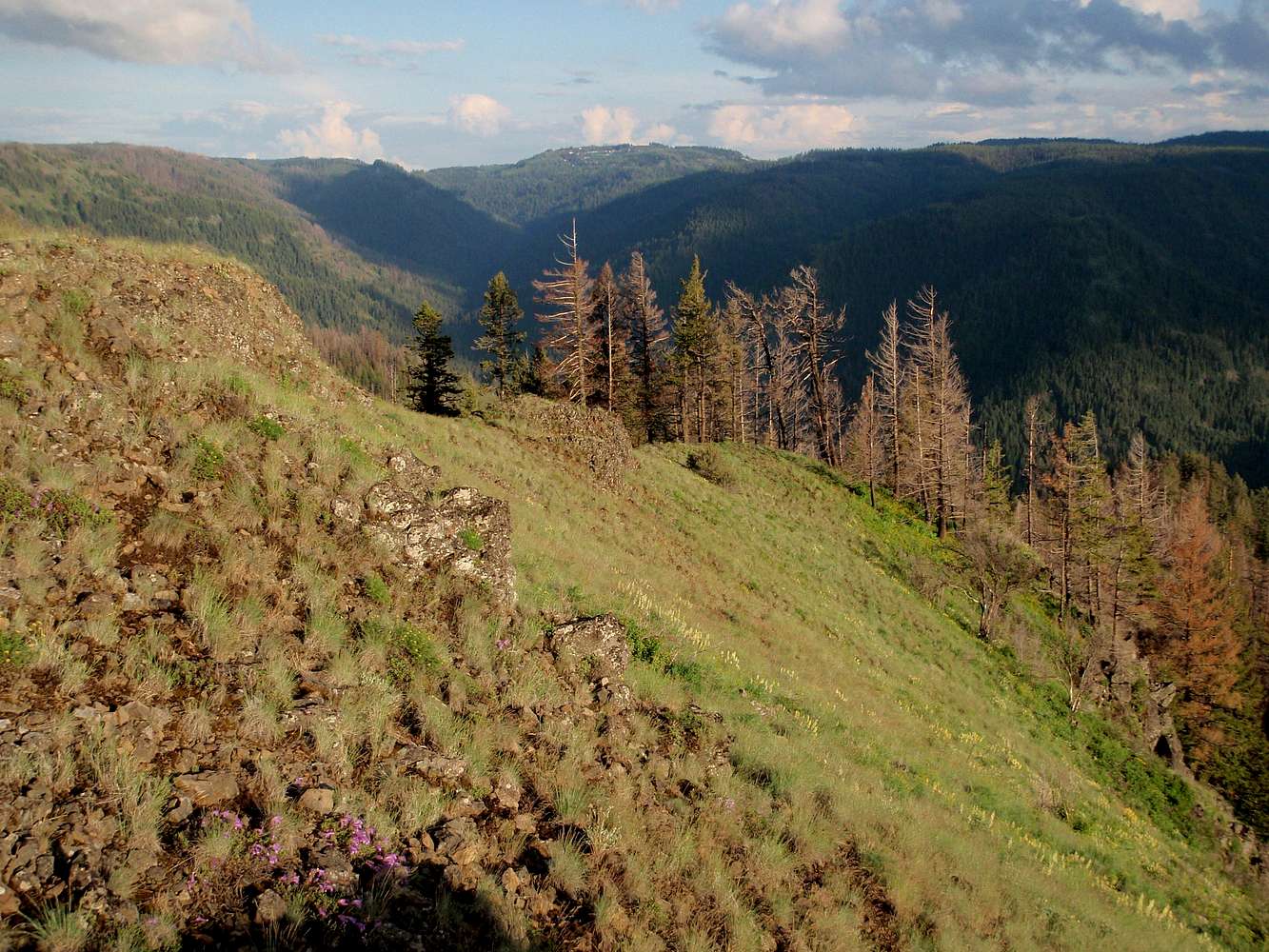
Tucannon River Headwaters
This photo taken from a prominent ridge near Hunter Spring, the trailhead for the Bear Creek Trail (#3110). It is looking south toward Mt. Misery (center) and Diamond Peak (on the horizon to the right). Diamond Peak is the regional high point at 6379 feet.


