
-
 6689 Hits
-
 79.87% Score
-
 12 Votes
|
|
Mountain/Rock |
|---|---|
|
|
46.65336°N / 11.77518°E |
|
|
Hiking, Via Ferrata |
|
|
Summer, Fall |
|
|
8704 ft / 2653 m |
|
|
Overview
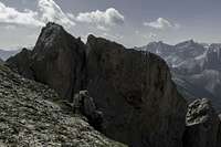
 Tullen seen from the south-east Tullen seen from the south-east |
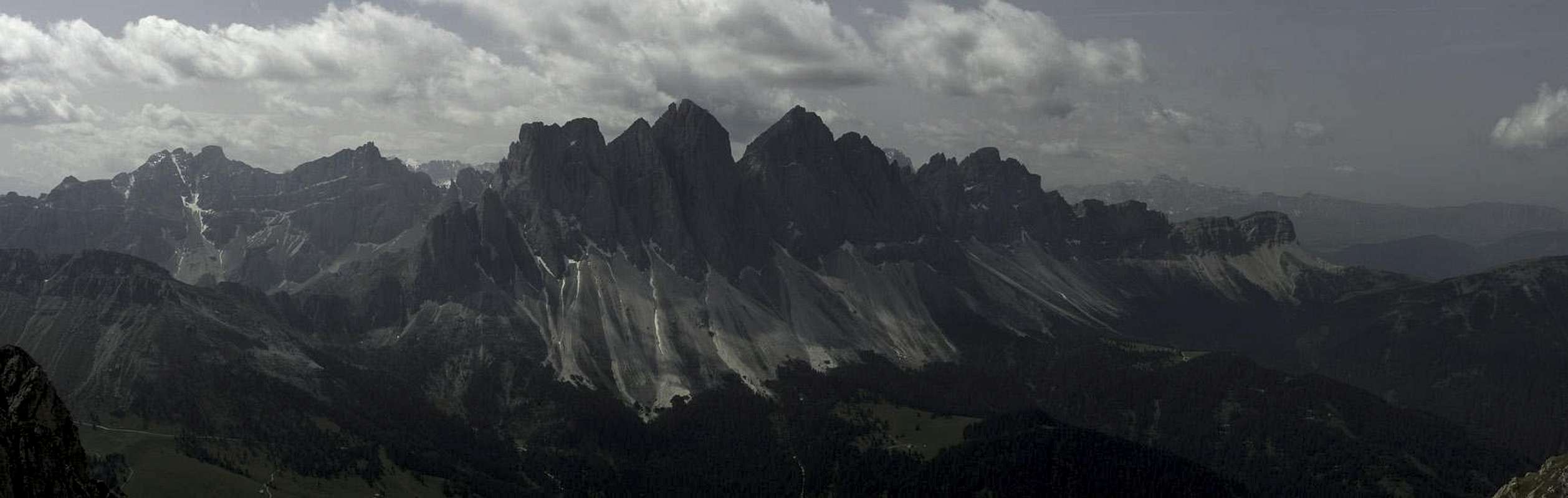
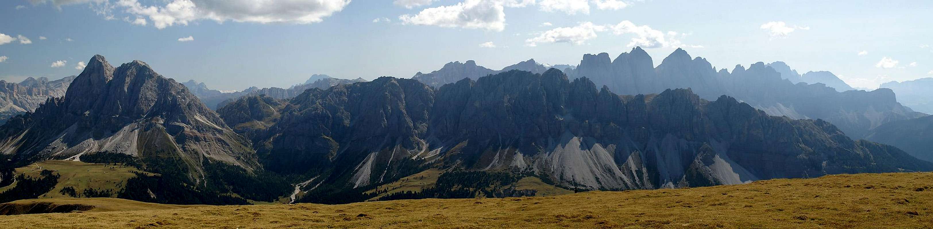
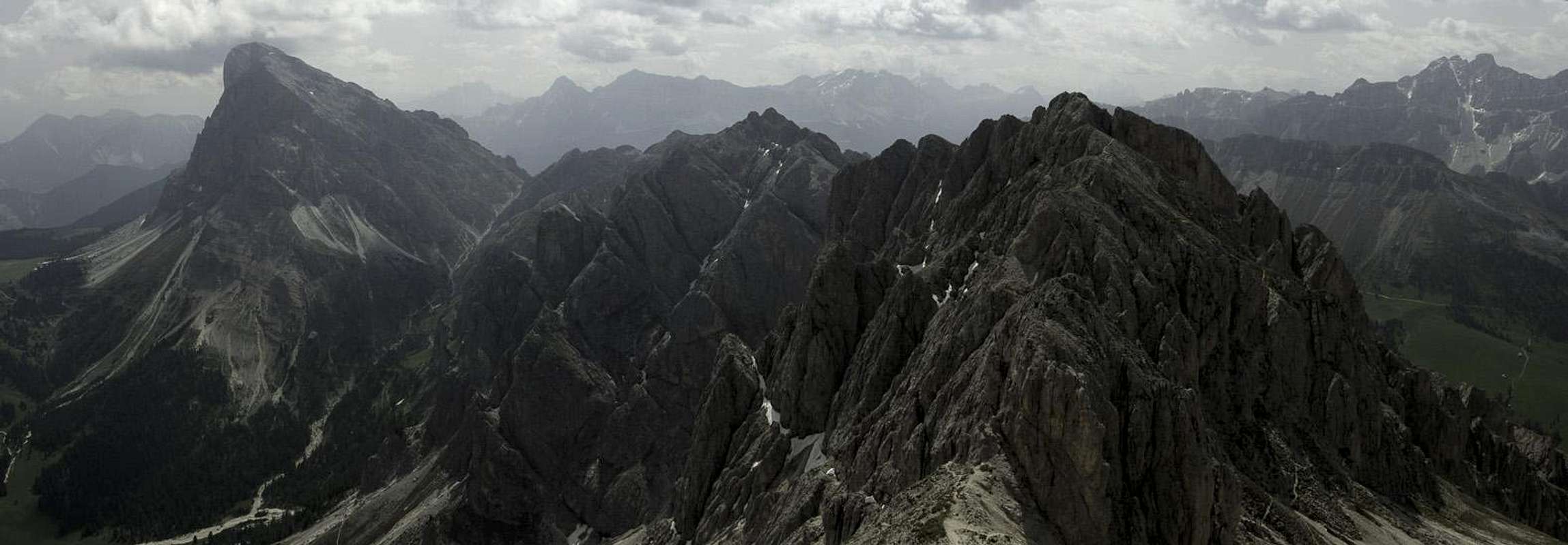
Whoever visits the Villnöß Valley / Val di Funes in the north-west of the Dolomites will be attracted by the rugged line of the Geisler / Odle Group to its south. Almost any Dolomites Calendar will show the impressive skiline towering above a little chapel in the end of the valley. Thus most visitors are not aware of the other mountain group of Villnöß / Val di Funes, the Aferer Geisler / Odle di Eores. Odla meens needle and looking at the mountains of this little group you ask yourself, where the name originated if not as a counterpoint to the far more impressive mountains in the south. Like their taller and more famous brethren, the Aferer Geisler / Odle di Eores are located on a single ridgeline, running west to east. They start directly from the valley floor in the west, while the eastern boundary is Peitlerscharte, the saddle, which separates them from the massive standalone Peitlerkofel / Sas da Pütia.
The highest mountain of the Aferer Geisler / Odle di Eores is Tullen (Italian: Monte Tullen) a dome shaped mountain, located on the western third of the ridge. Its north face drops for several hundred metres towards the road to Würzjoch / Passo delle Erbe and while it looks impressive it is barely climbable. All of the Aferer Geisler / Odle di Eores ridgeline is horribly brittle, made up from dolomite rock, but eroded into piles of rubble. The bases of the north faces are giant scree fields and even reaching the saddles between the summits is a major undertaking. Tullen is no exception - even the hike along the normal route to its south is little more than a scree scramble. The summit ridge is exposed and consists of the same scree as the remainder of the group so that protecting cables have been installed. However, putting your weight on these cables you can easily pull them from their bearings so that they should come as last resort.
 |  |  |
Tullen is located very close to Günther Messner Höhenweg / Alta Via Günther Messner, an easy ferrata (or rather sentiero attrezato - protected trail), which runs across the Aferer Geisler / Odle di Eores ridgeline. The trail has been named in honour to Reinhold Messner's brother, who died during their descent from Nanga Parbat. It leaves the ridgeline just east of Tullen, circumventing a few gendarmes and leading to a high valley beneath the south slopes of the mountain. The summit route starts in the south-east, heads for a saddle east of the summit from where a lofty traverse takes you to the top.
  |
Our mountain is famous for its views, mainly the closeup of the Geisler / Odle Group to the south across the valley but also towards Peitlerkofel / Sass da Pütia and beyond.
Getting There
 |
Tullen is usually climbed from Zanser Alm / Malga Zannes at the end of Vilnößtal / Val di Funes. It is either directly climbed from the south-east or in a round trip across Günther Messner Steig / Alta Via Günther Messner. Be prepared to pay a parking fee (€4 in 2012).
- Take the Brenner Motorway A22 to the exit Feldthurns / Valturno
- Go east on SP27 into Villnößtal /Val di Funes
- At the end of the road there are several parking lots at Zanser Alm / Malga Zannes
Route
 |
Tullen is usually climbed during the ferrata traverse of the Aferer Geisler / Odle di Eores, along Günther Messner Höhenweg / Alta Via Günther Messner. The via ferrata does not touch the summit but it runs by very closely. Tullen can be climbed without the use of the ferrata, when starting from the east. In that case the via ferrata part starts only after having passed the summit.
Red Tape
I'm not aware of any restrictions anywhere in the Aferer Geisler / Odle di Eores. However, the whole ridgeline is extremely brittle so that you should take care not to loosen any rocks. Some parts of Günther Messner Steig / Alta Via Günther Messner are very eroded. Be so kind to follow the regular trail without using any shortcuts.Accommodation
You can find any kind of accommodation in Villnösstal / Val di Funes. Have a look at their website:www.villnoess.com
Weather Conditions
Maps & Books
Books
- Climbing
- Alpenvereinsführer Dolomiten: Puez / Peitlerkofel
E.E. Striebitz
Rother Verlag
ISBN: 3 7633 1307 9
- Alpenvereinsführer Dolomiten: Puez / Peitlerkofel
- Vie Ferrate
- Klettersteige Dolomiten
H. Höfler, P. Werner
Rother Verlag
ISBN: 3 7633 3096 8
- Hülslers Klettersteigführer
E.E.Hülsler
Bruckmann Verlag
ISBN: 3 7654 4161 9
- Klettersteige Dolomiten
- Hiking and Trecking
- Höhenwege in den Dolomiten
H. Dumler
Bruckmann Verlag
ISBN: 3 7654 3860 X
- Dolomiten 1
F. Hauleitner
Rother Verlag
ISBN: 3 7633 4248 6
- Höhenwege in den Dolomiten
Maps
- Brixen / Bressanone
Kompass Map WK 56
ISBN: 3 8549 1063 0