
|
|
Mountain/Rock |
|---|---|
|
|
33.90970°N / 112.8261°W |
|
|
Maricopa |
|
|
Spring, Fall, Winter |
|
|
3382 ft / 1031 m |
|
|
Overview
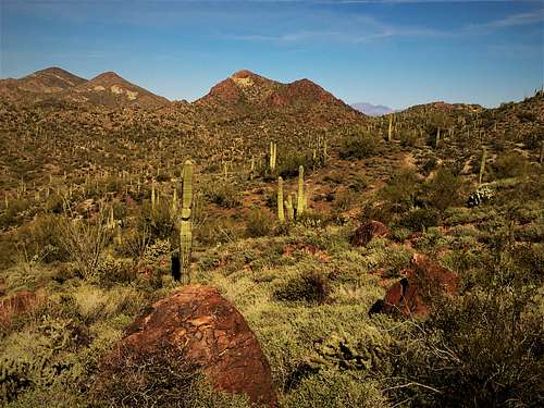
The Twin Peaks are two summits located in the Vulture Mountains, just over 2 miles north/northwest of the popular Vulture Peak.
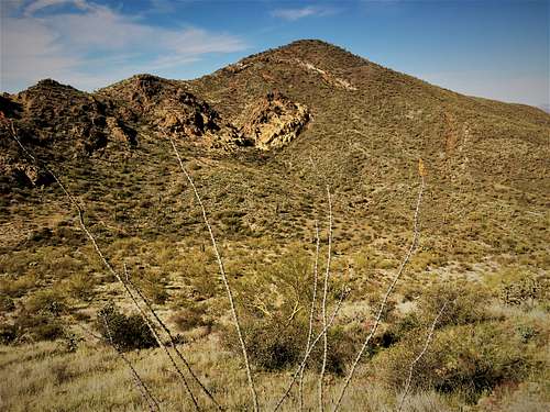
The summits themselves are separated by a little over a half a mile. Reaching both of them involves light trails and some relatively easy off-trail hiking. The two peaks are overshadowed by their popular neighbor, but they are quite pleasant and enjoyable in their own right. Rocky cliffs can be seen along the way, and there is enough mix of trail and off-trail to make the off-trail tolerable. Located in far west Maricopa County, these mountains are reached from not far south of the town of Wickenburg via Vulture Mine Road. Vulture Mine Road heads right to the base of Twin Peaks East.
The Twin Peaks are best hiked between November and March. Avoid hiking above 70 degrees which is snake weather, since sections of the hike are off-trail. Expect temperatures about 5-10 degrees cooler than Phoenix, since the trailheads are at about 2,700’.
It isn’t too difficult to combine the Twin Peaks with Vulture Peak, or even nearby Peak 3111.
Getting There
Once in the town of Wickenburg, head west on Highway 60 for about three miles to Vulture Mine Road. There are two starting points. The first is a little over 4 miles south of Highway 60 and is best if just hiking Twin Peaks West (although you can hike both). If hiking both peaks, the easier option is to drive about 5 miles south to the base of Twin Peaks East. There is a little pull off on the west side of the road, below the peak.
Route
From the northern pull off, take a dirt road for almost three-quarters of a mile, and there is a right turn descending down. Continue on the road for about 300 yards. Look for a use trail on the left. Take this trail as it goes between the Twin Peaks. It curves around and there is a sign pointing towards the “West Trail”. Continue along this trail as it reaches a saddle, and then descends. Continue back up to another saddle. At this point, you’ve been on the trail for about 0.8 miles. Take a right off the trail and its about ¼ mile and 310’ to the summit of Twin Peaks West.
Descend back down the trail. From here, you can head up the steep face of Twin Peaks East if so desired, gaining almost 400’ to the top. Then descend down the northern spine of Twin Peaks East until you reach the dirt road.
If just hiking Twin Peaks West, the round-trip distance is about 3 ¾ miles, gaining about 750’ to the summit, and over 850’ total. Add Twin Peaks East, and it’s about 1,200’ and a little over 4 miles total round trip.
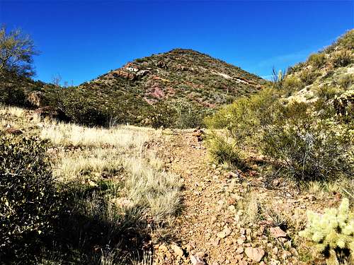
From the south pull out, you need to go up and over Twin Peaks East. There is a trail right at the pull-out. Look close enough and you’ll find it. The trail turns left after almost a quarter mile and starts to descend. Instead of following the trail, get off the trail, and head straight for the summit about 270’ above. It is pretty steep, but not too brushy.
Once at the summit, don’t go straight down right away. Go down the spine a little bit, but less than 100 yards, and you can find a relatively open way down. It’s steep, but not terrible. There is no trail. However, you can see a trail below you. Head down towards it. There is a dry creek crossing before you reach it. Once on the trail, follow it for a little over half a mile to the saddle mentioned above, and hike up Twin Peaks West.
To make it a loop, take the trail all the way back to the road. After a little over a third of a mile, turn right, and the road will lead back to the pull off. The total elevation gain round trip is about 1,250’; hiking about 3 ¾ miles.
Red Tape
No red tape. This is a recreational area, with no restrictions of note.
External Links
Twin Peaks West: https://listsofjohn.com/peak/77566