Toggle navigation
Mountains
Routes
Images
Trip Reports
Forum
What's New
People
Areas & Ranges
Articles
Trailheads
Canyons
Huts & Campgrounds
Albums
Logistical Centers
Fact Sheets
Lists
Custom Objects
Gear
Plans & Partners
WELCOME TO SUMMITPOST
SIGN IN
REGISTER
Mount Young
Additional Parents
Image
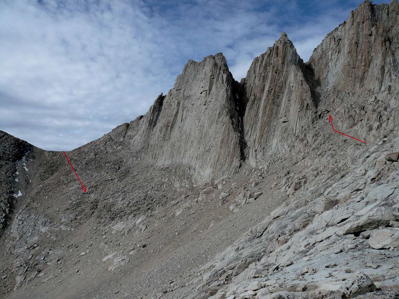
Two methods to the plateau
View High-Resolution Image
Two methods to the plateau
From the east. The red arrow up shows the approach to "Michaels" chute. The red arrow down is the traditional Class 2 route. Both methods access the shared plateau. (27 Oct 07)
« PREV
NEXT »
bechtt
on
Nov 20, 2007 1:24 am
Comments & voting
Other parents
Lat/Lon:
36.58814°N / 118.31436°W
Image ID:
358354
2574 Hits
72.08
% Score
2
Votes
Log in to vote
Comments
No comments posted yet.
to post!
Don't have an account?
Mount Young
(Mountain/Rock)
« PREV
Viewing
#2 of 3
GALLERY
NEXT »
bechtt's Image Gallery
« PREV
Viewing
#201 of 274
GALLERY
NEXT »
×
You need to login in order to vote!
User Name
Password
Remember me
Forgot your password?
Log me out when I close my browser.
Keep me logged in all the time.
sign in as a user
Don't have an account?
Register now for FREE
Rating available
Suggested routes for you
People who climb the same things as you
Comments Available
Create Albums
Register Here


