
|
|
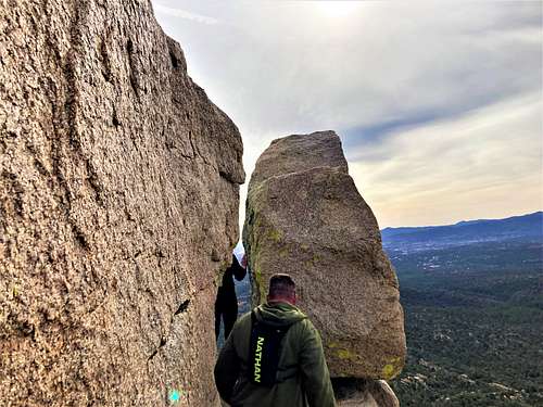
Mountain/Rock |
|---|---|
|
|
34.59890°N / 112.5649°W |
|
|
Yavapai |
|
|
Hiking, Bouldering |
|
|
Spring, Fall |
|
|
6900 ft / 2103 m |
|
|
Overview
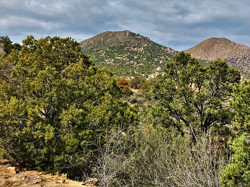
Two Rock Mountain is located less than 3 miles south of Granite Mountain 7,626’. It is known for the two rocks on the south end of its summit area.
Two Rock Mountain is attractive because it is a short hike, it is accessible (adjacent to the growing communities in Prescott, AZ), and it has a trail pretty much all the way to the summit.
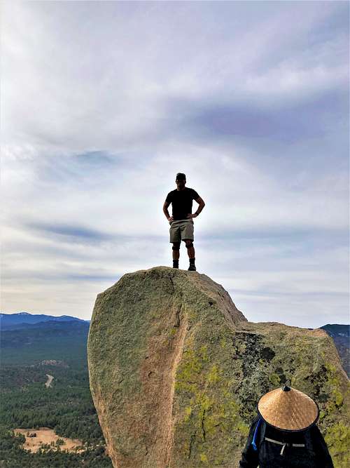
While the highest of the two rocks is not the true summit, it can be scaled by those brave enough to go up the 4th Class exposed rock face.
From the summit, there are views all around the mountains surrounding Prescott, as well as up towards Flagstaff and the San Francisco Peaks.
The best time to hike up Two Rock Mountain is spring and fall. Snowfall may occur during winter months, and it can get pretty cold. March-May and September-November are the best times.
Getting There
The trailhead is the Little Granite Mountain TR37 Trailhead off of Iron Springs Road, about six miles west of downtown Prescott. From the Phoenix metro area, take I-17 to Highway 69 which leads into Prescott. You can go through Prescott, which can be busy during the weekends, or take a faster, but slightly longer route via Fain Road. For that, turn right onto Fain Road about 20 miles from I-17 and continue 18 miles to Williamson Valley Road. Turn left and continue south for 2 ½ miles to Iron Springs Road. Take it west for 4.7 miles to the trailhead.
A lot of folks may put Trail #37 in their GPS, which will lead you to the wrong route via a dirt road off of Iron Springs Road. Keep in mind, the trailhead is on the north side of Iron Springs Road. It is easy to find even if GPS gets screwy.
Route
From the trailhead, hike up the main trail as it gains moderately towards some power poles a little over a half mile up. Cross the power pole road and continue up the trail until about 1 mile from the trailhead. At this point, there is a trail on the right, but it isn’t well marked at all. Look for anything that can be a trail. The way to know the trail junction has been passed is when the main trail cuts to the left away from Two Rock Mountain.
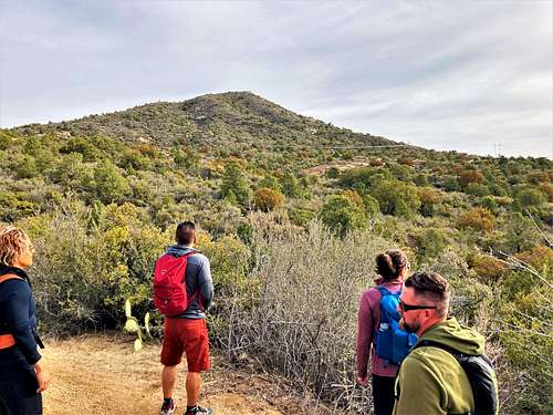
Once on the trail itself, it is less than a half mile up to the two rocks, gaining about 300’. Once at the two rocks, take a right and continue to the summit. The trail fades, but there is kind of a light path that enables hikers to get to the summit without too much brush.
It is a little over 1 ½ miles to the summit, gaining about 850’.

Fortunately, there is plenty more to explore in the area, including continuing along the main trail towards Little Granite Mountain 7,089’ (which requires bushwhacking to reach its summit). There are also plenty of opportunities for bouldering off of the trail up the many boulders along the way.
Red Tape
There is no red tape of note. The trailhead and the land are within Prescott National Forest.
External Links
Trailhead: https://www.fs.usda.gov/recarea/prescott/recarea/?recid=67525
Youtube video about this hike and Little Granite Mountain