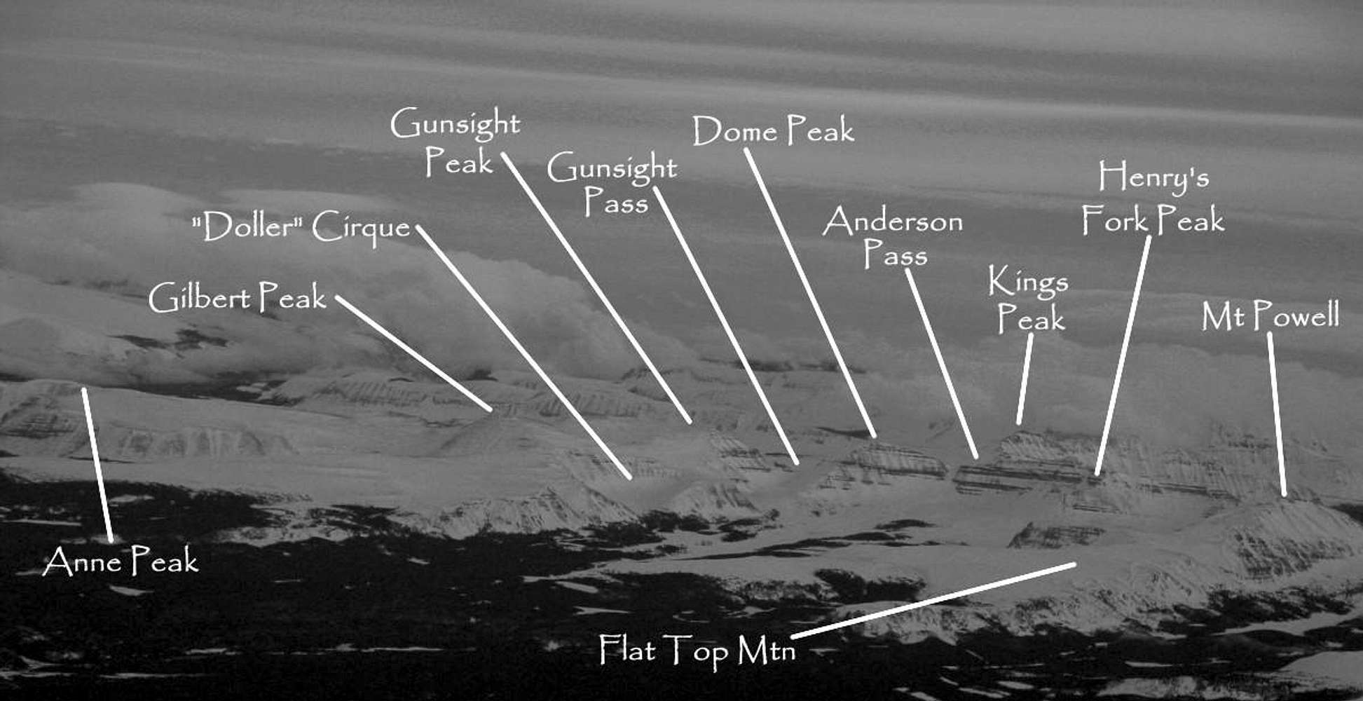
The High Uintas as seen from a commercial plane flight. Of the 10's of flights I have made out of and into Salt Lake City, I have never been blessed with the view of the Uintas that I want to have. Instead, I get stuff like this. Not bad, but the light was so flat it makes it hard to pick things out. Canon Powershot G5 (a great camera btw).
Please comment on my naming - I am pretty sure it is all correct. As far as place names are concered, since much of the Uintas' peaks are officially unnamed, I used some names that I have read in various guidebooks. For example, I believe Dome Peak is also referred to as West Gunsight Peak and Henry's Fork Peak is also known as Fortress Peak.


