
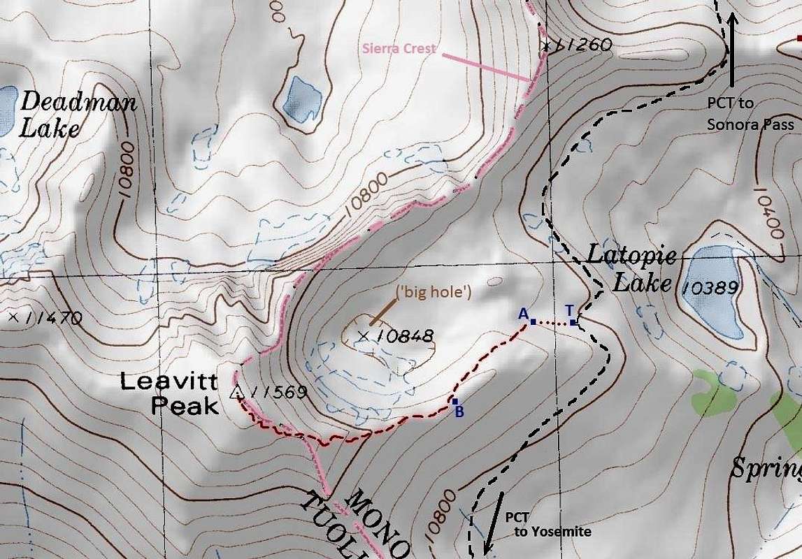
Use trail to Leavitt Peak
Near the point where PCT gets closest to Latopie Lake, search for a well outlined T-junction ("T" on this map), marking the start of a use trail that will get you all the way to the top of Leavitt. Actually, for the first several hundred feet, between "T" and "A" on the map, the use trail may be almost invisible. However, no need to worry, just continue uphill by using the lowest incline until you see a large cairn at "A". Here the trail becomes well defined. It gently climbs to Leavitt's east ridge, then follows the ridge line to the summit. There is another well built cairn at "B", that may be helpful in finding the right path on your way back.


