Toggle navigation
Mountains
Routes
Images
Trip Reports
Forum
What's New
People
Areas & Ranges
Articles
Trailheads
Canyons
Huts & Campgrounds
Albums
Logistical Centers
Fact Sheets
Lists
Custom Objects
Gear
Plans & Partners
WELCOME TO SUMMITPOST
SIGN IN
REGISTER
Columbia Icefield
Additional Parents
Mount Athabasca
Image
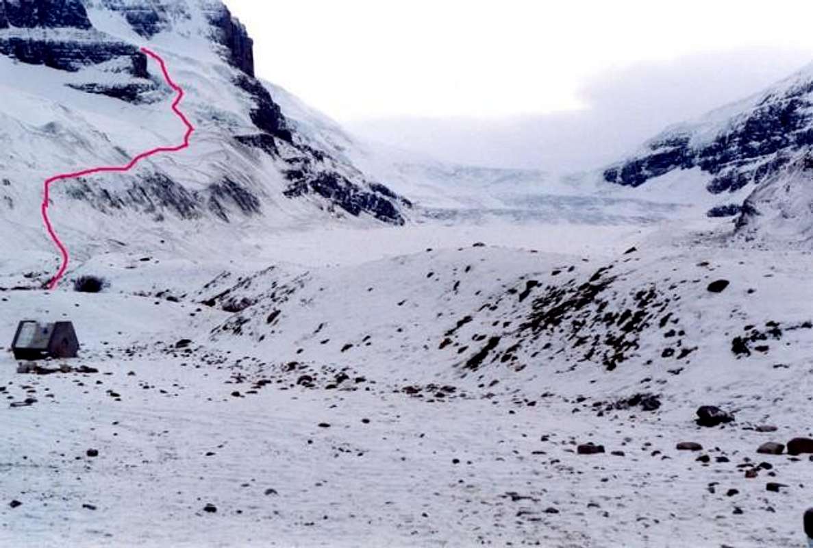
The red line indicates the...
View High-Resolution Image
The red line indicates the...
The red line indicates the route up by the glacier. The Columbia Ice field is in the center as it was in November 2000. William Marler.
« PREV
NEXT »
William Marler
on
May 22, 2001 8:13 am
Comments & voting
Other parents
Lat/Lon:
52.18100°N / 117.2011°W
Image ID:
678
3967 Hits
74.32
% Score
5
Votes
Log in to vote
Comments
No comments posted yet.
to post!
Don't have an account?
Columbia Icefield
(Area/Range)
« PREV
Viewing
#49 of 94
GALLERY
NEXT »
William Marler's Image Gallery
« PREV
Viewing
#836 of 1277
GALLERY
NEXT »
Mount Athabasca
(Mountain/Rock)
Loading....
×
You need to login in order to vote!
User Name
Password
Remember me
Forgot your password?
Log me out when I close my browser.
Keep me logged in all the time.
sign in as a user
Don't have an account?
Register now for FREE
Rating available
Suggested routes for you
People who climb the same things as you
Comments Available
Create Albums
Register Here


