-
 41766 Hits
-
 85.87% Score
-
 21 Votes
|
|
Area/Range |
|---|---|
|
|
Mountaineering, Trad Climbing |
|
|
Overview
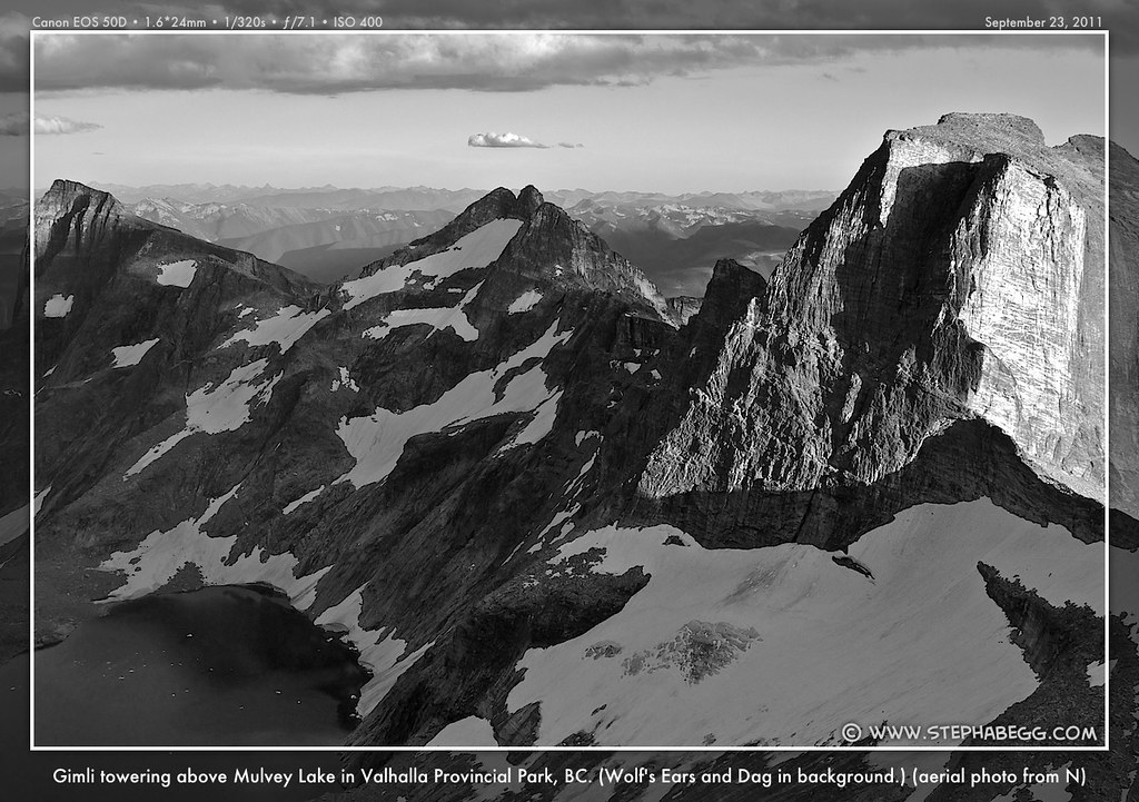
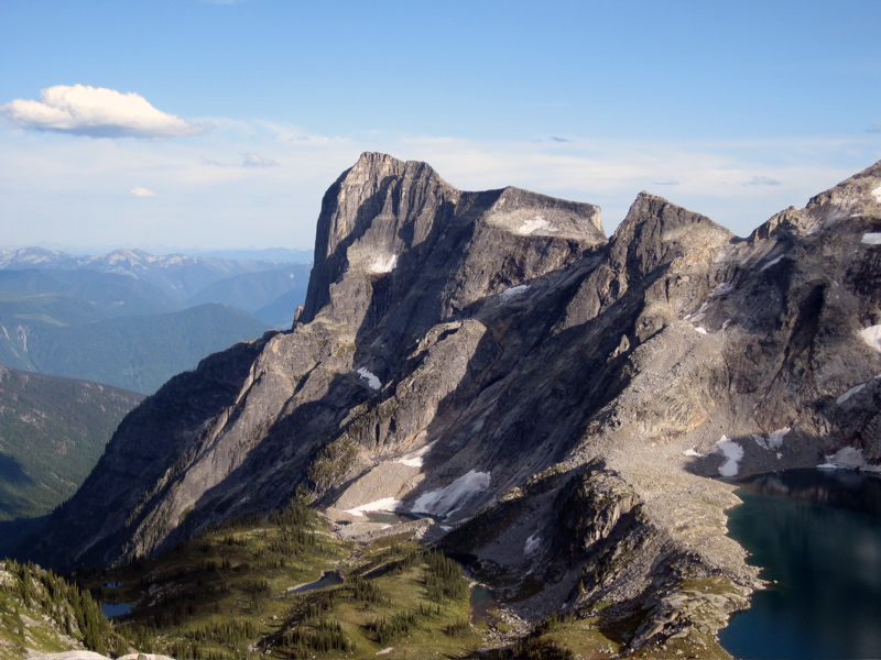
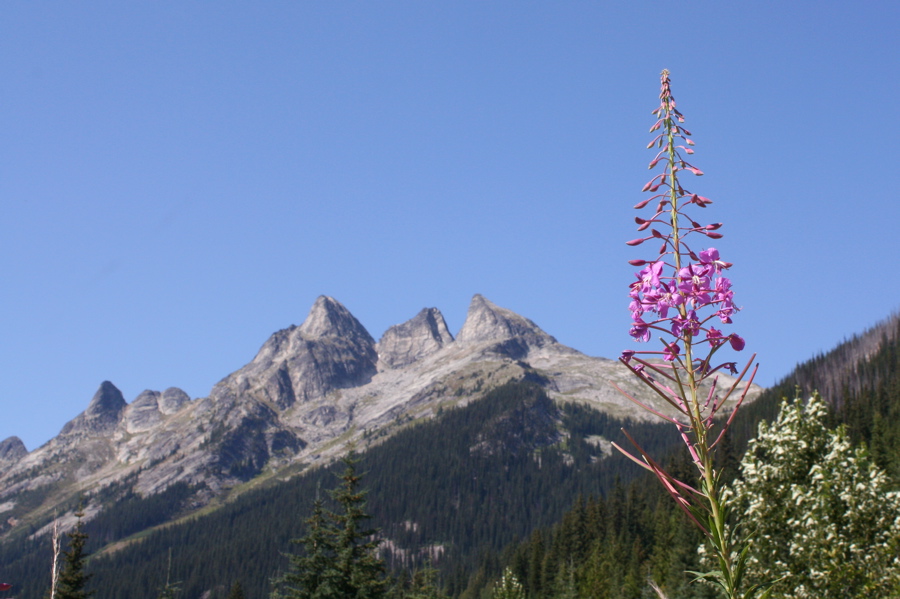
The Valhalla Range is a dramatically diverse area in the Selkirks of SW British Columbia, about 100km south of the Bugaboos. Along the southwestern boundary of Valhalla Provincial Park is an outstanding group of spires including Mount Dag, Wolf's Ears, Gimli, Asgard, and Gladsheim, all over 2,660m. These peaks offer great climbing.
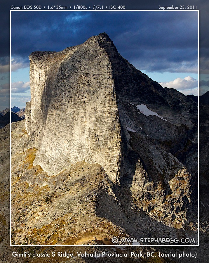
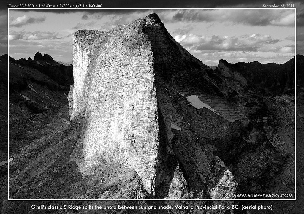
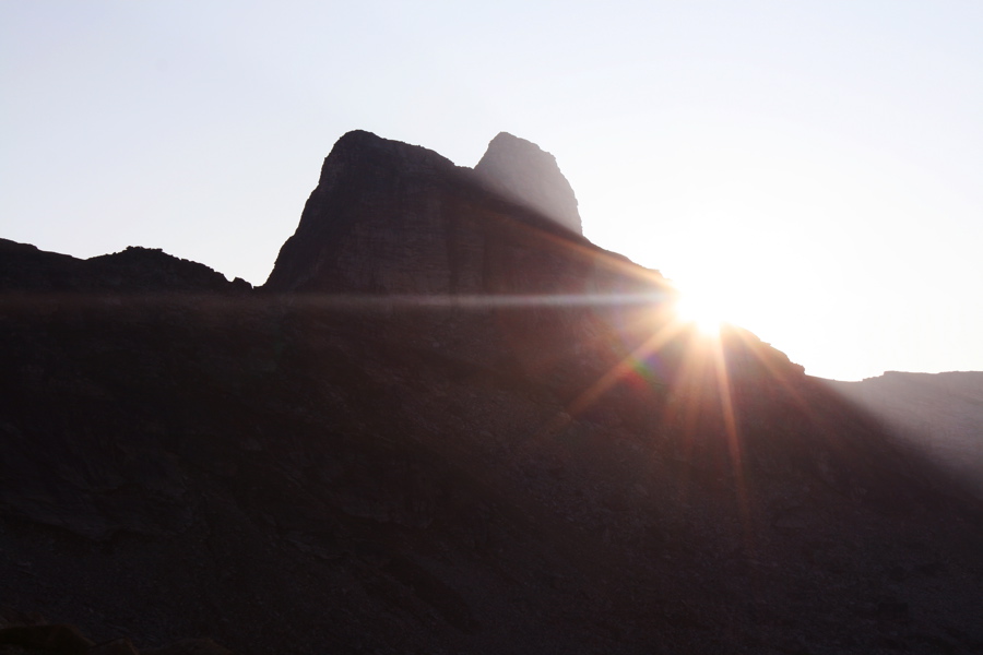
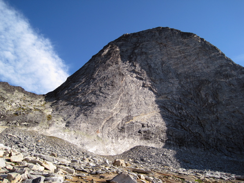
Mount Gimli is one of the most dramatic and accessible of the spires. The mountain is beautiful from all angles, but is particularly stunning when viewed from the south. From this viewpoint, the South Ridge forms a spectacular arête that begs to be climbed. And even more pleasing, the south ridge is composed of perfect gneiss and can be climbed at a moderate 5.8 grade over 7 pitches (although the grade of this route was listed as 5.10a in the most recent guide, due to a crux move on an upper pitch; the route is steep and sustained, so should not be underestimated). The approach is relatively short and there are no glaciers or snow to contend with.
Lack of Beta is a Good Thing!
The lack of published beta for these climbs is part of what makes the Valhallas unique and challenging. It is nice to find an area of great climbing where there is not a myriad of route descriptions detailing every turn on every possible climbing line. With the internet, many climbing areas are suffering from beta overload. I was strangely pleased when a Google search of the Valhallas yielded only ample information on one climb - the popular South Ridge of Gimli - leaving the other peaks/climbs relatively untainted. There does actually exist a guidebook for the area. An out-of-print Columbia Mountains of Canada West & South (by Whipple) reportedly contains errors and lacks descriptions for more recent routes. A new 2009 West Kootenay Rock Guide (by Kristiansen and Hempsall) provides some useful updated information on accessing the Valhallas, but contains only a few of the routes on just a couple of the peaks. For most climbs in the Valhallas, the only route description that exists is the feature name (i.e. "south ridge", "east face", ect.), so finding and climbing the route lines on the peaks themselves is a challenge left up to the climber.
Although I'm of the opinion that the Valhallas should be kept untainted by today's tendency to overdo route beta, below I've summarized the useful information on the Valhallas that I was able to glean from the guidebooks and internet searches. I've also provided lots of photos and trip reports for the climbs I've done in the Valhallas (on this page and others), but I've tried to leave the beta on the climbs themselves relatively vague. As I mentioned, most climbs in the Valhallas are just described by their feature name.
Getting There
 | 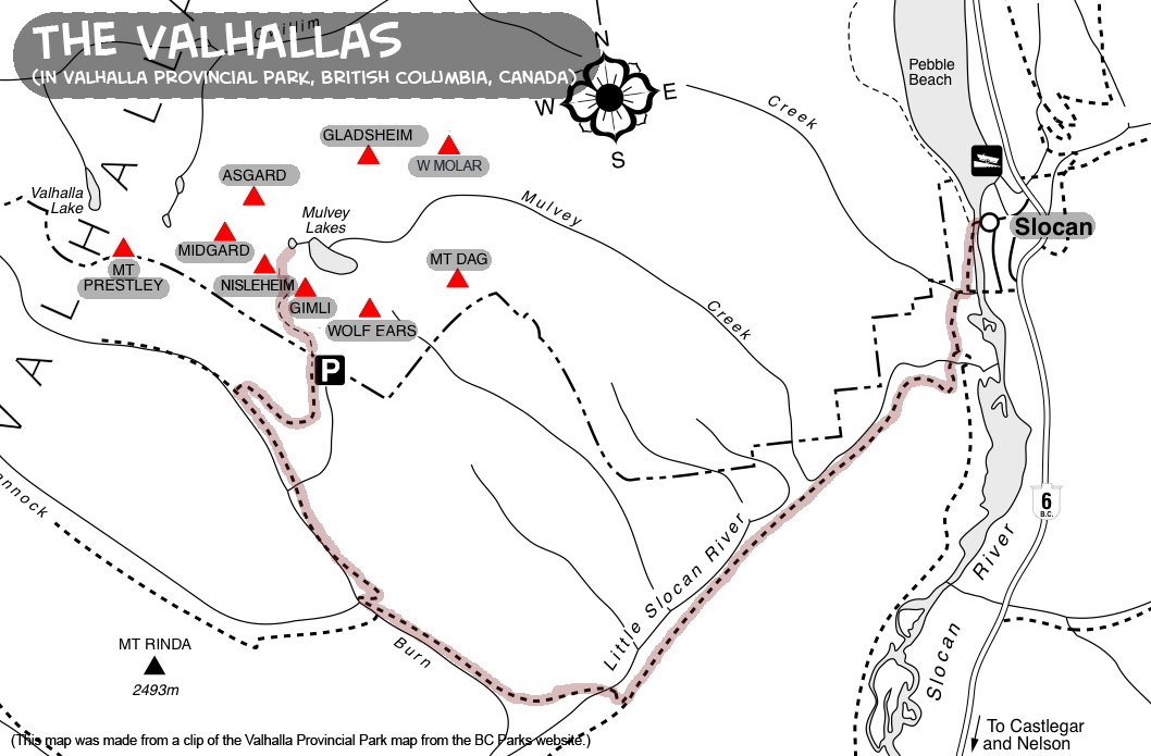 | 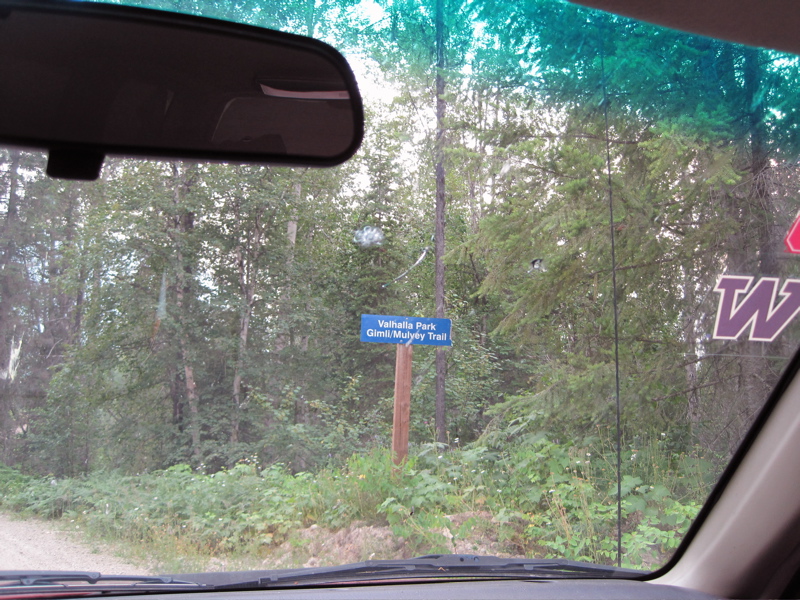 | 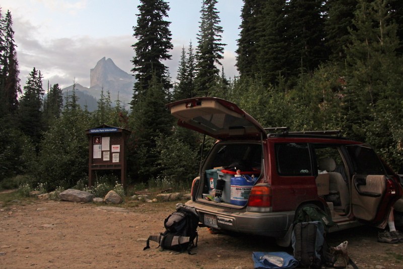 |
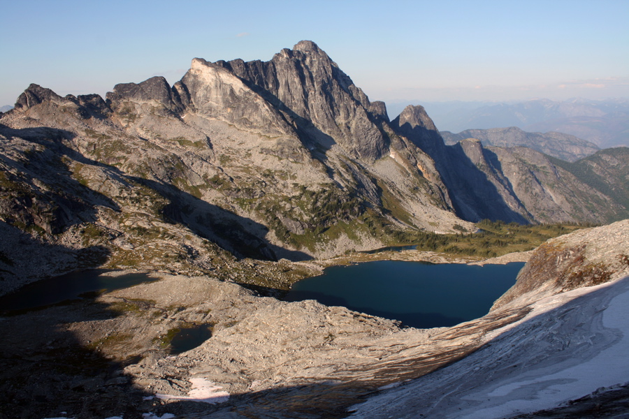
| The Valhallas are located at the south end of Valhalla Provincial Park in southeastern British Columbia, Canada. The are above the border of Washington and Idaho. They are not far to the SW of the Bugaboos. The first part of the approach is getting to Slocan, B.C. – there are a number of ways to do this: either from the north through Revelstoke (which involves a free ferry ride) or from the south via Castlegar. Slocan is situated at the south end of Slocan Lake, adjacent to Valhalla Provincial Park to the west and Kokanee Provincial Park to the east. Just south (about 1 kilometre) of the main exit (well signed) to Slocan there is a road called the "gravel pit road" – turn west here (right if coming from Revelstoke). Follow this road across the Slocan River and south until the 15 kilometre road marker, at which time you will turn right. Follow the blue "Valhalla" signs until you reach the trailhead at 26km (16 miles). The road is 2 wheel drive. From the trailhead, Gimli is visible to the north. Gimli is the closest and most climbed peak, and the route can be done car to car in a day for a relatively fast party starting early. It takes less than 2 hours to get to the base of Gimli, which is 2.5km and 700m elevation gain from the trailhead. The trail to Gimli starts out relatively flat but after crossing a log bridge is switchbacks up steeply all the way to a small saddle near the beginning of the South Ridge. The peaks on the southern side of the range - such as Dag, Wolf's Ears, Gimli, and Niselheim - can be approached from here. The trail continues to the col between Niselheim and Gimli, and from here down to Mulvey Lakes. Crampons and ice axe are needed for the descent from the col. It takes a couple hours to get from the base of Gimli to Mulvey Lakes. From Mulvey Lakes, the peaks on the northern side of the Valhalla range - such as Midgard, Asgard, Gladsheim, and West Molar - can be climbed. | |||
Camping
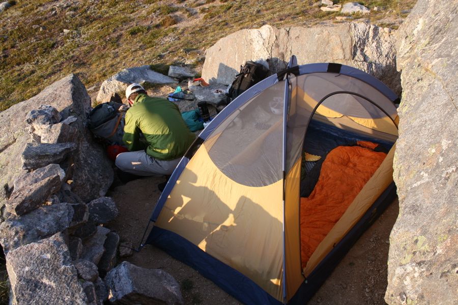 | 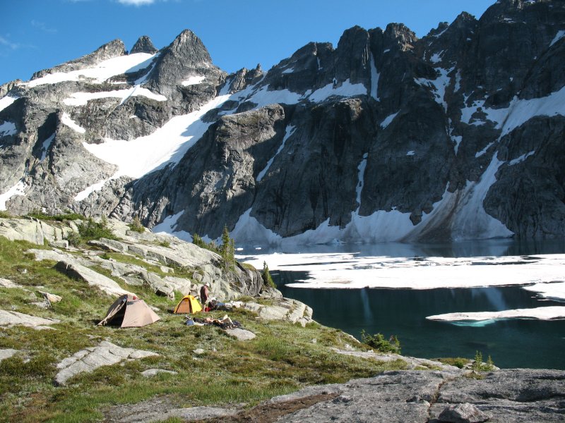 |  | 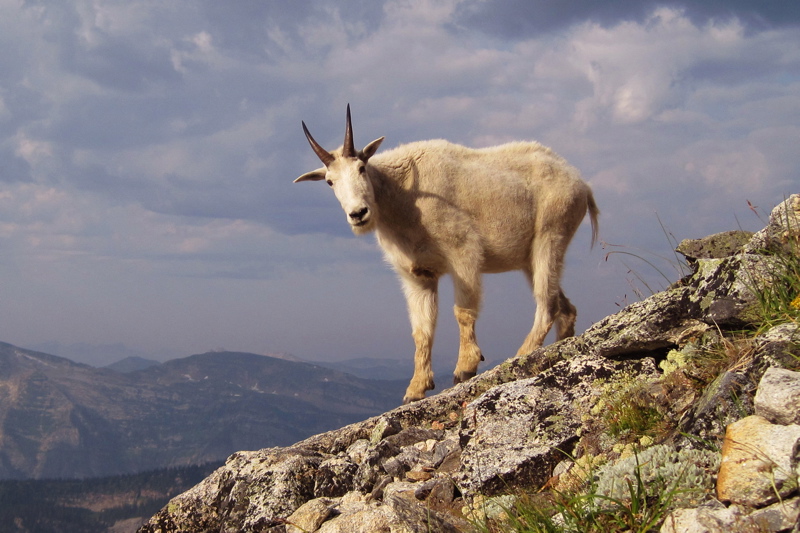 |
| There are a couple of camping spots below the South RIdge of Gimli, less than 2 hours from the trailhead. There is an outhouse here. The water source here is a couple of snowpatches, which could be gone by late August/September. Parties planning on an extended stay in the Valhallas often base themselves in Mulvey Lakes basin on the north side of the Gimli-Niselheim col about 2 hours further from the camp under the S Ridge of Gimli. There is always water here. There are nice camps in the upper basin or along the shore of the largest Mulvey Lake below. There is always water here. From here, the peaks on the northern side of the col can be climbed. There are mountain goats and snafflehounds in the Valhallas, so make sure to hang your food from boulders. | |||
Peaks/Climbs
  | |||
There are several peaks in the Valhallas. Most climbs in the Valhallas are just described by their feature name, and there is very little beta on the climbs themselves, which is part of the uniqueness and appeal of the area. Below, I've provided a list of routes on the major peaks. There are doubtless some climbs I have missed, and there's lots of potential for new routes in the Valhallas, so my list will become outdated with time. This list was initially compiled by Clint Cummins (link to Clint's page). I have occasionally updated the list as I have become aware of new routes. Here are the sources we have used: Sources: • SMG = http://summitmountainguides.com (online) • AAJ = American Alpine Journal (online and in print) • RC = rockclimbing.com • CC = trip reports on cascadeclimbers.com, by Drew Brayshaw and John Frieh • Gripped magazine August/September 2008, article by Kim Kratky www.gripped.com • 1992 Guidebook (out of print and with some errors; I have not looked at it): The Columbia Mountains of Canada West & South, Earle R. Whipple, et al, ed, American Alpine Club Press, 1992. • WK = 2009 Guidebook (short section on Valhallas): West Kootenay Rock Guide, by Aaron Kristiansen, Vince Hempsall. $26.95 (CND). Distributed by MEC, also available at Valhalla Pure Outfitters and Gravity Climbing Gym in Nelson, BC. | |||
  | Dag (2744m, 12 hour approach to North Face routes) 1. Dag - Ankles as Far as the Eye Can See 5.11 A1, VI, NE Face, (Ankles Aweigh?) 23p: 3 5.11, 9 5.10, bring pitons for some belays, AAJ2001 2. Dag - Ankles Me Boy VI 5.9+ A2, N Face direct, gully to ledge, 11 pitches above the ledge, AAJ2001 3. Dag - Suite Judy Blue Eyes VI 5.9 A3, N Buttress, gully to face above R edge of ledge, mossy cracks 4. Dag - Riding Skinfaxi VI 5.11d, right of buttress crest, some wide cracks and chimneys, RC, CAJ2003, SMG5. Dag - West ridge traverse III 5.2, SMG6. Nott to Dag traverse Little Dag (2680m) 1. Little Dag - North Buttress, quite mossy 2. Little Dag - North Face 5.8, 22p, maybe same as N Buttress? Batwing (2640m) 1. Batwing - NW Corner of West Ridge, AAJ1970 Nott (2580m) 1. Nott - Moss Ridge 5.5, North buttress, mossy but good, approach from Mulvey Basin | ||
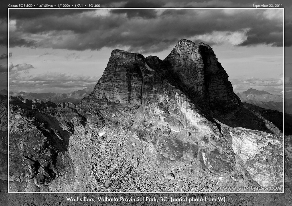
 | Wolf's Ears (2732m) 1. Wolf's Ears - not any beta I can find, but looks as if there are scramble routes to the top from the south side without having to descend into Mulvey Basin2. West Wolf’s Ear - The Gift, III 5.11+ 200m, SMG (new route as of June 2008)3. West Wolf’s Ear - SW Face 5.11c/d, maybe same as The Gift?, WK4. West Wolf’s Ear - Full West Ridge III 5.8, SMG5. West Wolf’s Ear - Regular West Ridge II 5.5, SMG6. East Wolf's Ear - East Ridge II 5.2, SMG7. East Wolf's Ear - Southeast Ridge 5.7, WK | ||
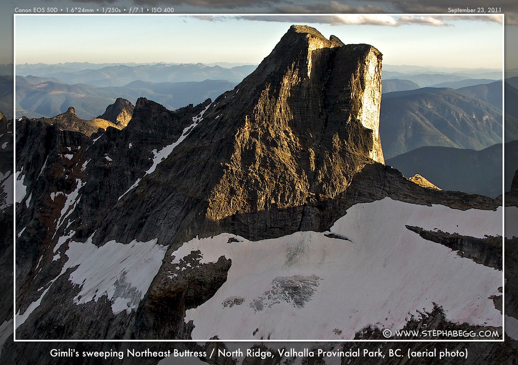
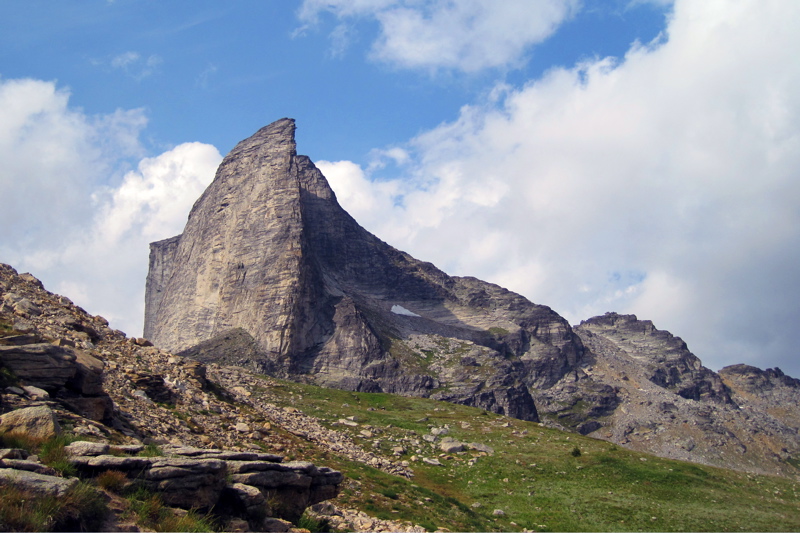 | Gimli (2806m=9100ft) 1. Gimli - South Ridge, aka Southeast Ridge, 5.8++ (or 5.10a), 8p, RC, Gripped June/July 2001, My Trip Report!2. Gimli - South Ridge Left start 5.7?, 2p, chimneys on L side of rib 3. Gimli - South Ridge Right start 5.10, 2p, starts right and below standard rib 4. Gimli - NW Buttress Right Edge III 5.8, incut holds on a steep and exposed corner, AAJ1990 5. Gimli - NE Buttress/North Ridge - 5.6, 10p, AAJ1970, My Trip Report! 6. Gimli - E Face - 5.07. Gimli - East Ridge 3rd, use for descent8. Gimli - Space Buttress 5.12d or 5.11+ C1, 8p, just L of crest of overhanging buttress on W face, 2 aid moves, freed on toprope?, www.gravityadventures.net, RC 9. Gimli - Lusting After Women 5.10c, 8p, corner system to roofs in center of SW Face, bolted station at top of p4 under roof, recent rockfall?, photos at RC, Gripped 10. Gimli - South Face Direct 5.11, WK 11. Gimli - Slave to Gravity, SW Face, 5.12- or 5.11a A0, 6p, found this in the summit register as a FA by Aaron Kristiansen and JT Croston on July 16, 2009! 12. Gimli - SW Face L 5.10c?, WK13. Gimli - SW Face R 5.11?, WK14. Gimli - Licken It 5.11a?, on E face, WK15. Gimli - Licken It L var. 5.10c?, joins Lichen It, WK | ||
 | Niselheim (2580m) 1. Niselheim - East Ridge 5.7, 4p, CC, My Trip Report! 2. Niselheim - South Ridge 5.6 3. Niselheim - North Ridge, 5.7?, WK4. Niselheim - NW Ridge 4th, use for descent5. Niselheim - South Face variant finishes, L=5.9 and R=10b/d, WK | ||
 | Prestley (2732m, west peak is main/highest) 1. Prestley - East Ridge, AAJ1970 2. Prestley Central - West Ridge, AAJ197 | ||
 | Midgard (2807m) 1. Midgard - North Ridge 3rd, CC 2. Midgard - South Ridge 3rd, CC | ||
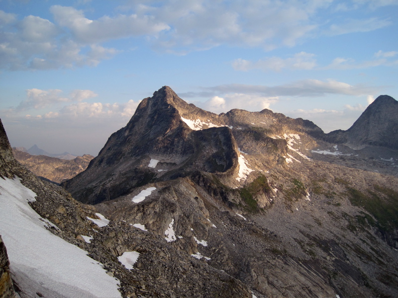
 | Asgard (2825m) 1. Asgard - West Ridge 5.5, 5p, RC 2. Asgard - SW Ridge 5.7, same as West Ridge? 3. Asgard - South Face Left 5.8, 5.7 R slab to R-leaning arch, 4p in cleft, exit crack, RC, My Trip Report! 4. Asgard - South Face Center IV 5.8, 7p, left-slanting cracks and roofs, some recent rockfall, RC5. Asgard - South Face Right - Étoile Filante IV 5.11c, 300m, SMG (new route as of July 2011) 6. Asgard - SE Ridge 5.7, 3p, joins East ridge at top, CC 7. Asgard - East Ridge, Class 3, use for descent8. Asgard - North Ridge III 5.7, AAJ1975 | ||
 | Gladsheim (2830m) 1. Gladsheim - West Ridge 5.3, 2-3 hours, RC, use for descent2. Gladsheim - Full West Ridge III 5.6, SMG3. Gladsheim - West Face, aka Southwest Face, III 5.8, 8p, p1 steep dirty dihedral, AAJ1977 4. Gladsheim - Koedt-Rowat SW Face 5.9, 5+p, RC5. Gladsheim - Brown-Marcus SW Face var. 5.8, 5p + 400m scrambling, CC6. Gladsheim - South Face, AAJ1970 7. Gladsheim - South Face, The White Dihedral IV 5.10d, SMG8. Gladsheim - Southeast Ridge, AAJ1970 9. Gladsheim - North Ridge Bypass, IV 5.10b, SMG (new route as of Aug 2008)10. Trireme Wall (on west end of Gladsheim) - West Ridge 5.6, 4p, aesthetic ridge climbing to top of West side of Gladsheim massive, My Trip Report!11. Trireme Wall (on west end of Gladsheim) - Up middle of S FaceGladsheim - First Ascent on Labour Day weekend, 1963. Email to me from Jack Oswald regarding his party's first ascent: "[The First Ascent of Gladsheim] was back in 1963 , I think. It was on the Labour Day weekend. Details of this first ascent were submitted to the Alpine Club of Canada and were presented in their annual journal about 1964, or 5. The writeup was done by the expedition leader, Kim Dean. The first ascent was by five people on two ropes. Kim Dean and Parker Williams led on the first rope. They were followed by three of us on the second rope. Rope leader was Bud Stoval, second was myself, Jack Oswald, and last on the rope, Mike Stewart. I was the only one carrying a 35 mm camera, and taking several pictures on slides. t was a memorable day as the weather was clear. We ate lunch on the peak of Gladsheim, and sat marvelling at the 360 degree view. Our descent was OK, but adventurous." West Molar (East of Gladsheim) 1. West Molar - South Face IV 5.8, AAJ1975 Molars1. Molars - original routes on some of them | ||
Aerial Photos
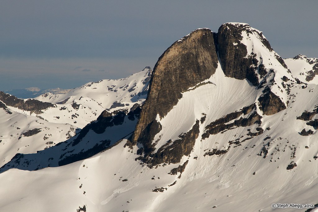
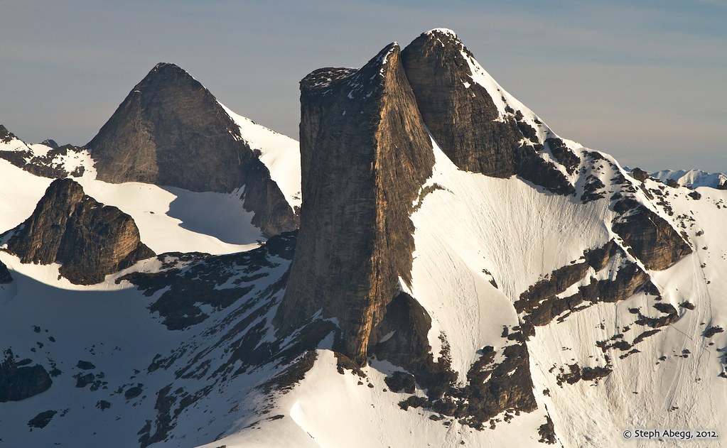
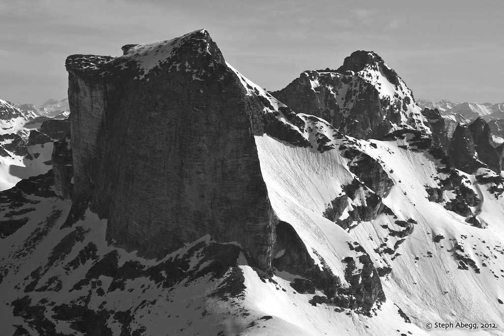
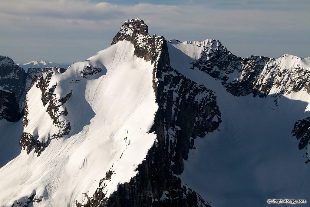
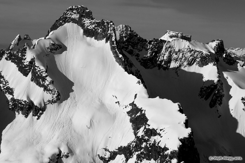
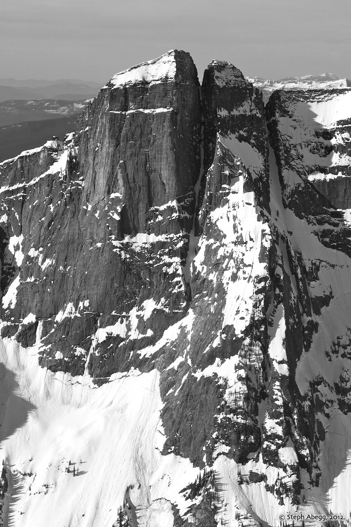
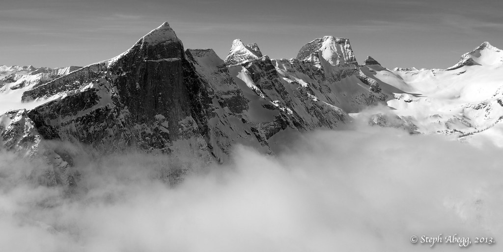
In the years since I first climbed in the Valhallas and put together this Valhallas overview page, I have had the unique and incredible opportunity to join pilot/photographer John Scurlock on aerial photography adventures which included flying over the Valhallas. To date John and I have flown over the Valhallas on three occasions capturing the spectacular range in three different seasons: (1) Fall: September 2011, (2) Spring: May 2012, and (3) Winter: March 2013.Click links for aerial photo trip reports. Below are some of my favorite photos from these amazing flights. Aerial Photos from September 2011:
Aerial Photos from May 2012:
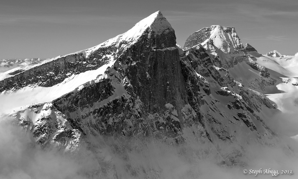
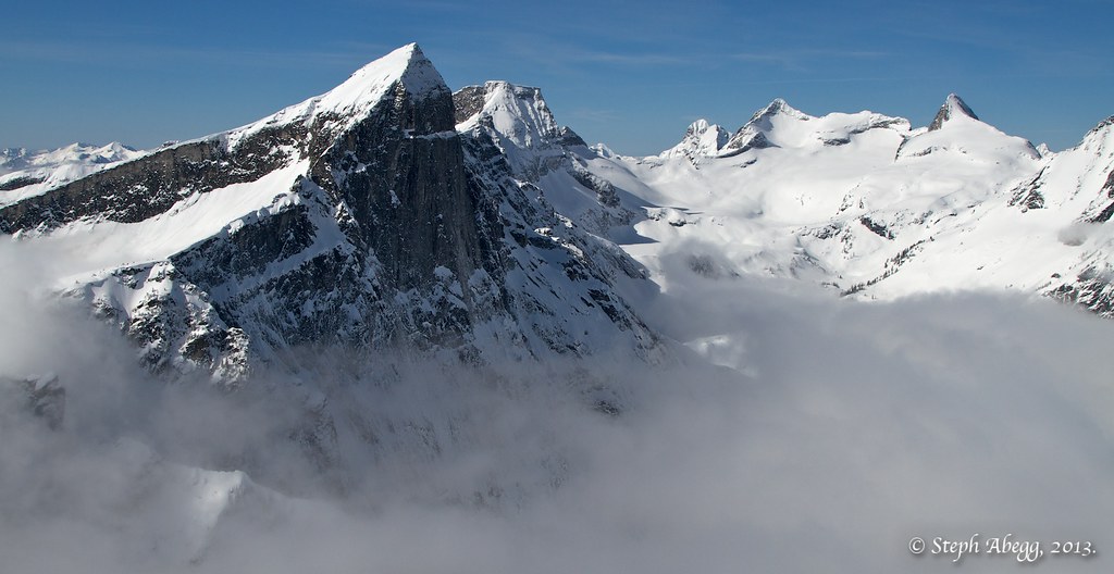
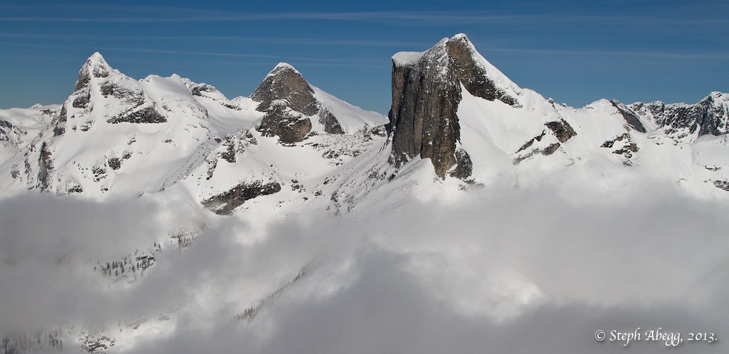
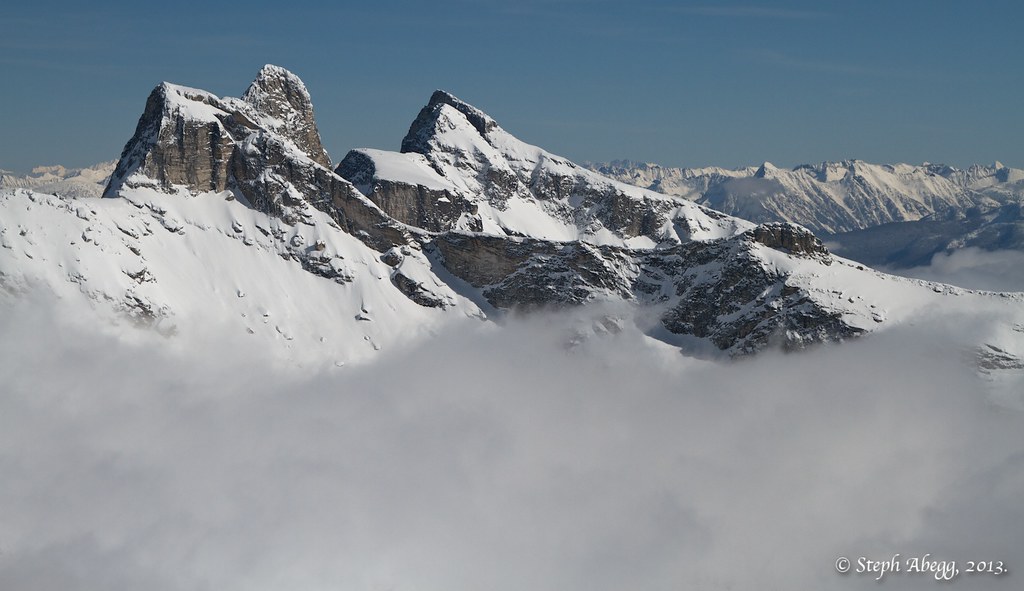
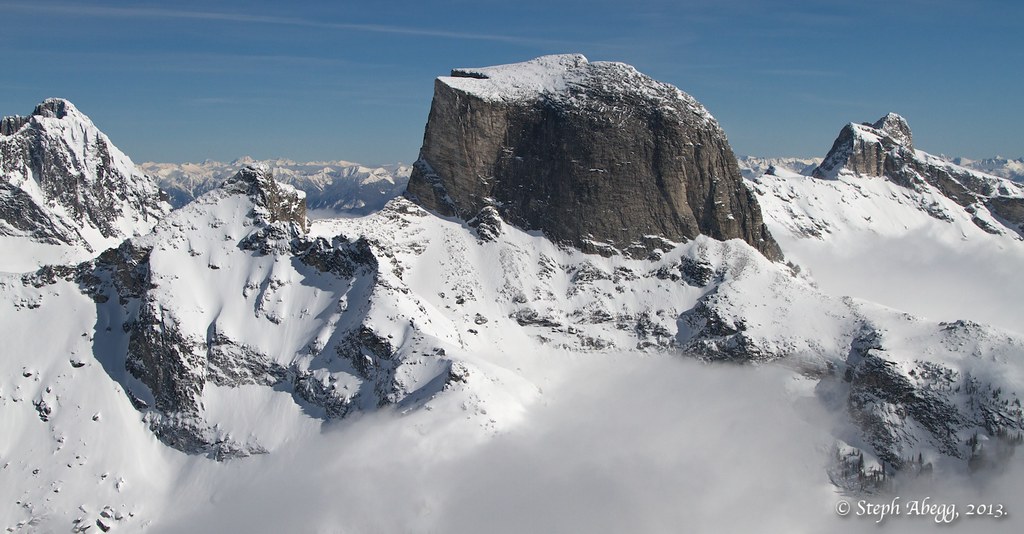
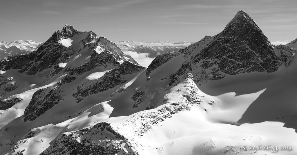
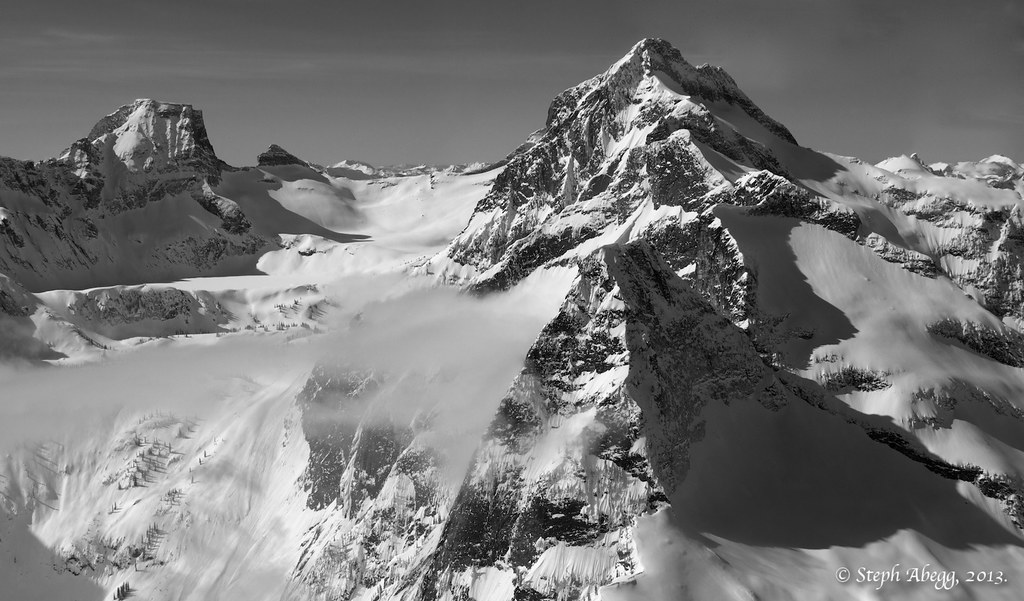
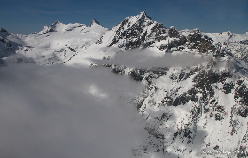
Aerial Photos from March 2013:
|