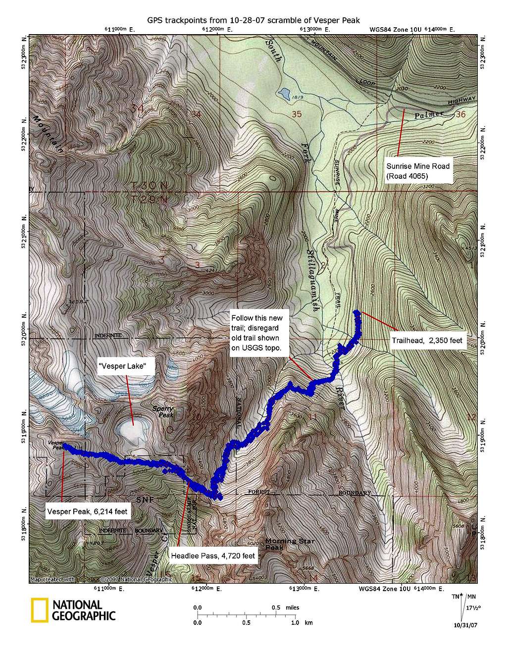
Vesper Peak East Ridge topo

Vesper Peak East Ridge topo

Topographic map of the route up the East Ridge of Vesper Peak via Sunrise Mine Trail and Headlee Pass. This printout from TOPO! version 4.2.8 mapping software superimposes 1,572 GPS track points (of both the ascent and return) onto an excerpt from USGS 7.5-minute series topographic base maps. The track points are from a Garmin eTrex Vista HCx handheld GPS unit. On this inaugural trip, the unit performed just as the manufacturer claimed. Its high-sensitivy receiver clung tenaciously to its lock on the GPS satellites, even in the woods.
MichaelKnoll
on Oct 31, 2007 9:20 am
Image Type(s): Hiking
Image ID: 352241

Comments

No comments posted yet.