Toggle navigation
Mountains
Routes
Images
Trip Reports
Forum
What's New
People
Areas & Ranges
Articles
Trailheads
Canyons
Huts & Campgrounds
Albums
Logistical Centers
Fact Sheets
Lists
Custom Objects
Gear
Plans & Partners
WELCOME TO SUMMITPOST
SIGN IN
REGISTER
To The Top of Vancouver Island: The Golden Hinde
Additional Parents
Image
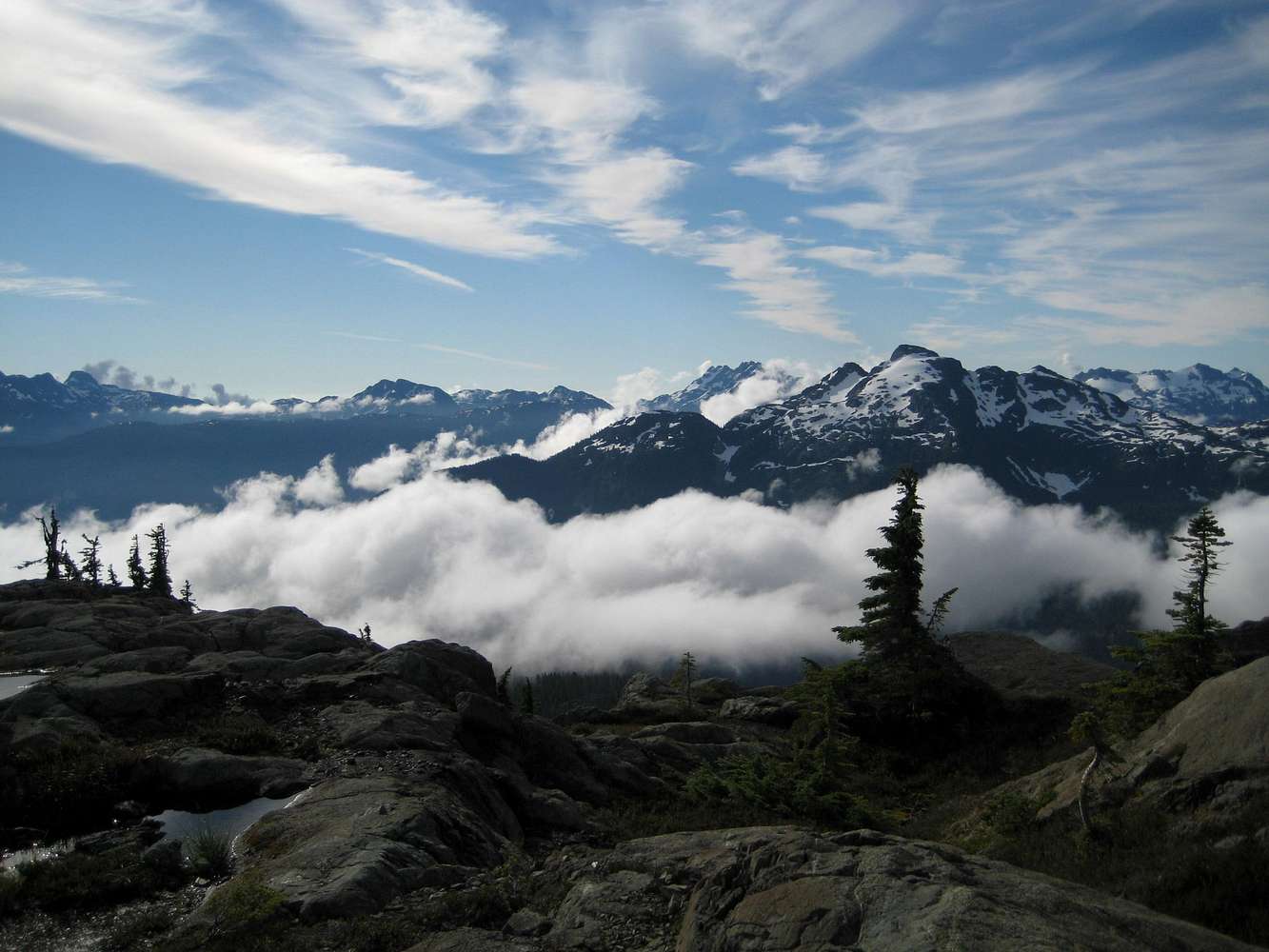
View South from Lower Phillips Ridge
View High-Resolution Image
View South from Lower Phillips Ridge
View south from approximately halfway between our first camp and Peak 1732. Mount Harmston at extreme right, then
Central Crags
, then the Septimus massif, then
Mt Myra
in the foreground and finally Big Interior Mountain
« PREV
NEXT »
vancouver islander
on
Sep 10, 2007 11:31 pm
Comments & voting
Other parents
Lat/Lon:
49.66200°N / 125.747°W
Image ID:
335586
2970 Hits
80.98
% Score
13
Votes
Log in to vote
Comments
No comments posted yet.
to post!
Don't have an account?
To The Top of Vancouver Island: The Golden Hinde
(Trip Report)
« PREV
Viewing
#4 of 37
GALLERY
NEXT »
vancouver islander's Image Gallery
« PREV
Viewing
#62 of 1858
GALLERY
NEXT »
×
You need to login in order to vote!
User Name
Password
Remember me
Forgot your password?
Log me out when I close my browser.
Keep me logged in all the time.
sign in as a user
Don't have an account?
Register now for FREE
Rating available
Suggested routes for you
People who climb the same things as you
Comments Available
Create Albums
Register Here


