

yatsek - Nov 9, 2008 2:08 pm - Voted 10/10
One of those sightsI tried hard to recall but I couldn't; now they're back - thanks

kamil - Nov 9, 2008 3:10 pm - Hasn't voted
Re: One of those sightsThat part of Rila is even less often visited I guess. Did you go there on your trek?
pzdr
k
yatsek - Nov 9, 2008 5:45 pm - Voted 10/10
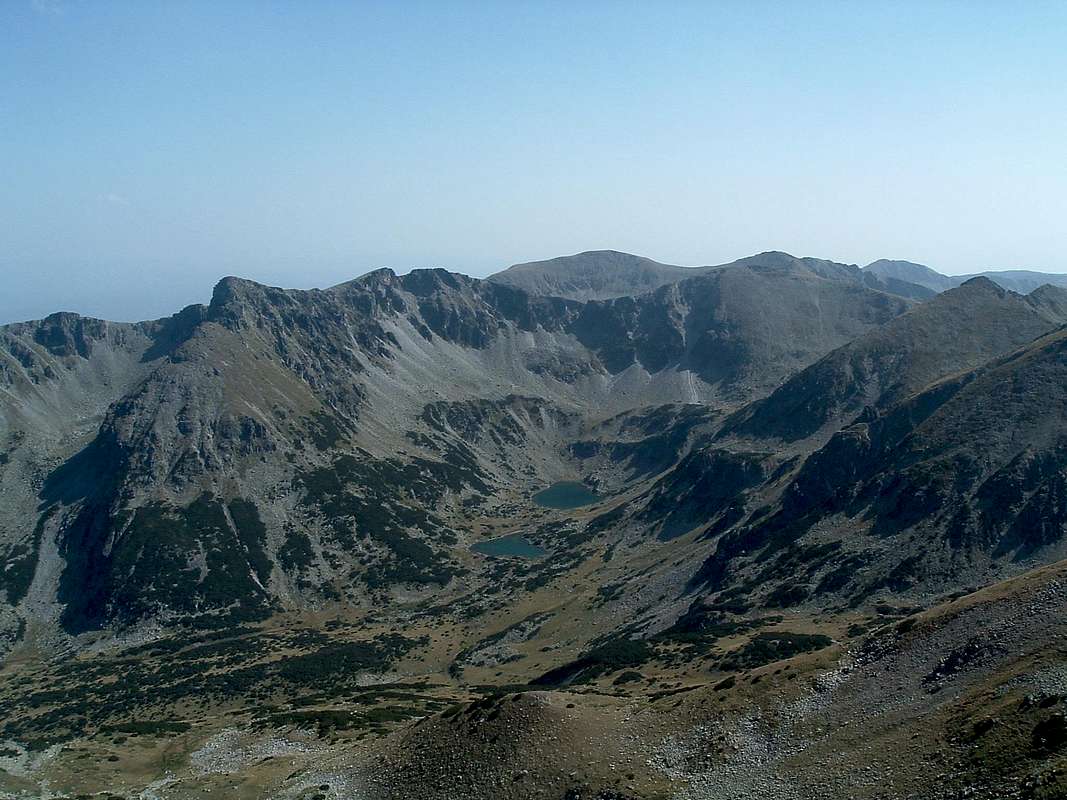
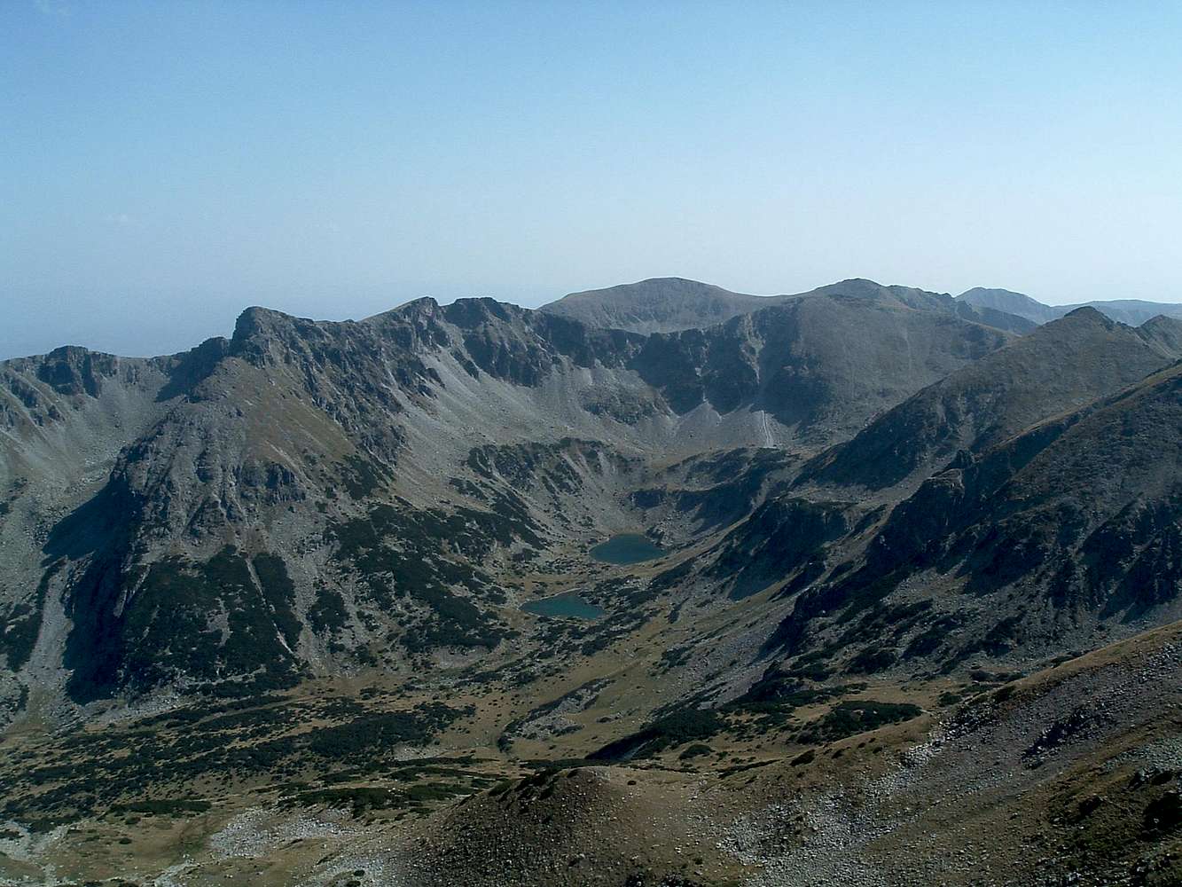
Re: Your questionmade me remember something, I rushed to unlock my case of maps, dug into it and took out a little diary written on the trek – the dates, route, impressions (I've already corrected my log). As to this particular view, it reads: "Fantastic sight to S – Marica cirque (nature reserve), a herd of chamois below us". No, we didn't go there though we did head south, along the main ridge, to Dżanka Pass, then west to the monastery to get some food, back east to Makedonia chalet, then south towards the Pirin. Two years later, I visited (besides part of Romania and the highest part of the Stara Planina) NW Rila – the most picturesque plus a range of (also technical!) climbing options.
So Kamil, thanks a million for refreshing my memory - feels like DDR2 in place of DDR1 (though DDR is over, just like the plaques:-)
Cheers,
Jacek
kamil - Nov 10, 2008 8:11 am - Hasn't voted
Re: Your questionMust have been a great trip of many days...
Spojrzałem na mapę i mniej więcej wiem jak szliście, zupełnie nie znam tamtej części Riły.
yatsek - Nov 10, 2008 10:49 am - Voted 10/10
Re: Your questionS Rila looks like a higher version of the Bieszczady combined with W Tatras; The following area is by far Rila's best:
http://www.summitpost.org/mountain/rock/155165/maljovica.html
Mieliśmy mapkę wycietą z "Poznaj Świat'a" - jakieś 20X15 cm:-) - to też ma swoje uroki, chociaż nieuchronnie coś ciekawego się zawsze ominie


Comments
Post a Comment