
-
 4613 Hits
-
 74.92% Score
-
 5 Votes
|
|
Route |
|---|---|
|
|
32.73555°N / 16.92863°W |
|
|
Download GPX » View Route on Map |
|
|
Hiking |
|
|
Spring, Summer, Fall, Winter |
|
|
Most of a day |
|
|
Hike |
|
|
Overview
 Pico do Arieiro seen from the south-west
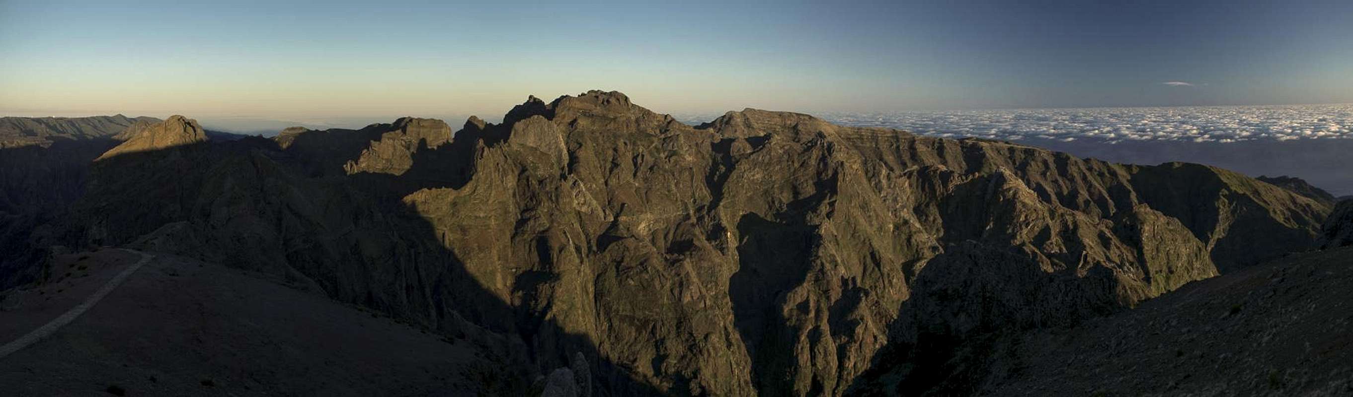
Pico do Arieiro, Madeira's third highest Mountain might not be the obvious hiking objective. A road goes up to its top, there is a huge parking lot, a restaurant, a souvenir shop and - worst of all - a large radar installation. On the other hand the mountain is the trailhead for the most famous hike of the island, the breathtaking traverse to Pico Ruivo, Madeira's highpoint, which can be done in reverse, starting from Achada do Teixeira.
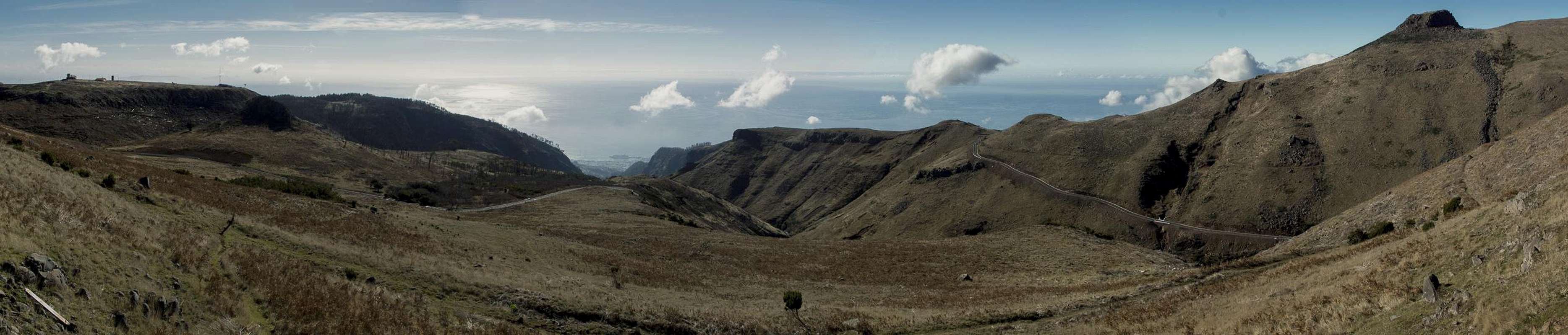
Another, less breathtaking but still impressive route leads from Pico Alto above Monte along the narrow Levada do Barreiro, which springs near Poco de la Nieve, an old snow cave only a few hundred metres from the summit of Pico do Arrieiro. In contrast to other levada routes this one is not flat - it covers roughly 900m elevation gain. Some of the sections are rather exposed, also there are scrambling sections beside little waterfalls so that the route offers something for everyone. Mainly, however, it is very solitary which contrasts starkly with the hectic activity around Pico do Arieiro itself.
Getting There
 View from Pico Alto onto Funchal
- Leave motorway R101 at Funchal and drive up ER103 through Monte.
- Above the village, at approximately 1100m elevation, there is a small parking near a Posto Forestal lot on the left hand side of the road, which serves as trailhead for both Pico Alto and Pico do Arreiro.
Route Description
  |
- General:
- Start altitude: 1060m
- Summit altitude: 1816m
- Prevailing exposure: W
- Type: Hike and Scramble
- Protection: None
- Start altitude: 1060m
- Effort: 2 - Elevation gain: 900m
- Power: 2 - Some very steep sections
- Psyche: 2 - Easy but exposed in some sections
- Difficulty: 2 - Some Scrambles beside small waterfalls
- Orientation: 2 - Easy along the levada, overgrown near the top
From the parking lot near the Posto Forestal you might want to hike 700m southwards to Pico Alto a minor summit with a wonderful view across the bay of Funchal. The route runs along a broad level track and only during the last 200m you gain a bit of elevation (20m). Enjoy the view, then return to the Posto Forestal. Here turn left onto a narrow mountain road, which winds across the slope more or less staying level. There are a couple of viewpoints, the second one with a small picnic area.
From here follow the road for some 250 to the north where the track to Levada do Barreiro turns off to the left. Some 100m it stays level berfore plunging down some 40m towards the Levada. The starting point of the descent is rather hard to see even though there is a large signboard beside it.
 | 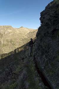 |  |
Now follow the fast flowing but narrow levada, which hugs the rocks to its east. An even narrower path accompanies it, switching sides every now and then. Very soon, after some 100 level metres you reach the first of the levada waterfallls (often forced into drainpipes but as often kept open), an obstacle which lou'll have to surmount by scrambling up 50m of elevation.
 |  |  |
This pattern ooccurrs sevaral more times: more or less long level sections suddenly end in one of these waterfalls, which you have to negotiate along steep and slippery slopes beside the levada. A particulary nasty one is between 1300m and 1350m, heading up an overgrown slope to the east. At around 1500m the orientation gets a bit tricky as the levada kind of vanishes - it simply doesn't carry any water in this area. You have to scramble up a cliff, upon which the levada suddenly rejoins from the left.
 |  |  |
Having negotiated some trees in this area you suddenly step out onto the sloped plain south of Pico do Arieiro. A tiny Levada do Barreiro now aims straight for the mountain, ending south of Poco de la Neve. In this igloo-like hut (and underground cave) snow and ice was stored in winter to be delivered to Funchal during the warmer months. The poco is located directly beside the road to Pico do Arieiro, which you can follow for about 1 km to the summit buildings. A better track starts south of Poco de la Neve and runs in a long bend into the uppermost valley of Ribeira des Santa Luzia ending at the parking lot on Pico do Arieiro.
Essential Gear
 |
Hiking gear is sufficient