Toggle navigation
Mountains
Routes
Images
Trip Reports
Forum
What's New
People
Areas & Ranges
Articles
Trailheads
Canyons
Huts & Campgrounds
Albums
Logistical Centers
Fact Sheets
Lists
Custom Objects
Gear
Plans & Partners
WELCOME TO SUMMITPOST
SIGN IN
REGISTER
Smith Peak
Additional Parents
Image
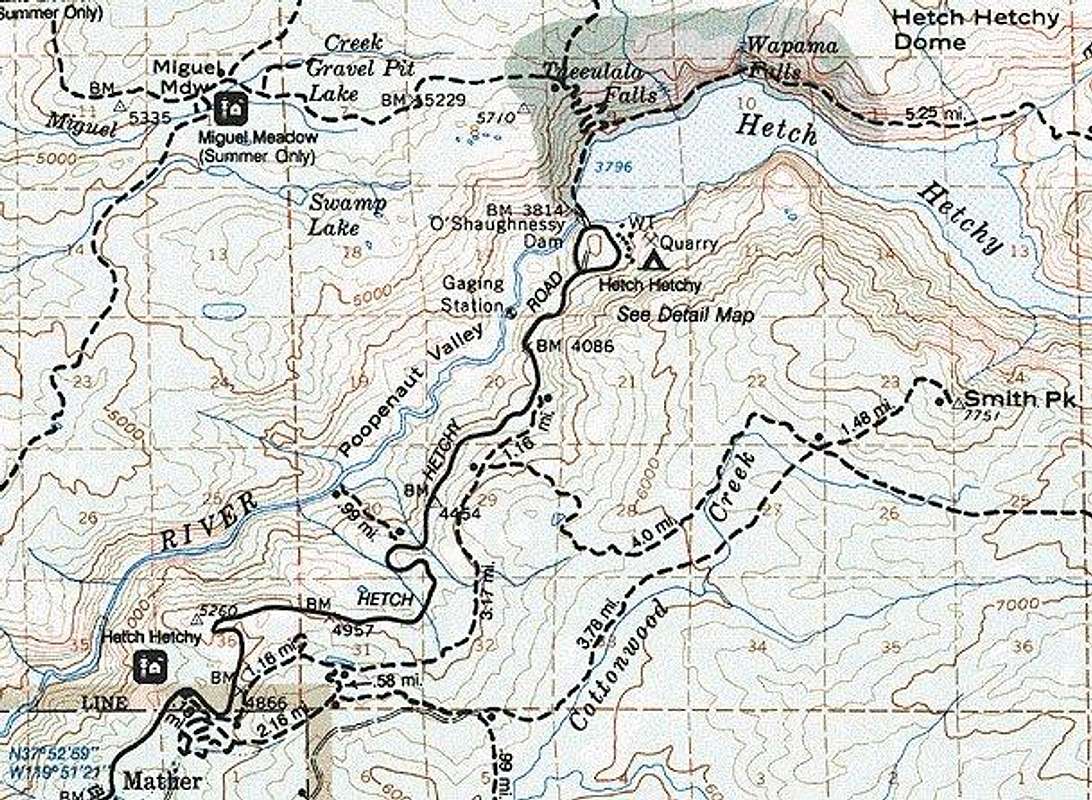
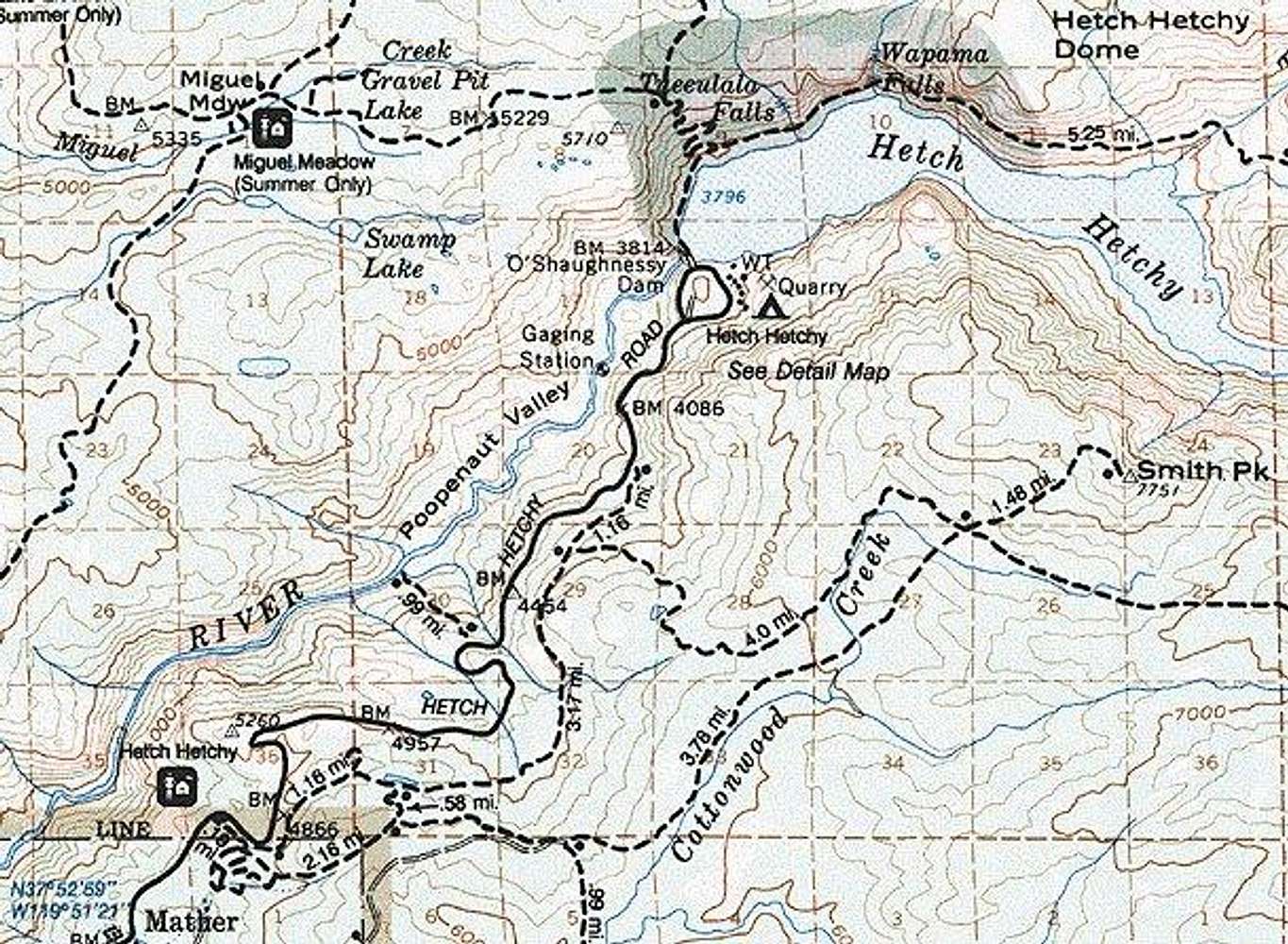
Map of Smith Peak trails and...
View High-Resolution Image
Map of Smith Peak trails and...
Map of Smith Peak trails and roads from Hetch Hetchy Ranger Entrance Station. Credit: Topo! mapping software.
« PREV
NEXT »
John
on
Jul 10, 2001 7:41 pm
Comments & voting
Other parents
Lat/Lon:
37.92670°N / 119.7342°W
Image ID:
1012
7439 Hits
71.81
% Score
2
Votes
Log in to vote
Comments
No comments posted yet.
to post!
Don't have an account?
Smith Peak
(Mountain/Rock)
« PREV
Viewing
#9 of 11
GALLERY
NEXT »
John's Image Gallery
« PREV
Viewing
#378 of 521
GALLERY
NEXT »
×
You need to login in order to vote!
User Name
Password
Remember me
Forgot your password?
Log me out when I close my browser.
Keep me logged in all the time.
sign in as a user
Don't have an account?
Register now for FREE
Rating available
Suggested routes for you
People who climb the same things as you
Comments Available
Create Albums
Register Here


