Introduction
Late June and early July 2017 presented a rare opportunity for me. Usually that time of year it is very hard to get time off work, but this year I would just happen to be between projects.
The original plan for this year's big trip was for my wife and I to go to Kilimanjaro and do a Safari, but since I had time off in late June and early July we decided to do a family trip (Kilimanjaro being out of our budget range for all four of us to go).
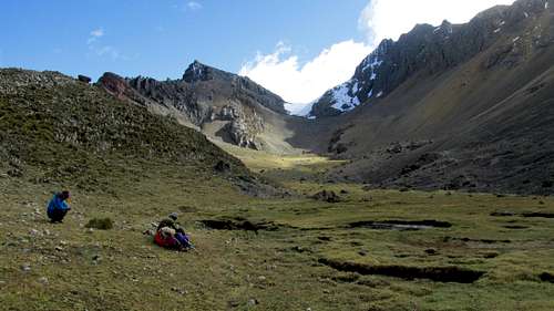
We decided to go to Peru since Kim hadn't been there (it was the third Peru trip for Kessler and me and the second for Shaylee). At first we thought of Kessler and I doing some of the big peaks in the Cordillera Blanca, while the girls did something else, but then we decided that we should do something we could all do. Kim just had a major heart surgery in January, so really serious mountaineering was out of the question for her.
I had always wanted to go to the Huayhuash, but I never could get time off at the right time of year. We decided to do the challenging, but non-technical and very spectacular Huayhuash Circuit. Kessler and I hoped that we could find several mountains along the way that we could climb on a whim.
Since we were pressed for time to organize and take part in the trip, we contacted
Peruvian Mountains for transportation, mules, and logistical support. We gave them our timeline and explained that we would need a flexible itinerary so we could climb peaks we found at random and to take any exploratory side trips that we thought looked interesting.
It was a great trip and we did end up finding several peaks to climb. We even made the second ever ascent of the spectacular Pucaccacca! The trek itself was incredibly spectacular, and of all the places I have been was perhaps only eclipsed in scenery to some of the places in the Himalaya. Things went well and it was one of our best trips ever.
Here is our story.
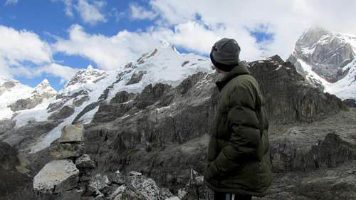
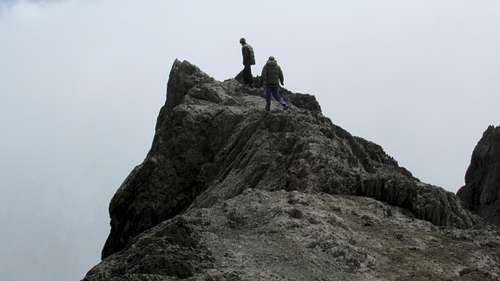
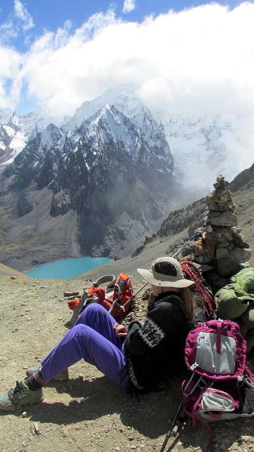
![Cerro Huacrish]() Getting ready to head down from Cerro Huacrish.
Getting ready to head down from Cerro Huacrish.![Kessler high on Pucaccacca]() Kessler high on Pucaccacca.
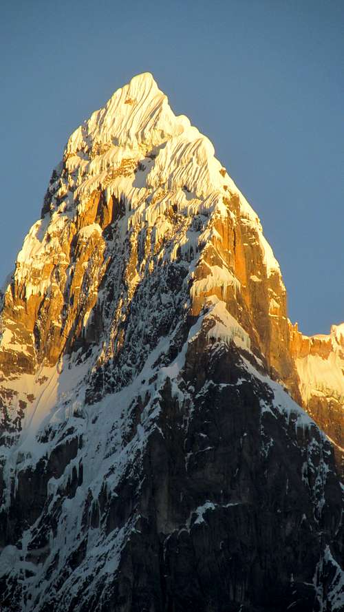
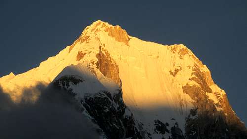
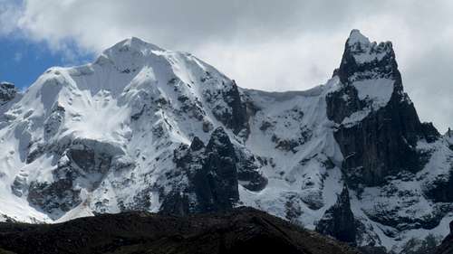
Kessler high on Pucaccacca.![Jirishanca]() Sunset on Jirishanca.
Sunset on Jirishanca.June 23: Lago Churup
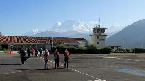
We landed in Huaraz the afternoon before and were eager to start a hike.
![Airport]() Huaraz Airport with Huascaran rising behind.
Huaraz Airport with Huascaran rising behind.![Huaraz]() Huaraz, Peru.
Huaraz, Peru.
With Diogenes (Peruvian Mountains) we rode up to the trailhead at Pitec.
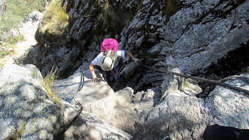
The trail to the lake was very beautiful and a bit steep, though it wasn’t difficult. There were several sections where cables aided in the ascent over some cliffs though.
![Trailhead]() The beginning of the trail to Lago Churup.
The beginning of the trail to Lago Churup.![Route to Lago Churup]() part of the route to Lago Churup.
part of the route to Lago Churup.
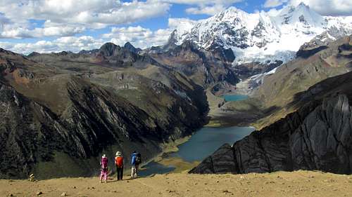
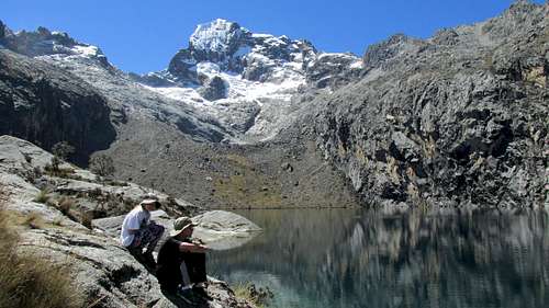
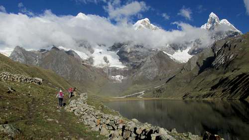
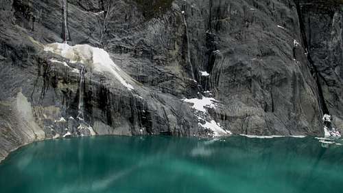
We arrived at Lago Churup just in time for lunch. The lake is beautiful, deep, and clear, with the impressive Nevado Churup rising above. There were some nice rocks to laze on and we spent much time at the lake just looking at the view and the mountains. After enjoying the lake, we headed down the trail and then to Huaraz.
![Lago Churup]() Lago Chirup.
Lago Chirup.June 24: Quebrada Cuncush
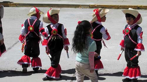
Today, by minibus, with Diogenes, we headed for Quartelhuain, which is at the beginning of the Huayhuash Trek. Along the way, the minibus stopped at a beautiful lake for some photographs and at a village where we set off to see if we could buy some ponchos. We found a few and watched a parade going on in the village. The parade consisted of children, ages 3-5 dressed up in costumes. After watching much of the parade, it was time to get back on the bus and head for Quartelhuain. Along the way we did stop for lunch in a beautiful grassy area.
![Parade]() A children's parade seen in a village on the way to the Huayhuash.
A children's parade seen in a village on the way to the Huayhuash.
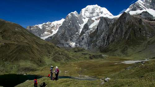
Once we reached Quartelhuain, Kimberly and I set off up the valley to see if we could get some better views. We walked up the valley, road, and hillside up to where we got some nice views of Niñashanca. It was cloudy much of the time, but we did get a good view of the peak before we headed back to camp.
![Niñashanca]() Niñashanca.
Niñashanca.June 25: Quartelhuain to Mitacocha/Cerro Gasha Norte
In the morning, we met our two donkey drivers (Yosmer and Other) and our cook (Marcelino). Because of Kim’s recent heart surgery, the length of the trek, and because we were pressed for time, we decided to go with a local guiding service (though we would were free to choose our own schedule and side trips along the way). Diogenes (Peruvian Mountains) would be the guide for the trip.
We all headed up the well beaten, but relentlessly uphill trail to the top of the pass known as Cacananpunta, where we took a rest. We saw three condors along the way!
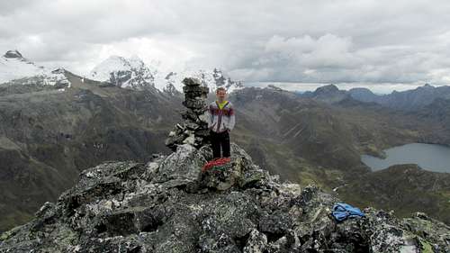
At the pass, the kids and I headed south along the ridge to the next peak, which is just north of Cerro Gasha. We dubbed our peak Gasha Norte and it had good views. We then headed back to the pass and down the valley and around the hill to the Rio Janca. There were some great views along the way and we could see all the way to the Cordillera Central, which is in central Peru. Our camp was near the river.
![Summit]() The summit of Gasha Norte.
The summit of Gasha Norte.
After a late lunch, Kessler, Shaylee, Diogenes, and I headed up the scenic valley to the beautiful lake of Mitucocha. We saw a lot of bird life along the way and the views were spectacular. The lake above this one is often listed as the source of the Amazon River, but there are other sources as well.
After enjoying the wonderful scenery, we headed back down to camp.
![Hiking]() Hiking towards Mitucocha.
Hiking towards Mitucocha.![Jirishanca]() Hiking towards Jirishanca.
Hiking towards Jirishanca.![Rondoy]() Rondoy as seen from Mitucocha.
Rondoy as seen from Mitucocha.![Mitucocha]() Mitucocha.
Mitucocha.![Mitucocha]() Mitucocha and Jirishanca.
Mitucocha and Jirishanca.June 26: Mitucocha to Carhuacocha
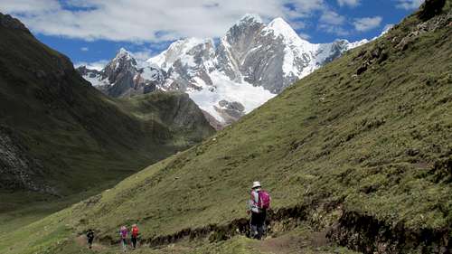
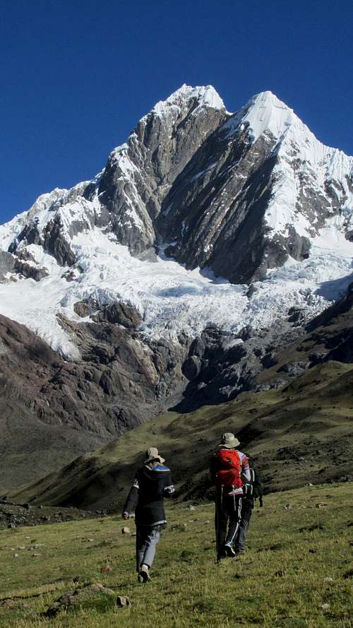
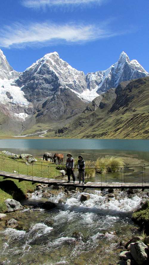
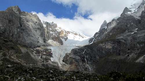
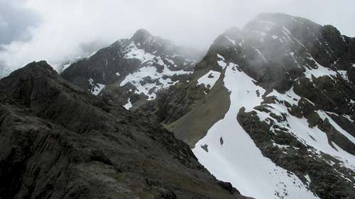
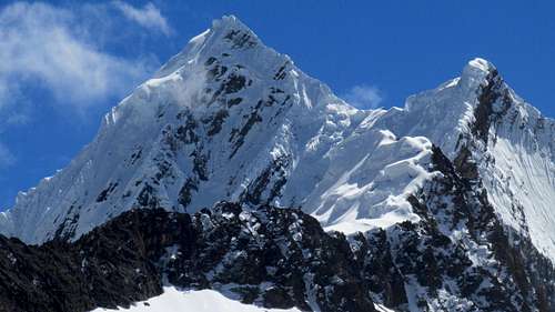
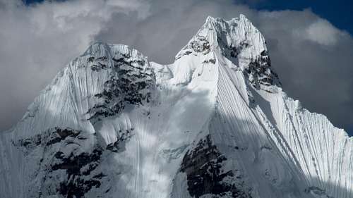
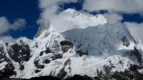
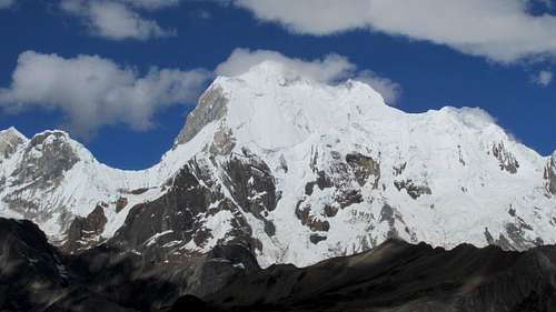
Today we hiked from Mitucocha to Carhuacocha. The climb up to the pass (Carhuac) was rather gradual, but the mountains were hidden for much of the route to Carhuac. After the pass though, the views really opened up and we could see Siula Grande, Yerupaja, and Jirishanca.
We camped near the lake. Shaylee, Kessler, and I took a quick bath in the lake, but it was cold! We saw many birds, including some flamingos.
![Yerupaja]() Yerupaja from the northeast.
Yerupaja from the northeast.![Lago Siula]() Lago Siula.
Lago Siula.![Carhuacocha]() Carhuacocha.
Carhuacocha.![Campsite]() Campsite at Carhuacocha.
Campsite at Carhuacocha.![Sunset]() Sunset on Yerupaja.
Sunset on Yerupaja.June 27: Carhuacocha to Huayhuash/Cerro Azulcocha
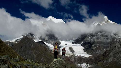
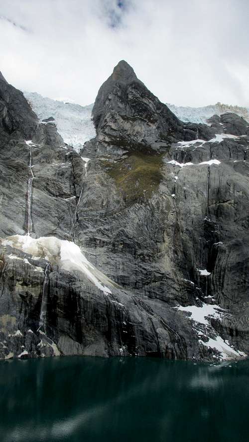
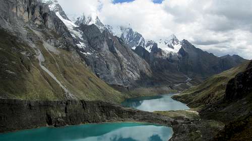
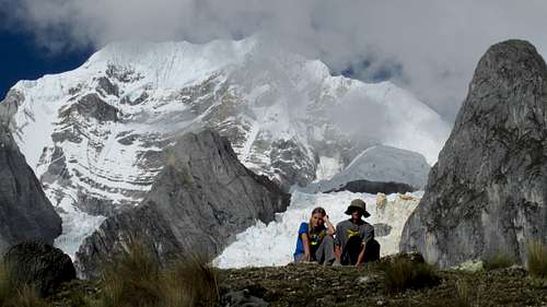
Today was one of the most scenic days any of has ever had. We hiked from Carhuacocha to Huayhuash. The views were incredible, even though the weather was cloudy for much of the day. There were many lakes to see along the way. The first lake, Gangrajanca was the most spectacular lake and avalanches spilled off the cliffs into the lake. We had to climb up a moraine to see the lake up close, but it was worth it. We saw several icefalls and avalanches.
![Beginning of day]() Starting the day at Carhuacocha.
Starting the day at Carhuacocha.![Route]() Hiking along the route to Gangrajanca.
Hiking along the route to Gangrajanca.![Along the route to Azulcocha]() Along the route to Azulcocha.
Along the route to Azulcocha.![Gangrajanca]() Gangrajanca.
Gangrajanca.
The next two lakes were spectacular as well, and after the lakes, the route climbs steep up to Siula Punta. The views on the way to the pass were just gorgeous.
![Gangrajanca]() Gangrajanca.
Gangrajanca.![Views]() Views from above Quesillococha.
Views from above Quesillococha.![Down valley]() Looking down valley from near Siula Punta.
Looking down valley from near Siula Punta.
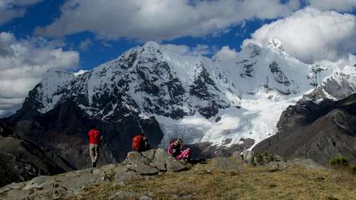
Once we reached the pass, we ate lunch. It was cloudy a bit cool, but the views were great and we saw several caracaras. Kimberly saw several vicachas, but I missed them.
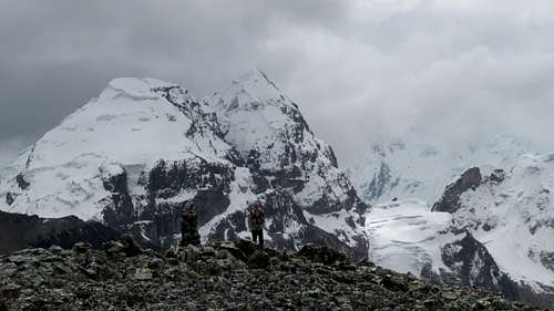
Kessler, Diogenes, and I headed up the ridge to climb Cerro Azulcocha, while the others headed down the south side of the pass. The scramble to the summit of Cerro Azulcocha was interesting and the views from the summit were among the best I have ever seen with Nevado Carnecerio towering above and a string of glistening glacial lakes to the north, along with some of the most spectacular mountains in the world towering above the lakes. We also saw a heart shaped lake which I thought that Kim would have enjoyed seeing.
![Summit]() View from the summit of Cerro Azulcocha.
View from the summit of Cerro Azulcocha.![Summit shot]() The summit of Azulcocha.
The summit of Azulcocha.
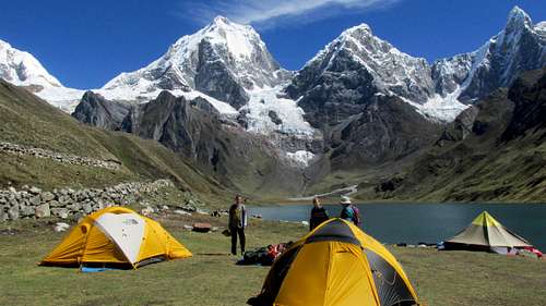
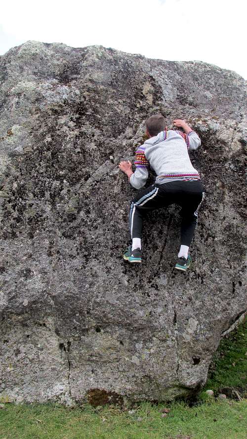
We returned to the pass and headed down the hills to Huayhuash. It was a nice campsite, but crowded. There were some boulders to go bouldering on. Kessler and Diogenes did some of the harder routes while Shaylee, Kimberly, and I climbed some of the easier routes.
![Siula Grande]() Siula Grande.
Siula Grande.![Bouldering]() What a good way to "rest" after trekking for 100 kilometers and climbing several peaks; doing some bouldering after arriving at camp.
What a good way to "rest" after trekking for 100 kilometers and climbing several peaks; doing some bouldering after arriving at camp.June 28: Huayhuash to Laguna Viconga
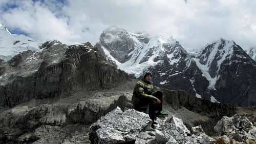
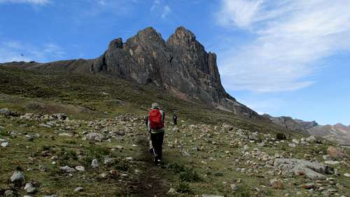
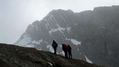
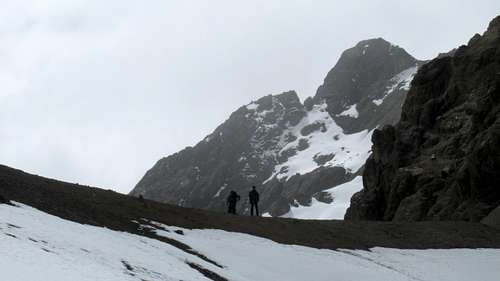
There was some rain the night before, but the morning was fairly sunny. After packing up, we hit the trail and headed for Portachuelo de Huayhuash. The mountains looked different from the ones in previous days, but they were still scenic and the views were good. We saw two condors near the pass.
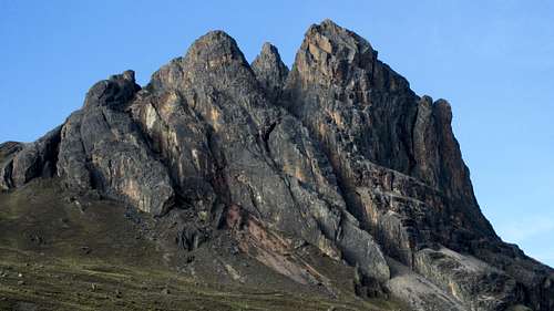
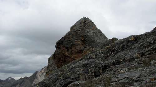
The views of the seldom visited Cordillera Raura were visible as well. Kessler and I made a quick climb of an un-named peak above Laguna Viconga as well. Laguna Viconga was big and scenic as was the waterfall below it. As we descended and made our way to camp, I had my eyes on the peak scanning them for reasonable ascents. They all looked really rugged. Some of the peaks of around and including Cerro Negro looked like they might be reasonable climbing targets, but I also noticed a cairn on the summit of Cerro Pucaccacca, which looked like a difficult summit.
![Descending]() Descending from Siula Punta.
Descending from Siula Punta.![Llama]() A llama as seen below Siula Punta.
A llama as seen below Siula Punta.![Spectacular peaks]() Some of the spectacular peaks north of Viconga.
Some of the spectacular peaks north of Viconga.
We reached the hot springs in the early afternoon. The hot springs were great. There were even some locals selling some sodas. Kimberly and Shaylee wanted to take a rest day here and Kessler and I wanted to climb a peak.
A visible summit cairn indicated a route somewhere on the spectacular rock castle of Cerro Pucaccacca, but it didn’t look like an easy peak. Perhaps there was a “sneak route” somewhere through the cliffs. It was decided that it would be our target for a rest day tomorrow.
![Tapecio]() Trapecio.
Trapecio.June 29: Cerro Pucaccacca
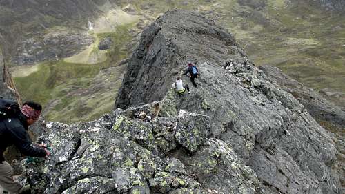
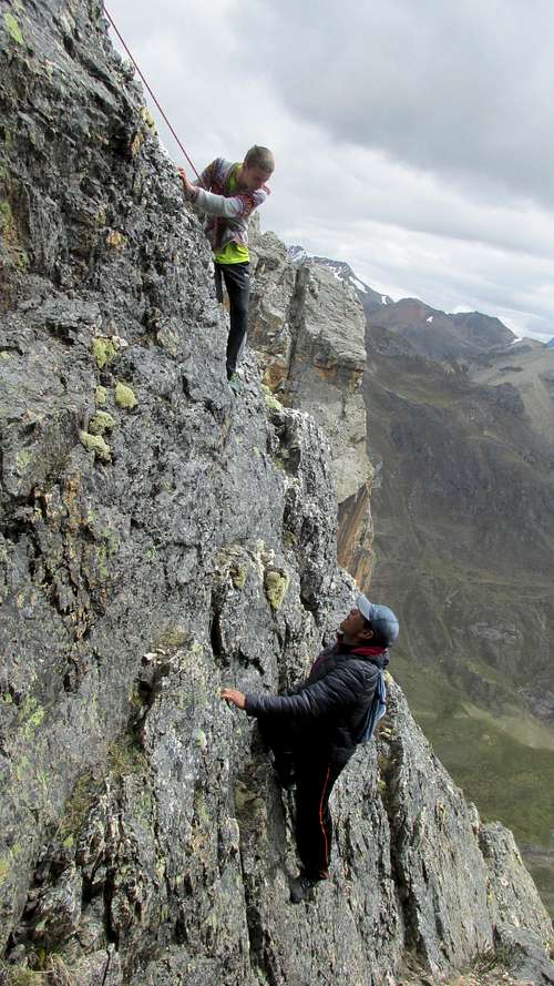
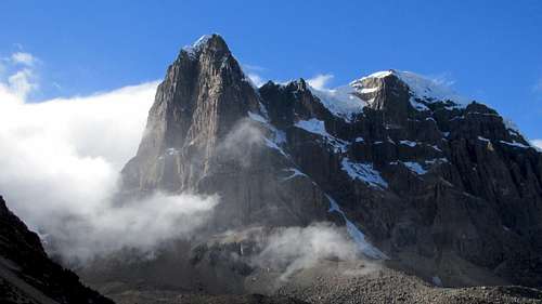
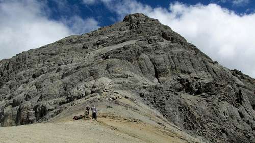
We climbed Pucaccacca today; it was one of my best climbs ever. It is possible that our ascent of the peak was only the second one; the first being in 2013. By Peru standards, the mountain isn't that high (16,644 feet/5073 meters), but it is the hardest peak yet that we have done in the Andes, even though we have climbed a lot of higher peaks.
Kimberly and Shaylee took a rest day at the hot springs, while Kessler, Marcelino, Diogenes, and I climbed the peak. From far below, I spied the cairn on top and wanted to give the peak a try since the girls wanted a rest day at the hot springs on day 6 of our trek. We didn't bring rock climbing gear, but used a 30 foot section of climbing rope that had been brought to tie the camping gear down to the donkeys on the trek.
![Pucaccacca]() Pucaccacca from the north.
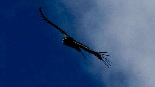
Pucaccacca from the north.![Condor]() A condor near Pucaccacca. We saw several, but they are hard to get a photo of!
A condor near Pucaccacca. We saw several, but they are hard to get a photo of!
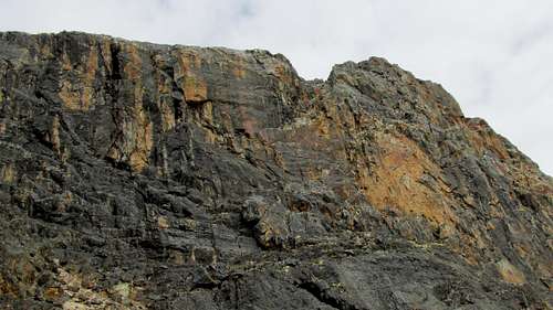
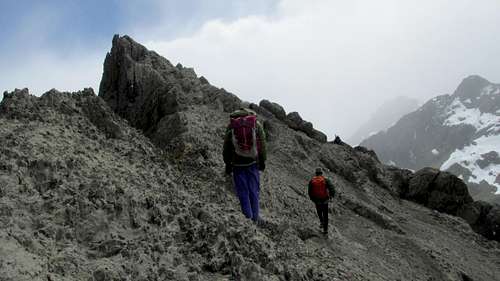
We checked out the 2013 (first ascent?) route, but I didn't like the looks of it and suggested that we check out an exposed ledge crossing out onto the vast north face. We followed the exposed ledge and found a series of gullies and faces that allowed us to reach the summit.
![Pucaccacca]() Heading towards Pucaccacca.
Heading towards Pucaccacca.![Looking up]() Looking up the east face of Pucaccacca.
Looking up the east face of Pucaccacca.![Summit]() Approaching the summit of Pucaccacca.
Approaching the summit of Pucaccacca.![Summit]() Summit of Pucaccacca.
Summit of Pucaccacca.
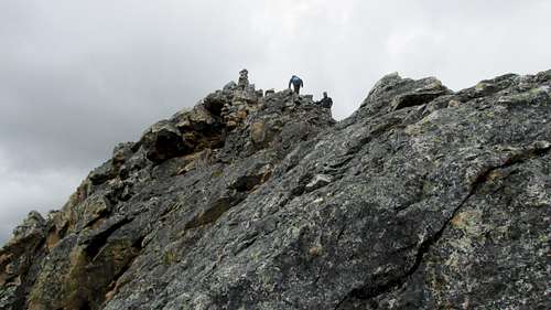
From a technical standpoint, the pitches weren't that difficult (5.5), but some parts of the route were really exposed, with 2000+ foot (600 meter) voids yawning below. The crux up top involved a short, but scary knife edge, where you had to grab the top of the knife edge and scoot along, but with 2600 foot/800 meter drops on either side. I was ready to turn around here, but since the other three completed the knife edge, I did as well. The summit was surprisingly roomy.
![Summit]() Kessler on the summit of Pucaccacca.
Kessler on the summit of Pucaccacca.![Summit]() The summit of Pucaccacca.
The summit of Pucaccacca.
The climb was a bit scary at times, but a good one and one that we won't be forgetting.
![View]() View from the northeast summit of Pucaccacca.
View from the northeast summit of Pucaccacca.![Descending]() Descending the north ridge of Pucaccacca.
Descending the north ridge of Pucaccacca.![Looking back]() View from the northeast summit of Pucaccacca.
View from the northeast summit of Pucaccacca.![Cerro Pucaccacca]() Kessler and Other on Cerro Pucaccacca on June 29 2017. It is possible that our ascent of th peak was only the second one; the first being in 2013. (Yes we should have wore helmets, but this was an unplanned ascent, so we didn't bring them to Peru). By Peru standards, the mountain isn't that high (16,644 feet/5073 meters), but it is the hardest peak yet that we have done in the Andes, even though we have climbed a lot of higher peaks.
Kessler and Other on Cerro Pucaccacca on June 29 2017. It is possible that our ascent of th peak was only the second one; the first being in 2013. (Yes we should have wore helmets, but this was an unplanned ascent, so we didn't bring them to Peru). By Peru standards, the mountain isn't that high (16,644 feet/5073 meters), but it is the hardest peak yet that we have done in the Andes, even though we have climbed a lot of higher peaks.June 30: Laguna Viconga to Quebrada Cuyoc
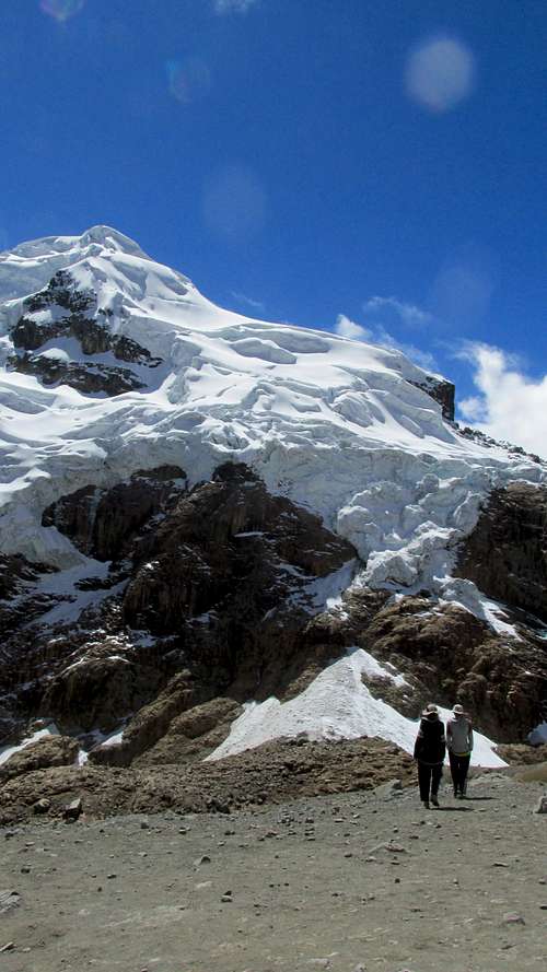
It rained pretty good last night. Today we hiked from the hot springs at Viconga to the campsite at Quebrada Cuyoc. Kimberly was not feeling well today and neither of us slept well. We hiked up to Punta Cuyoc seeing three condors, several geese, and a vicuña. One of the condors was very close. We saw several foxes around camp.
Cuyoc Punta was the highest point yet on the trek (Kessler and I had reached 5073 meters on Pucaccacca) and we reached 5050 meters. We were very close to Nevado Cuyoc and the glaciers.
![Punta Cuyoc]() Punta Cuyoc.
Punta Cuyoc.
The camp was a scenic one, with towering cliffs all around. It reminded me of the Cirque of the Towers in the Wind River Mountains, but these mountains around our camp were much bigger!
![Cuyoc]() Cuyoc.
Cuyoc.July 1: Quebrada Cuyoc to Cutatambo/Cerro Santa Rosa
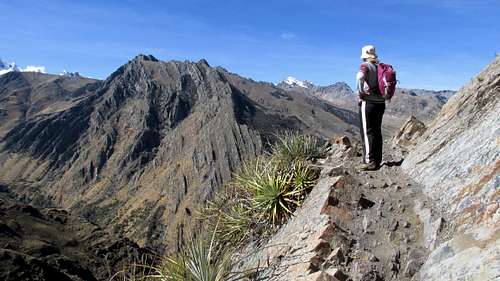
Kimberly wasn’t feeling well today, so she took the long way around the mountains to Cutatambo by way of horseback. Kessler, Shaylee, Diogenes, and I headed for Punta Santa Rosa (also known as Juraupunta). The route was fairly steep and we decided to climb Cerro Santa Rosa (5192 meters) along the way. We left the trail and climbed the south ridge of Santa Rosa.
![Cerro Santa Rosa]() Cerro Santa Rosa, just left of center, as viewed from the south.
Cerro Santa Rosa, just left of center, as viewed from the south.
After quite a bit of scrambling, we reached the summit area. There were two summits that appeared to be about the same height. We climbed the west summit first, or at least got very close. The difficult part was short, but the rock was loose and the last part very exposed. We could climb up and lean over, and get within two horizontal feet of the summit (less than one horizontal meter), but since the rock was so loose it didn’t seem safe to stand on the summit.
![High]() High on Cerro Santa Rosa with some light snow falling.
High on Cerro Santa Rosa with some light snow falling.![South Ridge]() High on the South Ridge of Cerro Santa Rosa.
High on the South Ridge of Cerro Santa Rosa.![West Summit]() The West Summit of Cerro Santa Rosa.
The West Summit of Cerro Santa Rosa.
After a quick snack we headed for the east summit. There was some scrambling and exposure, but it was an easier ascent than the west summit. It began to snow at times as well, but it didn’t accumulate.
![Approaching East Summit]() Approaching the east summit of Santa Rosa.
Approaching the east summit of Santa Rosa.![East Summit]() The East summit of Cerro Santa Rosa.
The East summit of Cerro Santa Rosa.![Cerro Santa Rosa]() The east summit of Cerro Santa Rosa is to the left.
The east summit of Cerro Santa Rosa is to the left.
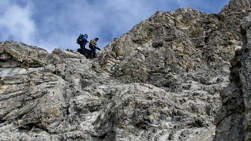
After climbing the two summits, we headed east and down to the pass. It was steep and exposed in places and Shaylee and I took a different route than Diogenes and Kessler. Once Diogenes pulled out the rope, Shaylee and I decided to look for a different route.
![Cerro Santa Rosa]() Looking south up to Cerro Santa Rosa.
Looking south up to Cerro Santa Rosa.![Punta Santa Rosa]() On the Punta Santa Rosa.
On the Punta Santa Rosa.
We reached the pass and started the long and steel descent down to Cutatambo. It was raining for much of the time. We could see that it was clear to the west, but to the east and in the big glaciers hanging from the Nevados Jurau it appeared to be snowing heavily. We saw one viscacha (an animal that looks like a rabbit with a bushy tail) along the way.
![Resting]() Resting just below Punta Santa Rosa
Resting just below Punta Santa Rosa
Our route took us directly above the pretty lake of Juracocha before descending to the moraine and then camp. The rain lasted into the evening.
![Cerro Santa Rosa]() Climbing Cerro Sant Rosa.
Climbing Cerro Sant Rosa.July 2: Siula Grand Base Camp
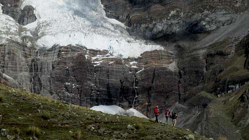
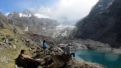
Today Kimberly and Shaylee took a rest day, while Diogenes, Kessler, and I headed for the area around the Siula Grand Basecamp. Unfortunately, it was cloudy for much of the time (and raining at camp), so some of the mountains were obscured by clouds.
Siula Grande is the mountain where the Joe Simpson and Simon Yates had the Touching the Void epic and the basecamp was the one that they used on their climb.
The hike to base camp was scenic and we could hear many avalanches and icefalls. Along the way, the steep ice flutings of Nevado Sarapo were in full view, but Siula Grand was obscured by clouds. We climbed the moraine and hill west of the basecamp for better views. Yerupaja was often visible, but we never did get a good view of Siula Grande. We could look down on the basecamp (the rocks placed by Simpson and Yates were still there) and see the glacier spilling into Sarapococha (lake). We viewed the icefall and glacier that Joe Simpson had to crawl through after breaking his leg and escaping the crevasse.
After enjoying the views and waiting for Siula Grande to emerge from the clouds (it never did), we headed back to camp. It was still raining off and on at camp. From camp we viewed some cliff hanging cows high on the cliffs above and we wondered how they got there and why.
![Siula Grande Base Camp]() Siula Grande Base Camp.
Siula Grande Base Camp.![Rasac]() Rasac as viewed from Siula Grande Base Camp.
Rasac as viewed from Siula Grande Base Camp.July 3: Cutatambo to Huatiaq
Today was very different from the previous days of our trek. We headed down the valley of the Rio Calinca and dropped below 4000 meters for the first time in several days. At first, we could look behind us and see the big mountains, but these slowly got swallowed by the arid valley walls. Along the way there was a beautiful waterfall spilling out of the mountains to the north. There were lots of grazing animals and we started to see farms, children, and other villagers as we approached the village of Huallapa.
![Village]() The first village we saw in a while. This is at Huayllapa, an isolated village along the Huayhuash trek.
The first village we saw in a while. This is at Huayllapa, an isolated village along the Huayhuash trek.
We passed above the village on the steep trail and headed north up the relentless grade to Huatiaq where we camped. It was a longer day than the other days we had. The views of the big mountains slowly were revealed as we approached Huatiaq.
We had originally thought of climbing Diablo Mudo while in this area, but in the end we decided not to bring all the gear we needed just for an ascent of a few hours.
![Quebrada Huanacpatay]() Trekking in the Quebrada Huanacpatay.
Trekking in the Quebrada Huanacpatay.July 4: Huatiaq to Jahuacocha/Cerro Llaucha/Cerro Huacrish
We were nearing the end of our big trek, but today was spectacular. It was the longest day we had and one of the most beautiful as well.
We got an early start and headed for our first pass, Tapush Punta. As we descended the valley after the pass, we could view much of the route for the last day of the trek (tomorrow). We turned east towards our next pass, the Llaucha Punta. Along the way we passed through a forest of Queñua trees which were in bloom. At 4720 meters/15,500 feet, these were the highest elevation trees that I have ever seen (there is at least one place in Bolivia where they grow higher). The trees were interesting.
![Queñua trees]() These Queñua trees are at 4720 meters/15,500 feet and just west of Llaucha Punta, are the highest elevation trees that I have ever seen.
These Queñua trees are at 4720 meters/15,500 feet and just west of Llaucha Punta, are the highest elevation trees that I have ever seen.![Llaucha Punta Approach]() The approach to Llaucha Punta.
The approach to Llaucha Punta.
We then headed for the pass where we took a rest. Kimberly decided to take the easier route to Juhuacocha, while Kessler and I (with Diogenes) decided to take the more difficult, but more scenic route over the ridge to the north while climbing some of the peaks along the way.
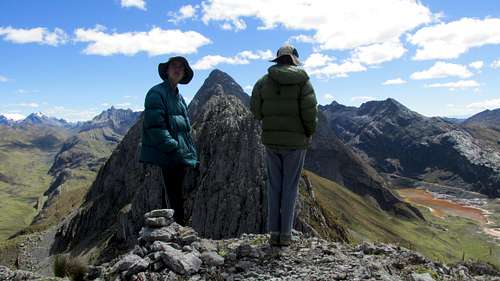
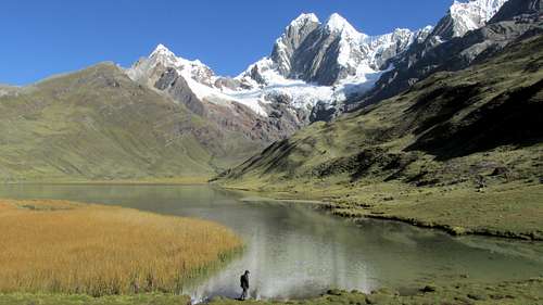
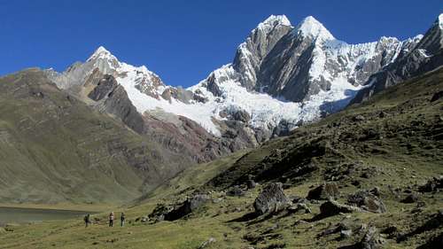
We headed north on a trekker made trail to where there was an awesome viewpoint of the most impressive peaks in the Huayhuash. Rondoy, Jirishanca, and Yerupaja were all in full view. While most people stop at the viewpoint, we climbed to the summit of Cerro Llaucha for even better views. It wasn’t that far out of the way. I actually beat the kids to the top since they had continued farther down the trail before climbing to the summit. There was one short vertical pitch along the way (it could be bypassed, but we climbed it directly). The views were fantastic! The weather was great as well.
![Jirishanca]() Jirishanca as seen from the ridge between Cerro Llaucha and Cerro Huacrish.
Jirishanca as seen from the ridge between Cerro Llaucha and Cerro Huacrish.![Summit]() The summit of Cerro Llaucha.
The summit of Cerro Llaucha.![Rasac and Yerupaja]() Rasac (foreground) and Yerupaja (background) as seen from the summit of Cerro Llaucha.
Rasac (foreground) and Yerupaja (background) as seen from the summit of Cerro Llaucha.
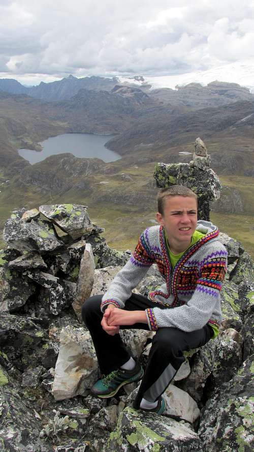
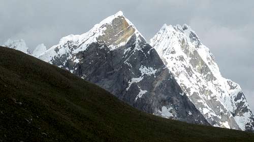
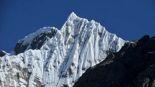
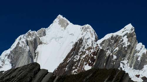
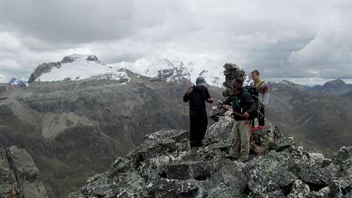
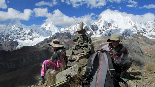
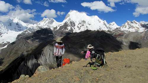
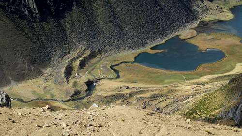
After climbing Cerro Llaucha, we headed north along the ridge (with great views all along the way) to Cerro Huacrish, another fantastic viewpoint. It was really something. After resting there and taking many photos, we headed down the extremely steep slope to the east and down to Juhuacocha. This part was steep and unpleasant, and we slipped several times, but it was definitely worth doing since we enjoyed all those wonderful views. Along the way we also saw a huge icefall off the glacier descending from Jirishanca.
![Close up]() A close up shot of Jirishanca from the Cerro Llaucha-Cerro Huacrish Ridge.
A close up shot of Jirishanca from the Cerro Llaucha-Cerro Huacrish Ridge.![Summit]() Yerupaja as seen from Cerro Huacrish.
Yerupaja as seen from Cerro Huacrish.![Yerupaja]() Yerupaja as seen from Cerro Huacrish.
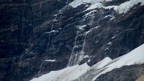
Yerupaja as seen from Cerro Huacrish.![Avalanche]() What was left of an avalanche of Jirishanca as viewed from Cerro Huacrish. Unfortunately, most of it was gone by the time I got my camera out!
What was left of an avalanche of Jirishanca as viewed from Cerro Huacrish. Unfortunately, most of it was gone by the time I got my camera out!![Looking down on camp]() Looking down on camp from the slopes of Cerro Huacrish.
Looking down on camp from the slopes of Cerro Huacrish.
The lake was a very scenic campsite and the weather was good.
July 5: Jahuacocha to Llamac
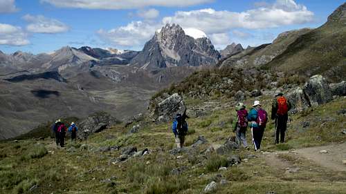
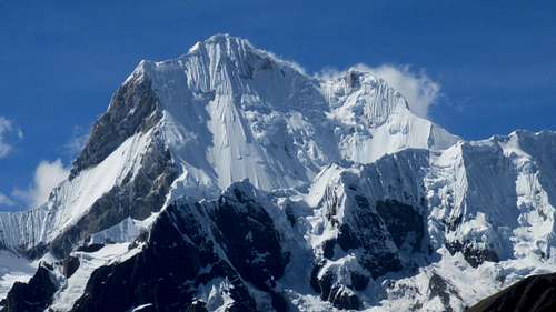
Today was our last day of the Huayhuash Trek. We got an early start and headed down the valley. We then took the upper trail towards the pass of Macrash Punta. There were some very nice views of the mountains along way way, but the last views we had of the really big peaks were from the pass. Yerupaja really stood above the other peaks in the area and was obviously the king of the mountains.
![Enroute]() Enroute to Pampa Llamac.
Enroute to Pampa Llamac.
After the pass, it was a long descent down to Llamac. It wasn't difficult, but it was extremely dusty! It was probably my least favorite part of the trek.
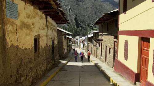
Llamac is a charming little town at the base of the mountains. The streets are narrow and clean. Most are too narrow for motor vehicles. After reaching town and loading up, we rode the mini-bus back to Huaraz.
It was a long bus ride at night, but it sure was a spectacular trip!
![Yerupaja]() Yerupaja as seen from near Macrash Punta.
Yerupaja as seen from near Macrash Punta.![Llamac]() The village of Llamac, where our long trek ended.
The village of Llamac, where our long trek ended.


Comments
Post a Comment