Toggle navigation
Mountains
Routes
Images
Trip Reports
Forum
What's New
People
Areas & Ranges
Articles
Trailheads
Canyons
Huts & Campgrounds
Albums
Logistical Centers
Fact Sheets
Lists
Custom Objects
Gear
Plans & Partners
WELCOME TO SUMMITPOST
SIGN IN
REGISTER
Hall Mountain
Additional Parents
Image
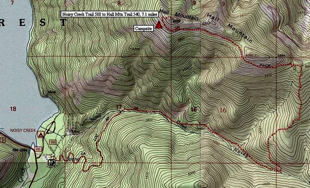
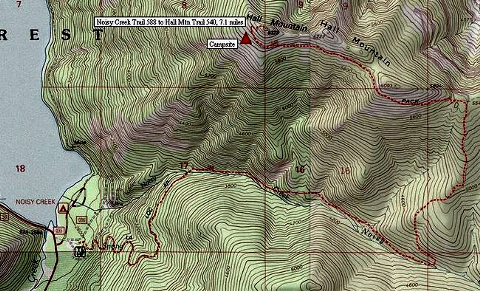
Topo map shows 5.8-mile-long...
View High-Resolution Image
Topo map shows 5.8-mile-long...
Topo map shows 5.8-mile-long Noisy Creek Trail 588 to 1.3-mile western leg of Hall Mountain Trail 540. Campsite is shown with red triangle near summit.
« PREV
NEXT »
dluders
on
May 19, 2005 12:22 am
Comments & voting
Other parents
Lat/Lon:
48.80660°N / 117.255°W
Image ID:
105819
3292 Hits
73.06
% Score
3
Votes
Log in to vote
Comments
No comments posted yet.
to post!
Don't have an account?
Hall Mountain
(Mountain/Rock)
« PREV
Viewing
#4 of 17
GALLERY
NEXT »
dluders's Image Gallery
« PREV
Viewing
#22 of 89
GALLERY
NEXT »
×
You need to login in order to vote!
User Name
Password
Remember me
Forgot your password?
Log me out when I close my browser.
Keep me logged in all the time.
sign in as a user
Don't have an account?
Register now for FREE
Rating available
Suggested routes for you
People who climb the same things as you
Comments Available
Create Albums
Register Here


