Toggle navigation
Mountains
Routes
Images
Trip Reports
Forum
What's New
People
Areas & Ranges
Articles
Trailheads
Canyons
Huts & Campgrounds
Albums
Logistical Centers
Fact Sheets
Lists
Custom Objects
Gear
Plans & Partners
WELCOME TO SUMMITPOST
SIGN IN
REGISTER
Rowe Peak
Additional Parents
Mummy Pass - Icefield Pass
Image
Map of the Mummy Pass -...
View High-Resolution Image
Map of the Mummy Pass -...
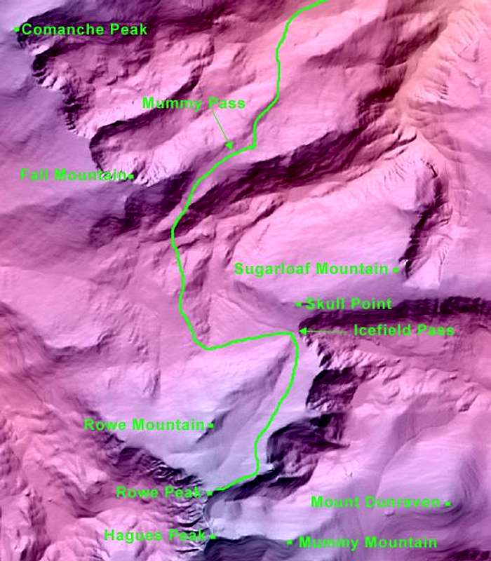
Map of the Mummy Pass - Icefield Pass route. Emmaline Lake Trailhead is off the north end of the map. Take a look at my website for more Rowe Peak photos:
www.leachfam.com
.
« PREV
NEXT »
Andy
on
Oct 16, 2002 7:56 am
Comments & voting
Other parents
Lat/Lon:
40.49030°N / 105.645°W
Image ID:
12855
4989 Hits
71.63
% Score
2
Votes
Log in to vote
Comments
No comments posted yet.
to post!
Don't have an account?
Rowe Peak
(Mountain/Rock)
« PREV
Viewing
#11 of 14
GALLERY
NEXT »
Andy's Image Gallery
« PREV
Viewing
#578 of 631
GALLERY
NEXT »
Mummy Pass - Icefield Pass
(Route)
Loading....
×
You need to login in order to vote!
User Name
Password
Remember me
Forgot your password?
Log me out when I close my browser.
Keep me logged in all the time.
sign in as a user
Don't have an account?
Register now for FREE
Rating available
Suggested routes for you
People who climb the same things as you
Comments Available
Create Albums
Register Here


