Welcome to SP!  -   
 
 MbPost.com -- It's SP for Mountain Biking!
Areas & Ranges·Mountains & Rocks·Routes·Images·Articles·Trip Reports·Gear·Other·People·Plans & Partners·What's New·Forum

Topo of Standard Route up... [ Sizes: Orig | Small | Thumb ]
Topo of Standard Route up...
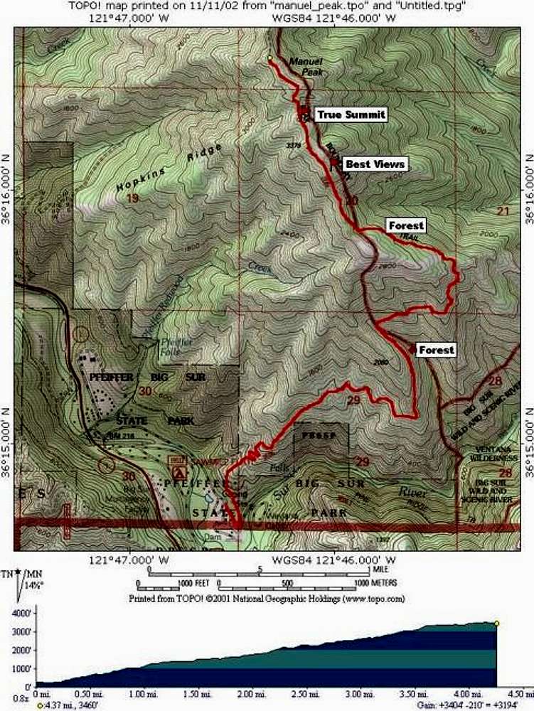
Topo of Standard Route up Mount Manuel, along with elevation profile. True distance to summit is about 5 miles. Note, the first part of this route is variation 3) mentioned in the text, "from State Park Trailhead / Softball Field Parking Lot". Larger version is here.


Comments

No comments posted yet.


Sign in to post!

Don't have an account? Register now.


Rate This Image
Current Score: 86.03

Log In To Vote
 Mount Manuel (Mountain/Rock)


« PREV

Viewing
#3 of 18
GALLERY

NEXT »

 mpbro's Image Gallery


« PREV

Viewing
#112 of 304
GALLERY

NEXT »
Image Data

Submitted by mpbro
on Nov 18, 2002 9:54 am

Image ID: 14105
Hits: 1972 

Lat/Lon: 36.27400°N / 121.77°W


"Computers make it easier to do a lot of things, but most of the things they make it easier to do don't need to be done."   --Andy Rooney   

© 2006 SummitPost.org. All Rights Reserved.