
-
 3787 Hits
-
 0% Score
-
 0 Votes
|
|
Route |
|---|---|
|
|
47.20604°N / 13.39620°E |
|
|
Scrambling |
|
|
Summer, Fall |
|
|
Half a day |
|
|
T5 (on a SAC Hiking Scale) |
|
|
Rating The Route (By Hiking Standards)
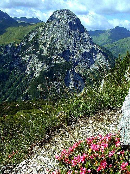
Riedingspitze from the South route on Mosermandl
1. Effort. 1200 m. 3 h 30 min.
2. Power. 2 - easy.
3. Psysche. 3 - medium. Some care and a reliable step required on the top section.
4. Orientation. 2 - easy.
The grading system for hiking and scrambling routes is here.
This route is recommended also as a demanding ski tour. It requires safe conditions and very good skiing technique.
Getting There
See the main page of Mosermandl how to get to Riedingalm, 1500 m.Route Description

Mosermandl from Jakoberalm

Mosermandl and its S ridge from the W
The path goes towards Mosermandl and at the same time to Franz-Fischer-Huette. It is very panoramic, we all the time see across the valley Weisseck, the highest summit of Radstatt Tauern, and Riedingspitze. On a few places the path crosses steep slopes, but is comfortable enough. After getting around the steepest part of the ridge, we find ourselves on a broad enough carst terrace, where we must take care to find the path, going right towards the summit. The crossroads is not marked well, but the ascent direction on the south ridge is obvious.
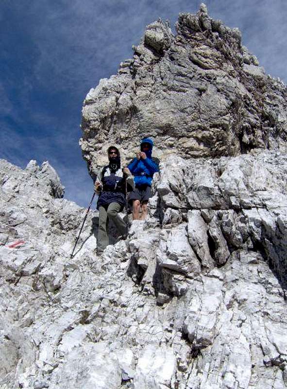
Now, we start gaining altitude quckly. The ridge becomes more and more narrow and also more and more steep. Just on its top we need to take care walking up, until the path over gravel reaches solid summit rocks. Here some steel protection awaits us, but the route over the final 150 m of rocks is not excessively protected. On many places we need to use also hands, so it can be qualified as a very easy climb (UIAA I). Through a ravine like terrain we reach the panoramic summit.
We can descend by the same route, but it is much nicer to use the NW ferrata to get down on the upper edge of the big karst plateau, then continue over Windischkopf, 2609 m, to Windischscharte, 2304 m, and from there left down (towards the SW) to Zaunersee and further into Riedingtal. This is then a very nice round tour!
Show a bigger map