
-
 5817 Hits
-
 74.01% Score
-
 4 Votes
|
|
Route |
|---|---|
|
|
47.02660°N / 12.20530°E |
|
|
classical climb |
|
|
One to two days |
|
|
ice 30-35°, rock UIAA II |
|
|
A) Approach from the west (Ahrntal / Italy)
valley to hut
The Ahrntal ist the northernmost valley of Italy. It begins at the town of Bruneck / Brunico which is also the last railway station. The highest village is Kasern / Casere (1566 m), also the final bus station. To gain the Lenkjoechl hut (2603 m) you have the choice between walking through two different high valleys. The northern one is the Windtal valley. Therefore you have to walk half an hour in the upper Ahrntal valley and pass the Heiligengeist chapel. I recommend the Windtal valley for the ascent (because more and less steep parts vary) and the other one, the Roettal valley, for descent from the hut the other day.The Lenkjochl hut (homepage) is situated a little south of the pass where the two high valleys meet; 3 h.
The round trip along the two high valleys is also a nice (and popular) daytrip for hikers.
Hut is guided from July to September. Owner is the italian alpine club
 |
hut to mountain
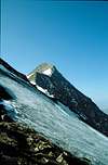
The next day cairns mark the route to the beginning of the Roetkees glacier. In the summer season there will be a path visible and lead you to the ridge, which is gained at the Untere Roetspitze (3290 m), where you meet the route from the austrian side.Another possibility is following the marked route from the hut to the mountain pass Vorderes Umbaltoerl (2928 m) and then climbing the NE-ridge in total. This requires 1-2 h in addition.
 |  |  |
B) Approach from the east (Virgental / Austria)
valley to hut
The Virgental valley is probably the most important valley of the Venediger Group. It starts at Matrei in Osttirol (be careful: not Matrei am Brenner which is south of Innsbruck!) (see map on the group's page). The final parking - and bus station - in this valley is at Streden (1403 m). The upper part of the Virgental valley is called Umbaltal valley. Follow this valley along the path beneath the waterfalls (a main tourist attaction in this area). After two steps the valley is almost even, but narrow, and towered above by the Roetspitze. It's 2,5 h of hiking to the Clara hut (2038 m), where you can stay the night.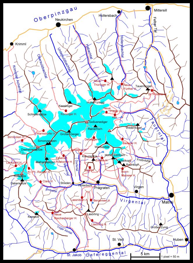
Or you can proceed the same day further on in the valley and follow a marked route to the left until the Kleine Philipp-Reutter hut (2692 m), 2 h from the Clara hut. This is a bivuoac hut with 8 beds, the key for it is available at the Clara hut. At this site there used to be the old Essener hut, which was rushed away by an avalanche in 1958. You can still see some walls left.
 |
hut to mountain
The next day the most common route is climbing the slopes directly (a little to the left) above the hut over scree, snow or perhaps a little ice until you reach the NE-ridge a little north of P. 3093 m. Now you just have to follow the ridge until the fore-summit of the Untere Roetspitze (3290 m), where the main ascent from the other side reaches the ridge. Rock and ice changes several times.Another possibility is following the marked route from the hut to the mountain pass Vorderes Umbaltoerl (2928 m) and following the NE ridge in total. This requires 1-2 h in addition.
 |  |  | 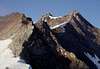 |
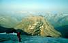
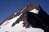
C) final ascent
the most dificult part of the climb are the steep rocks to P. 3312 m. There are some iron cables (in 1994 not very reliable) and an iron tag. It was then possible to pass this section on the right. The next step is also steep but easy. You can follow footprints in the scree to the height of the final ridge. This is not dificult but very exposed. One last little crack has to be passed for the summit3,5 h from the Lenkjochl hut
3 h from the Kleine Philipp-Reutter hut
 |  |
Essential Gear
At least for the ascent from the italian side, a rope has to be used for crossing the glacier. If you have to use the rope for belaying in rocky sections depends on your abilities.Ice axe and crampons are surely necessary.