
-
 4622 Hits
-
 71.06% Score
-
 1 Votes
|
|
Route |
|---|---|
|
|
38.81400°N / 104.9712°W |
|
|
Hiking, Mountaineering, Trad Climbing, Toprope, Bouldering, Scrambling |
|
|
Spring, Summer, Fall, Winter |
|
|
Most of a day |
|
|
5.3 (YDS) |
|
|
1 |
|
|
Approach
As stated in the "Tuckaway Mountain" page, there are numerous ways to approach the summit. I will describe two of them here.Seven Bridges (from Gold Camp/High Drive)
Trailhead Elevation:7,500'
Total Climbing: 3,700'
Distance: 7.6 miles (one-way)
Park at High Drive and Gold Camp Road. From this point, Gold Camp Road is closed to vehicular traffic; start your hike by walking on the closed section of the road. Cross North Cheyenne Canyon Creek and find the Seven Bridges trail immediately on the right. This trail follows Cheyenne Canyon Creek and eventually climbs out of the canyon, offering a nice view of Colorado Springs. Shortly after exiting the canyon there will be a trail junction to the right; take this trail. Make your way north to Jones Park and then take the Jones Park Trail to the left. Now you are following Bear Creek. Reach the intersection with Trail 701, and follow the Route Description from this point.
Trail 701
Trailhead Elevation:10,200'
Total Climbing: 2,800'
Distance: 5.0 miles (one-way)
Once at the 701 Trailhead, simply hike north on Trail 701. This is a rolling and leisurely hike without much climbing. The trail ends at Jones Park Trail. From this point, follow the Route Description.
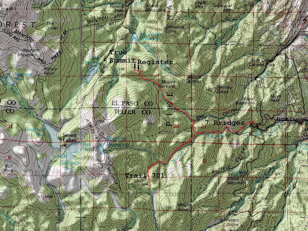
"Tuckaway Mountain" Map. Click image to enlarge.
Route Description
Once at the intersection of Trail 701 and Jones Park Trail, continue West on Jones Park Trail a short distance (less than 0.5 mile). The trail crosses to the north side of Bear Creek and continues west.Just west of the creek crossing, head north off of the trail. The terrain is not too difficult and you should be able to make good progress. Now you have a short but interesting scramble to the summit. Head straight up toward the summit, circumventing a rock field to its left, or climbing straight over it. There is a summit register placed my Mike Garratt within the eastern end of the summit contour. Climbing this summit requires no more than class 2+ scrambling. However, the true summit is located with in the western end of the summit contour and requires 5.3 climbing to reach the top.
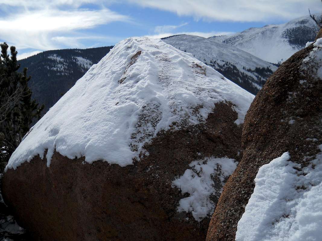
"Tuckaway Mountain" Summit Boulder. Click image to enlarge.