

|
|
Route |
|---|---|
|
|
49.18772°N / 20.05522°E |
|
|
Hiking, Mountaineering, Scrambling |
|
|
Summer, Fall |
|
|
Half a day |
|
|
YDS Class 3 |
|
|
Overview

This route leads from Morskie Oko, via Dolina za Mnichem (literally the Valley beyond the Monk) at about 1800m to Hińczowa Przełęcz/Hincovo sedlo - a saddle at 2323m. From Dolina za Mnichem the route is not marked with paint but has little cairns. The first half of the route is used as an approach route by most of the rock climbers who climb Mnich. The whole route is part of a descent / relatively easy ascent of Mięguszowiecki Szczyt Wielki/Veľký Mengusovský štít or Cubryna/Čubrina. Route ProfileApprox. time up: Morskie Oko Hut to Dolina za Mnichem 1h + Dolina za Mnichem to Hińczowa Pass 2h 20min = 3h 20min Net elevation gain: 913m
Total elevation gain: approx. 1,000m
Rock difficulty: Polish grade 0+ / YDS class 3
! Crumbly last stretch (the couloir)
When to Climb 25 October 2009 25 October 2009 |
Route Description
To find out how to get to Morskie Oko, please see the parent page.
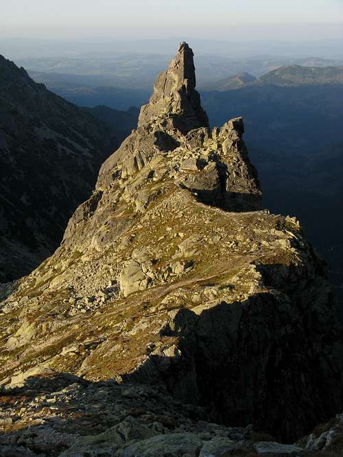
 Nearing Dolina za Mnichem, Morskie Oko on the left - photo by Konrad Sus Nearing Dolina za Mnichem, Morskie Oko on the left - photo by Konrad Sus 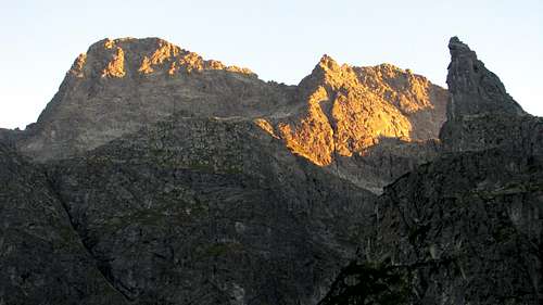 Looking towards Hińczowa/Hincovo Pass (centre) from the yellow trail Looking towards Hińczowa/Hincovo Pass (centre) from the yellow trail 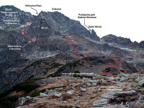 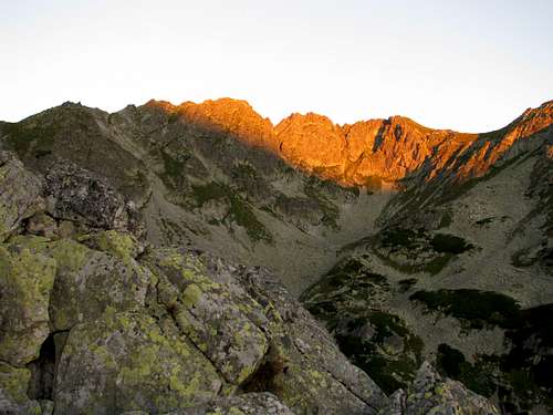 Looking across Dolina za Mnichem from the path to Mnichowe Plecy Looking across Dolina za Mnichem from the path to Mnichowe Plecy 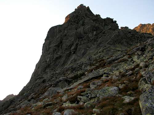 Mnich from the path to Mnichowe Plecy Mnich from the path to Mnichowe Plecy 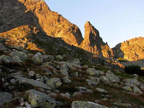 Mnichowa Kopa (the knoll on the left) and Zadni Mnich (the crag right of centre) Mnichowa Kopa (the knoll on the left) and Zadni Mnich (the crag right of centre) 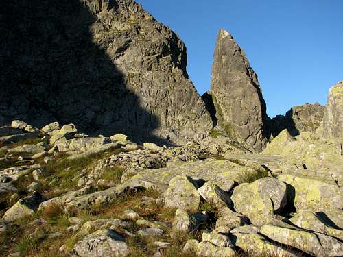 Beyond Mnichowa Kopa Beyond Mnichowa Kopa 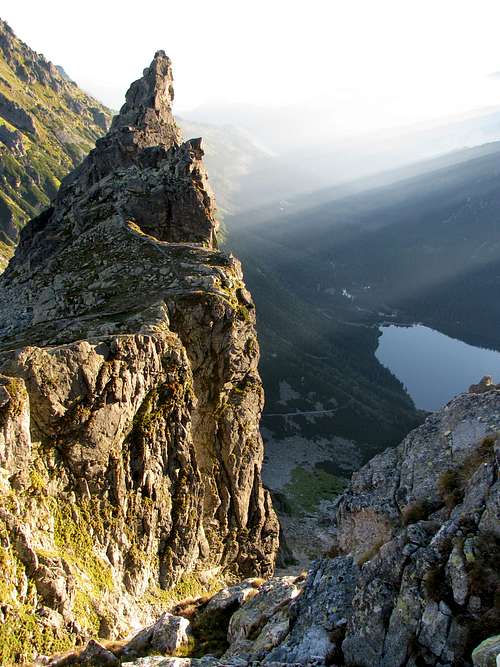 At the top of Żleb pod Mnichem At the top of Żleb pod Mnichem 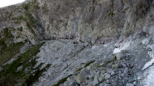 Mała Galeria Cubryńska Mała Galeria Cubryńska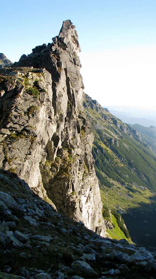 Mnich's SE face Mnich's SE face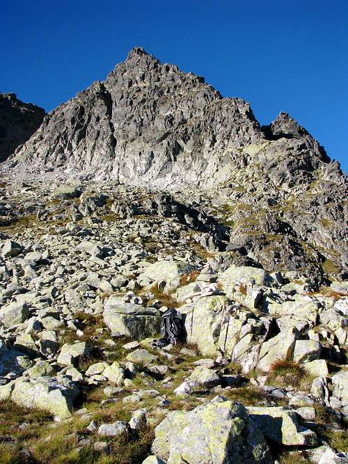 Cubryna's NE wall seen from Wielka Galeria Cubryńska Cubryna's NE wall seen from Wielka Galeria Cubryńska Mięguszowiecki Szczyt Wielki's NW face Mięguszowiecki Szczyt Wielki's NW face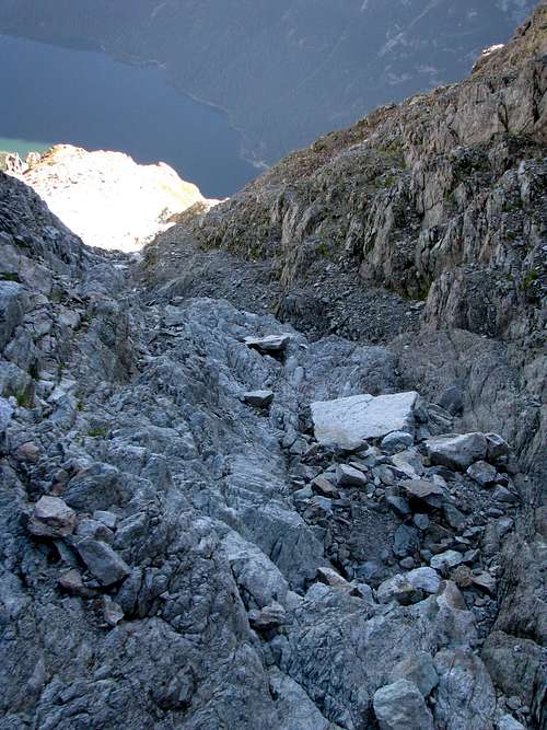 Just above Wielka Galeria Cubryńska Just above Wielka Galeria Cubryńska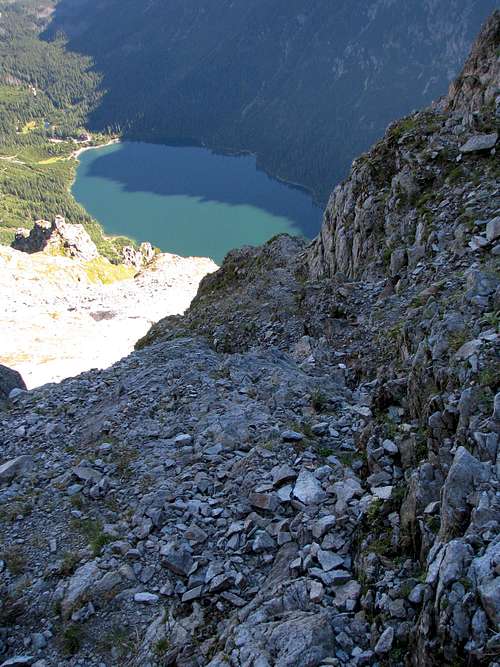 Halfway up Halfway up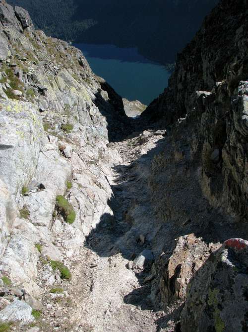 The couloir seen from the pass The couloir seen from the pass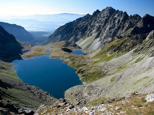 South from the pass South from the pass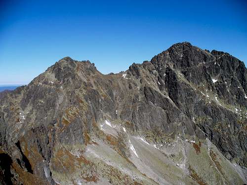 Seen from S: Cubryna (left) and Mięguszowiecki (right) - photo by horrste Seen from S: Cubryna (left) and Mięguszowiecki (right) - photo by horrste |
Essential Gear
Summer conditions: Normal hiking gear should suffice as long as there is no snow in the couloir, which can be filled with old snow throughout the summer.
 Seen from Łysa Polana - photo by Tomek Lodowy
Winter conditions (according to dynercia, yatsek would avoid the route in winter): crampons, ice axe, rope, a few ice screws and loops.
Maps
As for the analog maps of the Tatras, there are plenty of options. I would recommend the plastic 1:25,000 map of the Polish and Slovak Tatras by WiT. It has a large scale, is waterproof, durable and cheap. |
Red Tape & Mountain Conditions
In spring and early summer the route gets closed for climbers as falcons nest in the walls of Cubryna.
For more about the national park rules see the parent page.
 Mnich shot during an evening descent - by LukZem
External Links
Photo TR by R. Szadkowski, Tatra guide. The party chose our route for the first part of their ascent of Mięguszowiecki Szczyt Wielki/Veľký Mengusovský štit.