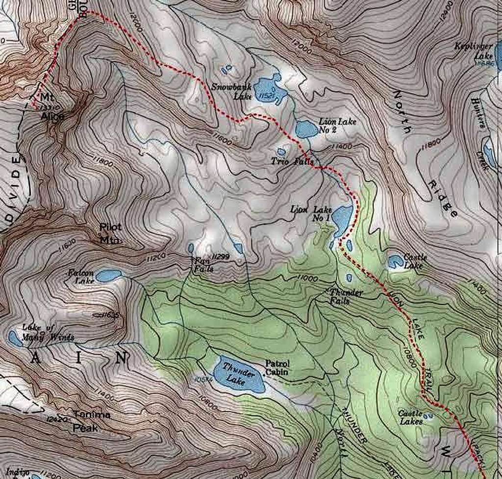
This is the mapped route via...
This is the mapped route via hourglass ridge. The red line begins at the Lion Lake Trail Junction. This is my favorite route because you get to pass Lion Lake #1, Lion Lake #2 and Snowbank Lake. These are some of the most beautiful, prestine lakes I have ever seen. the wildflowers are amazing, and there is abundant wildlife. I would highly reccomend this route, with a descent via Boulder-Grand Pass.
Route mapped using National Geographic Quads.
Obtain the USGS "Isolation Peak" Quad for the most accurate map of the area.


