Welcome to SP!  -   
 
 MbPost.com -- It's SP for Mountain Biking!
Areas & Ranges·Mountains & Rocks·Routes·Images·Articles·Trip Reports·Gear·Other·People·Plans & Partners·What's New·Forum

The Juniper Trail can be... [ Sizes: Orig | Med | Small | Thumb ]
The Juniper Trail can be...
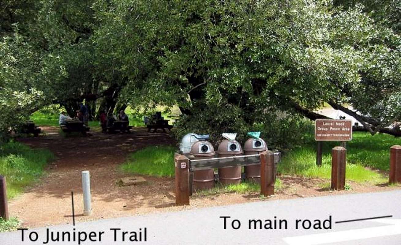
The Juniper Trail can be pretty difficult to find on the way up. Here we've followed the Deer Flat Road, which becomes paved and travels through a campground. Just before reaching the main road, look for the "Laurel Nook Group Picnic Area" on the left. There is a trail marker on the other side of the street also. Larger version here


Comments

No comments posted yet.


Sign in to post!

Don't have an account? Register now.


Rate This Image
Current Score: 78.97

Log In To Vote
 Mount Diablo (Mountain/Rock)


« PREV

Viewing
#94 of 160
GALLERY

NEXT »

 mpbro's Image Gallery


« PREV

Viewing
#183 of 304
GALLERY

NEXT »


 Moses Rock Ridge (Route)


Image Data

Submitted by mpbro
on Apr 27, 2003 11:15 am

Image ID: 19932
Hits: 750 

Lat/Lon: 37.88200°N / 121.913°W


"Freedom is just Chaos, with better lighting."   --Alan Dean Foster   

© 2006 SummitPost.org. All Rights Reserved.