Toggle navigation
Mountains
Routes
Images
Trip Reports
Forum
What's New
People
Areas & Ranges
Articles
Trailheads
Canyons
Huts & Campgrounds
Albums
Logistical Centers
Fact Sheets
Lists
Custom Objects
Gear
Plans & Partners
WELCOME TO SUMMITPOST
SIGN IN
REGISTER
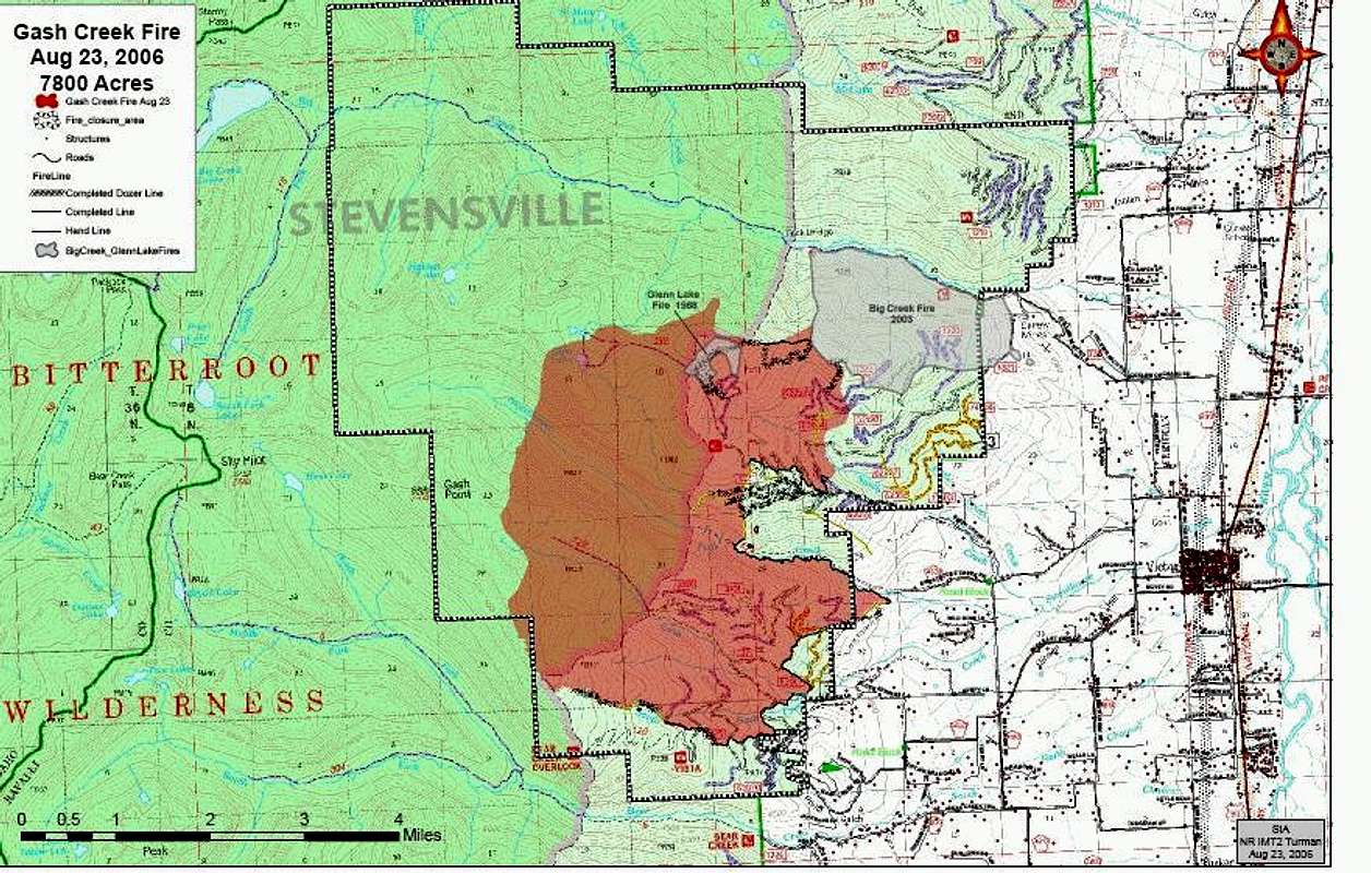
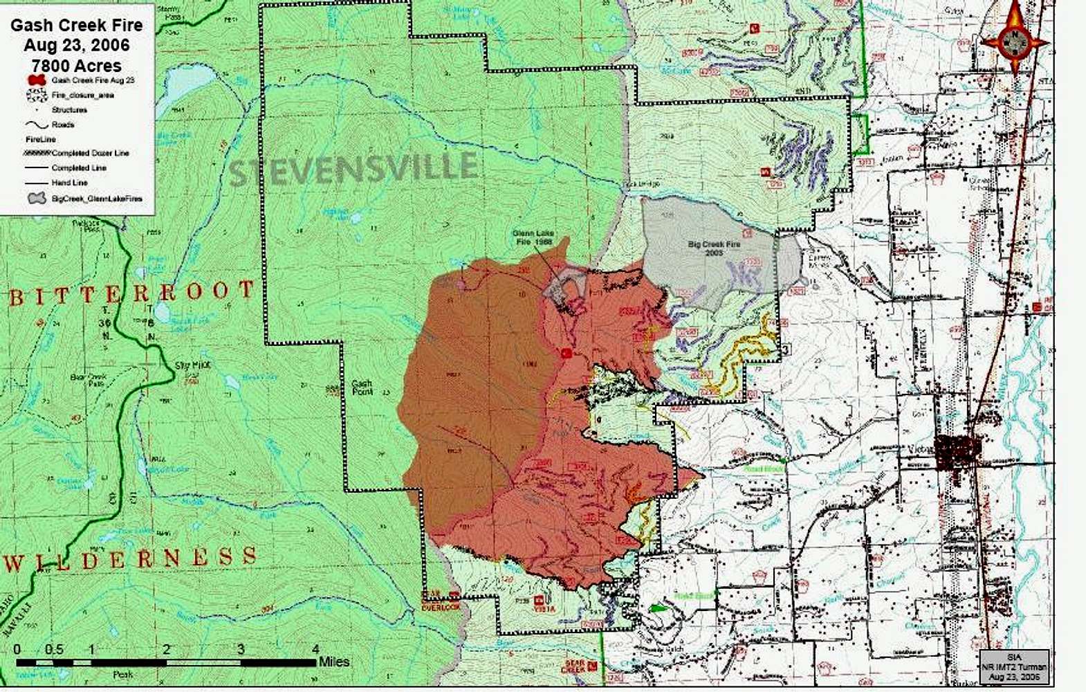
Gash Creek Fire Map
Gash Creek Fire Map
View High-Resolution Image
Gash Creek Fire Map
The Bitterroot Forest Service posted a map of the Gash Creek Fire as of 23aug06.
« PREV
NEXT »
Michael Hoyt
on
Aug 29, 2006 11:08 pm
Comments & voting
Other parents
Lat/Lon:
46.42170°N / 114.2854°W
Image Type(s):
Topo/Diagram
,
Informational
Image ID:
220659
2216 Hits
0
% Score
0
Votes
Log in to vote
Comments
No comments posted yet.
to post!
Don't have an account?
Michael Hoyt's Image Gallery
« PREV
Viewing
#1703 of 1801
GALLERY
NEXT »
×
You need to login in order to vote!
User Name
Password
Remember me
Forgot your password?
Log me out when I close my browser.
Keep me logged in all the time.
sign in as a user
Don't have an account?
Register now for FREE
Rating available
Suggested routes for you
People who climb the same things as you
Comments Available
Create Albums
Register Here


