Welcome to SP!  -   
 
 MbPost.com -- It's SP for Mountain Biking!
Areas & Ranges·Mountains & Rocks·Routes·Images·Articles·Trip Reports·Gear·Other·People·Plans & Partners·What's New·Forum

Breccia Peak-- Route Overview [ Sizes: Orig | Large | Med | Small | Thumb ]
Breccia Peak-- Route Overview
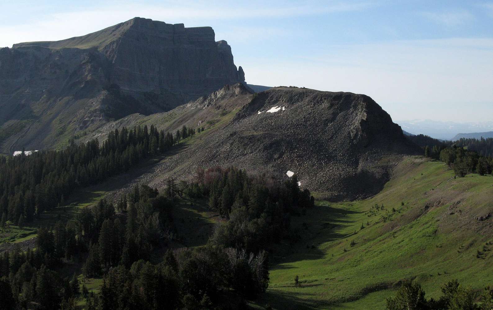
From the 10,000’ divide on the boundary of the Teton Wilderness. The summit of Breccia Peak is NOT visible here. Follow the ridgeline past Point 10,315 (Class 4 scramble on that if you feel like it); either side of the ridge works, but the right side is easier, in my opinion. From the notch on the other side of Point 10,315, ascend the ridge (Class 2 if you stay just beneath it and Class 3, and much more fun, if you stay atop it) to the gully system (visible here) just left of the sheer cliffs to reach the gentle tundra slopes above. The gullies section is the crux of the route because it is disgustingly loose and very steep, but the difficulties there are only Class 2+/3.

Enlarge to see in better detail.

Absaroka Range, WY; July 2007


Comments

No comments posted yet.


Sign in to post!

Don't have an account? Register now.


Rate This Image
Current Score: 87.69

Log In To Vote
 Absaroka Range (Area/Range)


« PREV

Viewing
#37 of 102
GALLERY

NEXT »

 Bob Sihler's Image Gallery


« PREV

Viewing
#959 of 2939
GALLERY

NEXT »


 Breccia Peak (Mountain/Rock)


Image Data

Submitted by Bob Sihler
on Aug 9, 2007 5:20 pm

Image ID: 321910
Hits: 961 

Lat/Lon: 44.25770°N / 109.8755°W

Image Type(s): Hiking, Informational, Scenery


"There is no emoticon for what I am feeling right now."   --Simpsons Comic Book Guy   

© 2006 SummitPost.org. All Rights Reserved.