|
|
Area/Range |
|---|---|
|
|
42.55308°S / 73.82812°W |
|
|
Hiking |
|
|
Spring, Summer, Fall |
|
|
2700 ft / 823 m |
|
|
Overview

The Chiloe Island is located right off the Chilean coast, close to Puerto Montt (about 1100 kms South of Santiago). It is 250 kms long and 50 kms wide.
The first ethnies to occupy Chiloe were the Chonos and the Mapuches (indians), before the Spaniards took possession of the island in 1567. However in 1598 the Mapuches kicked out the Spanish colons from most of Southern Chile, and Chiloe settlers got completely isolated. A boat coming from Lima every year was their only contact with the outside world, as they could'nt go back on the continent and risk to be killed by Mapuches.
In the early 19th century Chile got independent from Spain and manage to recover Chiloe in 1826.
Nowadays Chiloe has a big heritage with many wooden churches from the colonial time (some of them are exclusively made of wood, without a single iron nail). Since 2000, they are part of the UNESCO World Heritage.
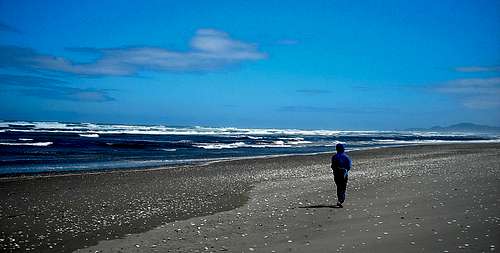
Apart from this rich historical background, Chiloe provides a marvellous National Park, by the Pacific Ocean. No big mountain there - the highest point of the island is Cerro Cap Maldonado (823m) - but a nice area for hiking with very little people around.

Getting There


To reach the island there are 3 main entry point, all by boat of course as this is an island !
The best is to go directly to central town of Castro, from where it is the best place to move onto the National Park.
-> Northern Access : from Puerto Montt or Puerto Varas
Several buses each day leaving from these two towns. The whole journey lasts about 4hrs. You will keep the same bus all the way long.
-> Eastern Access : from Chaiten
3 boats per week come and go. Depending on the state of the ocean it can take bewteen 8 to 10 hours. No bus required as both towns have their warf.
-> Southern Access : from Puerto Chacabuco
1 boat per week comes and goes. The journey lasts for 36 hours.
You will then need to take one of the frequent buses from Quellon (southern end of Chiloe) to Castro.
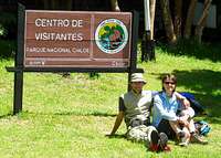
Parque Nacional Chiloe


This National Park is made of 3 sections and is 43,057ha big. It is mostly covered with evergreen forest (with fine gray sand and shells on its shore).
1. The northen part is 7800 ha large and is accessible from Chepu. Very little infrastructure and accessible from Chepu (faster from Ancud, the big town north of the island)
2. The second sector is the Metalqui Island very difficult to access as there is no regular boat going there.
3. The third and larger portion of the Park is closed to Cucao and is the most common to visit.
Logistics :
There a couple of buses leaving every morning from Castro to the entrance of the Park in Cucao. Ask for details at the bus station. At the gate there is a $2 fee to pay.
Hiking :
1. The main trail goes along the coast up to Anay (26 kms). Most people go to the Park for a day-hike, and only walk for a few kilometers and return. However you can go further to camp in Cole-Cole (tap water available), the first day. The hut in Cole-Cole is in very poor condition, and a tent will be more confortable. On the second day, hike to Anay, then back to Cole-Cole, and return to Cucao the same day, or the day after (with a second night in Cole-Cole), depending on how fit you feel. This way you're quite sure to have, sand, trees and the ocean for yourself !
2. Another very short trail makes a loop from the park gate (2 kms) and shows the different kinds of vegetation around with some canope ways going throught ancient trees.
Very nice for knowledge and nature care.
Books, Maps & Weather
 |
 |
 |
A map is not really necessary as the trail goes along the ocean. Difficult to get lost !
However there is a map available at the entrance.
The best hiking book is undoubtedly : Chile & Argentina : Backpacking & Hiking Guide by Tim Buford - Jun. 2005 (Bradt)
And for weather forecast : Meteo Chile