Welcome to SP!  -   
 
 MbPost.com -- It's SP for Mountain Biking!
Areas & Ranges·Mountains & Rocks·Routes·Images·Articles·Trip Reports·Gear·Other·People·Plans & Partners·What's New·Forum

Downclimb to Notch [ Sizes: Orig | Large | Med | Small | Thumb ]
Downclimb to Notch
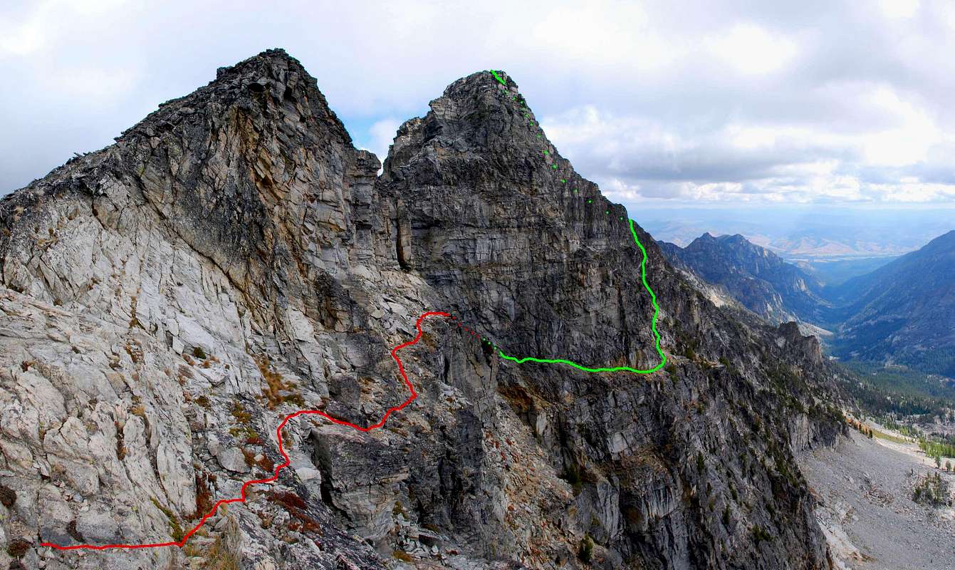
This shows a likely route between the east and west summits of The Shard.
The red line is the down-climb from the south ridge (leading to the west summit).
The green line is the traverse from the notch along cliff bands, then the climb to The Shard's highpoint, the east summit.
© Mike Hoyt, 6sep07.


Comments

No comments posted yet.


Sign in to post!

Don't have an account? Register now.


Rate This Image
Current Score: 88.05

Log In To Vote
 The Shard (Mountain/Rock)


« PREV

Viewing
#10 of 27
GALLERY

NEXT »

 thephotohiker's Image Gallery


« PREV

Viewing
#159 of 1575
GALLERY

NEXT »


 South Ridge - Chaffin High Lakes (Route)


Image Data

Submitted by thephotohiker
on Oct 10, 2007 8:34 pm

Image ID: 346314
Hits: 717 

Lat/Lon: 45.95842°N / 114.33598°W

Image Type(s): Informational, Scenery


"Apathy is not the problem. It's the solution."

© 2006 SummitPost.org. All Rights Reserved.