-
 14660 Hits
-
 96.51% Score
-
 60 Votes
|
|
Mountain/Rock |
|---|---|
|
|
32.65°S / 70°W |
|
|
Mountaineering |
|
|
Summer |
|
|
17238 ft / 5254 m |
|
|
Overview
Cerro Catedral is located 4.5 miles west of mighty Aconcagua, on the opposite side of the Horcones Valley. Although it is only a 3,000 foot climb from Plaza de Mulas, it doesn’t appear to be a very popular acclimatization hike and probably for good reason. It is quite a strenuous climb requiring crampons and an ice axe, climbing a large scree slope, and some minor scrambling. I haven’t been able to find any information on climbing this peak anywhere, but it is a very worthy destination. Cerro Catedral is visible from the lower portion of Aconcagua's normal route. Cerro Bonete is the smaller peak on the left.
Getting There
The approach for Cerro Catedral is the same as for the normal route on Aconcagua. The route description below begins at El Refugio, the famous hotel that is a 20-30 minute walk from Plaza de Mulas.South Slopes & Southeast Ridge Route
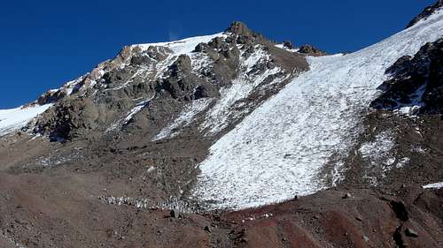
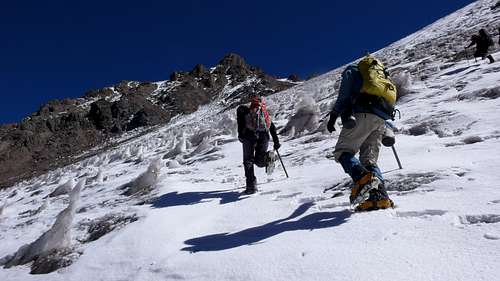
From El Refugio, follow the obvious trail west as it switchbacks its way up steep scree to Morro del Catedral, a flattish area around 4,500 meters. Here, the trail crosses a small creek to the south side of the drainage and continues on to Cerro Bonete. At this point, exit the trail and head north up a talus and scree slope. Although there may be a small cairn marking the turnoff, there isn’t any noticeable trail here.Soon a large snowfield will pop into view. Attaining the ridge at the top of this snowfield is your first goal. The angle of the slope is approximately 35-40 degrees at its steepest. I found it to be icy in mid February with plenty of penitents to negotiate. It is possible to do an ascending traverse and cross over to scree on the left hand (west) side of the snow field, but solid ice under the scree can make it difficult and unsafe to ascend.
Eventually it is necessary to exit the snowfield to the left onto the scree slope and climb up to the ridge directly ahead. As you near the ridge, scree over little hardpan ledges keeps you on your toes.
Once you gain the ridge, you can peer over the edge down on the steep northeast slopes of Catedral. Quite impressive. The route from here isn’t very obvious. The key is to climb a short, loose 3rd class chimney slightly to your left. After 10-15 feet, you should see a rather tame line up to the larger, main ridge. It is wise to mark the location of the chimney you just climbed to find it on the way back. This area is rather complicated.
After the chimney, hike up more steep scree to the larger ridge and head right along it toward the summit. It is wise to mark this entrance point as well. Hike along the crest of this 2nd class ridge to another small penitente snowfield. Crampons are again useful for this short 35 degree snow climb.
After exiting this 2nd snow field, the ridge really mellows out and all that remains is an easy stroll to the summit. The summit area is small and rather exposed with great views of Aconcagua’s west face.
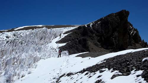
 Climbers hiking past some large penitentes en route to the summit of Cerro Catedral. It is just out of sight behind the jutting rock on the right.
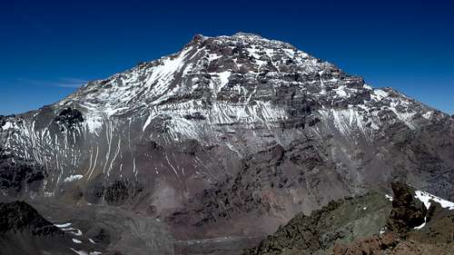
 Aconcagua's west face and much of the normal route can be seen from the summit of Cerro Catedral. Plaza de Mulas is visible at the bottom of the picture.


