Toggle navigation
Mountains
Routes
Images
Trip Reports
Forum
What's New
People
Areas & Ranges
Articles
Trailheads
Canyons
Huts & Campgrounds
Albums
Logistical Centers
Fact Sheets
Lists
Custom Objects
Gear
Plans & Partners
WELCOME TO SUMMITPOST
SIGN IN
REGISTER
Hinterer Brochkogel
Additional Parents
Image
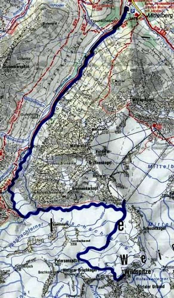
Map of the Taschachglacier...
View High-Resolution Image
Map of the Taschachglacier...
Map of the Taschachglacier with the way to the Wildspitze marked. From this way starting point of Petersenspitze-N-face and/or Hinterer Brochkogel-NW-face
Picture credit to:
kompass
« PREV
NEXT »
Rahel Maria Liu
on
Jan 16, 2002 5:12 pm
Comments & voting
Other parents
Lat/Lon:
46.88670°N / 10.85070°E
Image ID:
3899
3361 Hits
74.92
% Score
5
Votes
Log in to vote
Comments
No comments posted yet.
to post!
Don't have an account?
Hinterer Brochkogel
(Mountain/Rock)
« PREV
Viewing
#38 of 54
GALLERY
NEXT »
Rahel Maria Liu's Image Gallery
« PREV
Viewing
#155 of 182
GALLERY
NEXT »
×
You need to login in order to vote!
User Name
Password
Remember me
Forgot your password?
Log me out when I close my browser.
Keep me logged in all the time.
sign in as a user
Don't have an account?
Register now for FREE
Rating available
Suggested routes for you
People who climb the same things as you
Comments Available
Create Albums
Register Here


