
Viewing: 1-3 of 3

mountaindog - Feb 20, 2004 10:42 pm - Voted 10/10
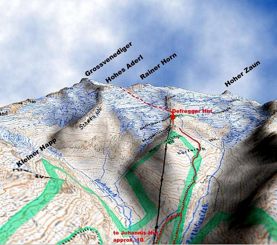
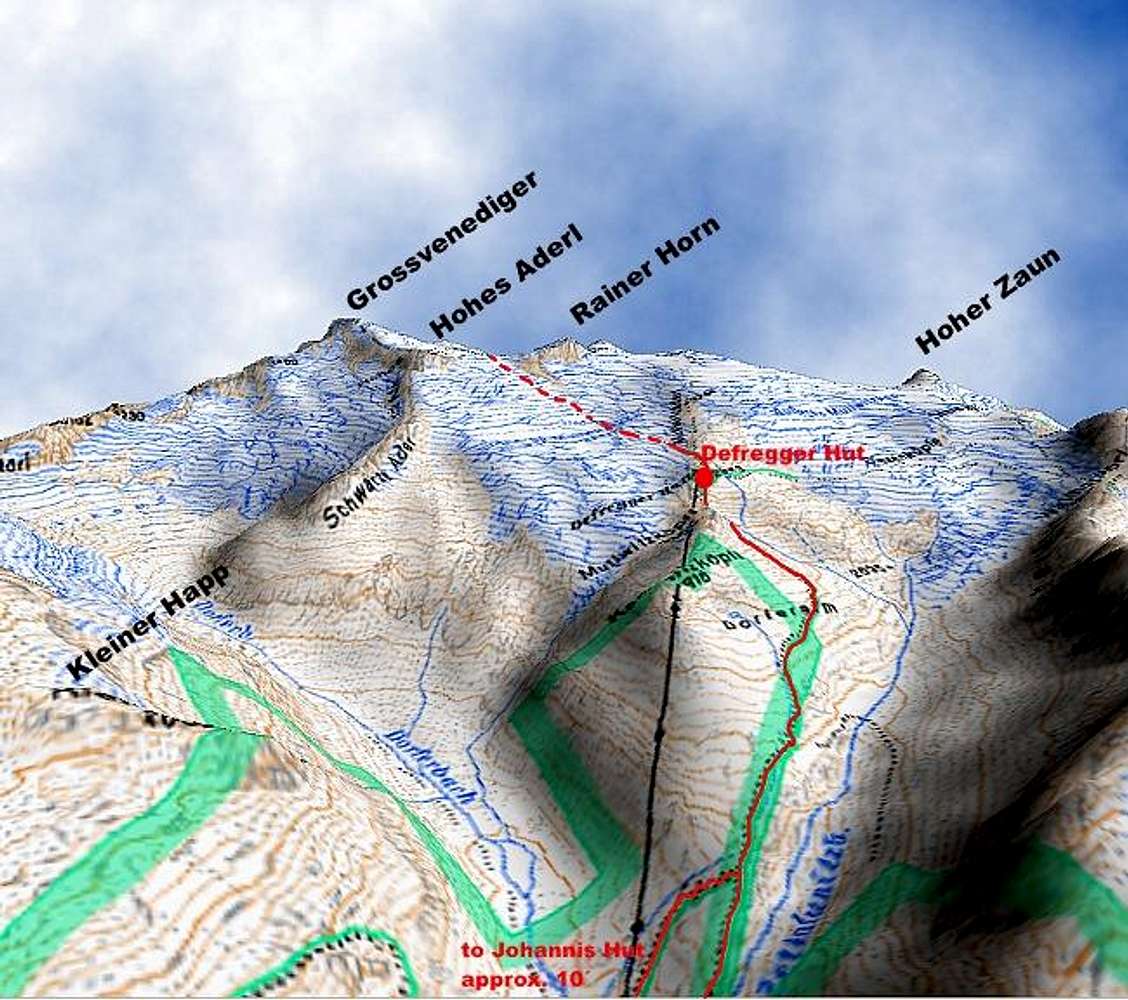
Very Useful!Nice one! This is the kind of photo/map which we could use more of...it makes this website more useful.

Bart - Aug 29, 2007 2:59 am - Voted 10/10
Cool mapWhere did you find this? Or did you make it somehow? Nice!

wuedesau - Aug 29, 2007 4:22 am - Hasn't voted
Re: Cool mapThanks, apparently not everone thinks that this is useful as you can see from the rating.
I made the map by myself using the digital Austrian map that has digital elevation data as well and Corel Photopaint.
Cheers, Klaus
Viewing: 1-3 of 3


Comments
Post a Comment