Welcome to SP!  -   
 
 MbPost.com -- It's SP for Mountain Biking!
Areas & Ranges·Mountains & Rocks·Routes·Images·Articles·Trip Reports·Gear·Other·People·Plans & Partners·What's New·Forum

Trailhead Access [ Sizes: Orig | Large | Med | Small | Thumb ]
Trailhead Access
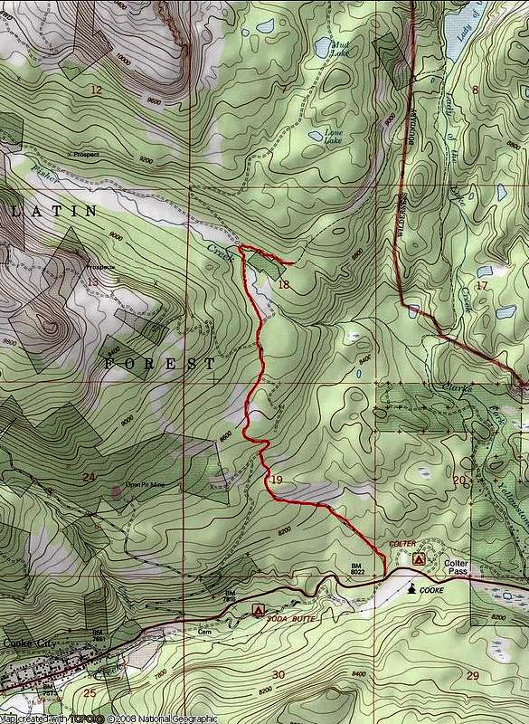
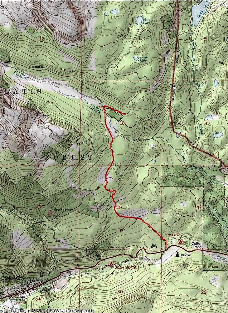
Just getting to the trailhead presents the most trouble for some who have tried the Southwest Couloir Route on Granite Peak. I posted this map after being lambasted for poor directions to the trailhead. May this picture be worth a thousand words...

LuLu Pass Road starts 1.8 mi. east of Cooke City and continues north and west to Lulu Pass. The turnoff for the trailhead is just after crossing Fisher Creek at 8800' elevation. Lady of the Lake, your first landmark along the route, is in the upper right corner of this map.


Comments

No comments posted yet.


Sign in to post!

Don't have an account? Register now.


Rate This Image
Current Score: 0

Log In To Vote
 Southwest Couloir Route (Route)


« PREV

Viewing
#27 of 27
GALLERY

You are at
the Last
Image

 Larry V's Image Gallery


« PREV

Viewing
#453 of 463
GALLERY

NEXT »
Image Data

Submitted by Larry V
on Sep 6, 2008 6:14 pm

Image ID: 439842
Hits: 578 

Lat/Lon: 45.02700°N / 109.9°W

Image Type(s): Topo/Diagram


"Conquer yourself rather than the world."   --Rene Descartes   

© 2006 SummitPost.org. All Rights Reserved.